Hartline, Washington
| Hartline | |
|---|---|
| Town | |
| Hartline, Washington | |
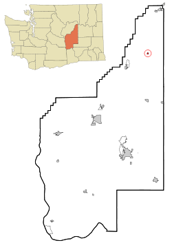 Location of Hartline, Washington | |
| Coordinates: 47°41′24″N 119°6′26″W / 47.69000°N 119.10722°WCoordinates: 47°41′24″N 119°6′26″W / 47.69000°N 119.10722°W | |
| Country | United States |
| State | Washington |
| County | Grant |
| Area[1] | |
| • Total | 0.33 sq mi (0.85 km2) |
| • Land | 0.33 sq mi (0.85 km2) |
| • Water | 0 sq mi (0 km2) |
| Elevation | 1,913 ft (583 m) |
| Population (2010)[2] | |
| • Total | 151 |
| • Estimate (2015)[3] | 156 |
| • Density | 457.6/sq mi (176.7/km2) |
| Time zone | Pacific (PST) (UTC-8) |
| • Summer (DST) | PDT (UTC-7) |
| ZIP code | 99135 |
| Area code | 509 |
| FIPS code | 53-29920 |
| GNIS feature ID | 1512279[4] |
Hartline is a town in Grant County, Washington, United States. The population was 151 at the 2010 census. There is a high school named Almira-Coulee/Hartline High School. The name "Hartline" is an Americanized spelling of the German last name "Hartlein" and is an uncommon last name.
History
Hartline was named for early settler John Hartline.[5] It was officially incorporated on March 6, 1907.
Geography
Hartline is located at 47°41′24″N 119°6′26″W / 47.69000°N 119.10722°W (47.690010, -119.107279).[6]
According to the United States Census Bureau, the town has a total area of 0.33 square miles (0.85 km2), all of it land.[1]
Climate
According to the Köppen Climate Classification system, Hartline has a semi-arid climate, abbreviated "BSk" on climate maps.[7]
| Climate data for Hartline | |||||||||||||
|---|---|---|---|---|---|---|---|---|---|---|---|---|---|
| Month | Jan | Feb | Mar | Apr | May | Jun | Jul | Aug | Sep | Oct | Nov | Dec | Year |
| Record high °F (°C) | 52 (11) |
62 (17) |
73 (23) |
93 (34) |
100 (38) |
103 (39) |
110 (43) |
110 (43) |
101 (38) |
86 (30) |
67 (19) |
56 (13) |
110 (43) |
| Average high °F (°C) | 31.8 (−0.1) |
39.1 (3.9) |
50.6 (10.3) |
61.4 (16.3) |
70.8 (21.6) |
78.6 (25.9) |
87.6 (30.9) |
86.2 (30.1) |
76.8 (24.9) |
61.6 (16.4) |
43.1 (6.2) |
33.8 (1) |
60.1 (15.6) |
| Average low °F (°C) | 19.2 (−7.1) |
24.1 (−4.4) |
30.5 (−0.8) |
36.1 (2.3) |
42.8 (6) |
49.3 (9.6) |
55.4 (13) |
54.5 (12.5) |
47.1 (8.4) |
36.9 (2.7) |
28 (−2) |
21.9 (−5.6) |
37.2 (2.9) |
| Record low °F (°C) | −19 (−28) |
−20 (−29) |
4 (−16) |
14 (−10) |
24 (−4) |
28 (−2) |
34 (1) |
31 (−1) |
26 (−3) |
4 (−16) |
−8 (−22) |
−19 (−28) |
−20 (−29) |
| Average precipitation inches (mm) | 1.07 (27.2) |
0.91 (23.1) |
0.83 (21.1) |
0.71 (18) |
0.95 (24.1) |
0.92 (23.4) |
0.47 (11.9) |
0.4 (10) |
0.52 (13.2) |
0.74 (18.8) |
1.34 (34) |
1.43 (36.3) |
10.29 (261.4) |
| Average snowfall inches (cm) | 6.8 (17.3) |
3.2 (8.1) |
0.7 (1.8) |
0.1 (0.3) |
0 (0) |
0 (0) |
0 (0) |
0 (0) |
0 (0) |
0.2 (0.5) |
3 (8) |
8.4 (21.3) |
22.4 (56.9) |
| Average precipitation days | 6 | 5 | 5 | 4 | 5 | 5 | 3 | 2 | 3 | 4 | 7 | 8 | 57 |
| Source: [8] | |||||||||||||
Demographics
| Historical population | |||
|---|---|---|---|
| Census | Pop. | %± | |
| 1910 | 237 | — | |
| 1920 | 282 | 19.0% | |
| 1930 | 170 | −39.7% | |
| 1940 | 168 | −1.2% | |
| 1950 | 205 | 22.0% | |
| 1960 | 206 | 0.5% | |
| 1970 | 189 | −8.3% | |
| 1980 | 165 | −12.7% | |
| 1990 | 176 | 6.7% | |
| 2000 | 134 | −23.9% | |
| 2010 | 151 | 12.7% | |
| Est. 2015 | 156 | [9] | 3.3% |
| U.S. Decennial Census[10] 2015 Estimate[3] | |||
2010 census
As of the census[2] of 2010, there were 151 people, 62 households, and 37 families residing in the town. The population density was 457.6 inhabitants per square mile (176.7/km2). There were 87 housing units at an average density of 263.6 per square mile (101.8/km2). The racial makeup of the town was 90.7% White, 0.7% African American, 1.3% Asian, 4.6% from other races, and 2.6% from two or more races. Hispanic or Latino of any race were 11.9% of the population.
There were 62 households of which 27.4% had children under the age of 18 living with them, 53.2% were married couples living together, 4.8% had a female householder with no husband present, 1.6% had a male householder with no wife present, and 40.3% were non-families. 33.9% of all households were made up of individuals and 4.8% had someone living alone who was 65 years of age or older. The average household size was 2.44 and the average family size was 3.16.
The median age in the town was 41.8 years. 25.8% of residents were under the age of 18; 7.2% were between the ages of 18 and 24; 20.5% were from 25 to 44; 31.7% were from 45 to 64; and 14.6% were 65 years of age or older. The gender makeup of the town was 53.6% male and 46.4% female.
2000 census
As of the census of 2000, there were 134 people, 60 households, and 36 families residing in the town. The population density was 406.6 people per square mile (156.8/km²). There were 77 housing units at an average density of 233.6 per square mile (90.1/km²). The racial makeup of the town was 93.28% White, 1.49% Native American, 2.24% from other races, and 2.99% from two or more races. Hispanic or Latino of any race were 2.24% of the population.
There were 60 households out of which 26.7% had children under the age of 18 living with them, 51.7% were married couples living together, 6.7% had a female householder with no husband present, and 40.0% were non-families. 36.7% of all households were made up of individuals and 21.7% had someone living alone who was 65 years of age or older. The average household size was 2.23 and the average family size was 2.78.
In the town the age distribution of the population shows 22.4% under the age of 18, 4.5% from 18 to 24, 32.1% from 25 to 44, 20.1% from 45 to 64, and 20.9% who were 65 years of age or older. The median age was 41 years. For every 100 females there were 109.4 males. For every 100 females age 18 and over, there were 112.2 males.
The median income for a household in the town was $27,917, and the median income for a family was $35,625. Males had a median income of $24,792 versus $26,250 for females. The per capita income for the town was $14,335. There were 5.7% of families and 8.5% of the population living below the poverty line, including no under eighteens and none of those over 64.
Notable people
- Dale Kinkade - Linguist who is a specialist in the Native American languages of the Pacific Northwest, was born and raised in Hartline.
References
- 1 2 "US Gazetteer files 2010". United States Census Bureau. Retrieved 2012-12-19.
- 1 2 "American FactFinder". United States Census Bureau. Retrieved 2012-12-19.
- 1 2 "Population Estimates". United States Census Bureau. Retrieved July 10, 2016.
- ↑ "Hartline". Geographic Names Information System. United States Geological Survey.
- ↑ Meany, Edmond S. (1923). Origin of Washington geographic names. Seattle: University of Washington Press. p. 110.
- ↑ "US Gazetteer files: 2010, 2000, and 1990". United States Census Bureau. 2011-02-12. Retrieved 2011-04-23.
- ↑ Climate Summary for Hartline, Washington
- ↑ "HARRINGTON, WASHINGTON (453529)". Western Regional Climate Center. Retrieved November 16, 2015.
- ↑ "Annual Estimates of the Resident Population for Incorporated Places: April 1, 2010 to July 1, 2015". Retrieved July 2, 2016.
- ↑ United States Census Bureau. "Census of Population and Housing". Retrieved October 5, 2013.
Municipalities and communities of Grant County, Washington, United States | ||
|---|---|---|
| Cities | 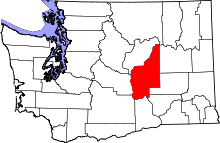 | |
| Towns | ||
| CDPs | ||
| Unincorporated communities | ||
| Ghost towns | ||
| Footnotes | ‡This populated place also has portions in an adjacent county or counties | |