Ephrata, Washington
| Ephrata, Washington | |
|---|---|
| City | |
|
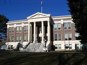
Grant County Courthouse in Ephrata, Washington. | |
 Location of Ephrata, Washington | |
| Coordinates: 47°19′1″N 119°32′53″W / 47.31694°N 119.54806°WCoordinates: 47°19′1″N 119°32′53″W / 47.31694°N 119.54806°W | |
| Country | United States |
| State | Washington |
| County | Grant |
| Area[1] | |
| • Total | 10.09 sq mi (26.13 km2) |
| • Land | 10.09 sq mi (26.13 km2) |
| • Water | 0 sq mi (0 km2) |
| Elevation | 1,276 ft (389 m) |
| Population (2010)[2] | |
| • Total | 7,664 |
| • Estimate (2015)[3] | 8,047 |
| • Density | 759.6/sq mi (293.3/km2) |
| Time zone | Pacific (PST) (UTC-8) |
| • Summer (DST) | PDT (UTC-7) |
| ZIP code | 98823 |
| Area code | 509 |
| FIPS code | 53-22080 |
| GNIS feature ID | 1512192[4] |
| Website | City of Ephrata |
Ephrata (/iːˈfreɪtə/ ee-FRAY-tə) is a city in Grant County, Washington, United States. The population was 7,664 at the 2010 census. It is the county seat of Grant County.[5]
History
Ephrata was officially incorporated on June 21, 1909 and was given the county seat for the newly created Grant County.[6]
Historically, the settlement of Ephrata is quite recent. There was no known settlement until 1886, just three years before Washington attained statehood. The horse rancher Frank Beezley was the first to settle near the natural springs, thus the area was known as Beezley Springs. As the climate and topography were not promising to settlement, the entire region remained sparsely populated until several federal congressional actions, including the Northern Pacific Land Grant Act, the Homestead Act, and Desert Claims Act, encouraged the settlement of this semi-arid desert. Originally, Douglas County spread over the entire territory of the Big Bend of the Columbia River. In 1909, the Washington State legislature divided it, creating Grant County. When the time came to present arguments to the state legislature regarding which town should be the county seat, someone apparently intentionally intoxicated the representative of a rival community, and Ephrata was chosen.[7]
It is generally believed that the city was named Ephrata by a man who worked for the Great Northern Railway. The name Ephrata is derived from a biblical description of an orchard in the middle of the desert. It is also the ancient name for the town of Bethlehem.
The region was known at the turn of the century for the great herds of wild horses that roamed the land. Horse trading was an important element of the local economy, and Ephrata served as the staging area for the horse round-ups. The last "Grand Horse Round-up" was held in Ephrata in 1906. Ephrata then developed as a trade and service center for cattle and sheep ranches in the area until the construction of the Columbia Basin Reclamation Project.
In 1939, one of the state's longest runways was built at Ephrata and served the U.S. Army Air Corps until 1945, when the field was turned into a commercial airport. The airport and hangars were used in Steven Spielberg's 1989 film Always, the final movie of Audrey Hepburn. It was used for the airport scenes for the fictional Flat Rock, Colorado.
Ephrata was in the national spotlight in a segment on 60 Minutes II after the 2003 murder of Craig Sorger by Evan Savoie and Jake Eakin. The two accused were the youngest defendants in state history to be tried as adults.
In January 2011, Jim McCullar bought his half of a $380 million Mega Millions lottery ticket at a Safeway supermarket in Ephrata. It was the second largest jackpot in U.S. lottery history.
Grant County Public Utility District has its headquarters located in Ephrata.
Columbia Basin Irrigation Project
Beginning in July 1918, several prominent Ephrata residents started the promotion of a plan to redirect waters of the Columbia River in order to irrigate the dry but fertile soils of the Big Bend country. Labeled "The Dam University", Ephrata residents persistently lobbied at the local, state, and federal levels to gather support for the project. Initial funding for the Grand Coulee Dam was through the Public Works Administration created under Franklin Roosevelt's promise of a "New Deal" in 1933. However, the irrigation waters would not be released as the nation focused on ending World War II during the 1940s. During this era, Grand Coulee Dam's main mission was to produce electricity for the Hanford Reservation and for aluminum manufacturing, vital to military aircraft production. When the war ended, the Project returned to its original mission, to irrigate the desert.
Population growth
The construction of the Irrigation Project and the military activity increased the population of Ephrata by a factor of eight between 1940 and 1960. As the federal projects phased out, the town experienced a population decrease of 22% between 1960 and 1975. The population stabilized between 1975 and 1982, with a slight decrease between 1980 and 1990. The city has seen steady population growth since 1990. The present population is 7,110.
Geography and climate
Ephrata is located at 47°19′1″N 119°32′53″W / 47.31694°N 119.54806°W (47.316971, −119.548059).[8]
According to the United States Census Bureau, the city has a total area of 10.09 square miles (26.13 km2), all of it land.[1]
Link to local weather information from the NWS Spokane Office (National Weather Service) – http://www.wrh.noaa.gov/otx/
Ephrata experiences a semi-arid climate (Köppen BSk).
| Climate data for Ephrata, Washington | |||||||||||||
|---|---|---|---|---|---|---|---|---|---|---|---|---|---|
| Month | Jan | Feb | Mar | Apr | May | Jun | Jul | Aug | Sep | Oct | Nov | Dec | Year |
| Record high °F (°C) | 61 (16) |
65 (18) |
75 (24) |
94 (34) |
101 (38) |
107 (42) |
109 (43) |
115 (46) |
106 (41) |
86 (30) |
72 (22) |
63 (17) |
115 (46) |
| Average high °F (°C) | 34 (1) |
42 (6) |
54 (12) |
64 (18) |
73 (23) |
81 (27) |
88 (31) |
88 (31) |
78 (26) |
63 (17) |
45 (7) |
34 (1) |
62 (16.7) |
| Average low °F (°C) | 22 (−6) |
27 (−3) |
33 (1) |
40 (4) |
48 (9) |
55 (13) |
61 (16) |
60 (16) |
51 (11) |
40 (4) |
30 (−1) |
23 (−5) |
40.8 (4.9) |
| Record low °F (°C) | −22 (−30) |
−24 (−31) |
2 (−17) |
22 (−6) |
28 (−2) |
33 (1) |
40 (4) |
36 (2) |
28 (−2) |
8 (−13) |
0 (−18) |
−15 (−26) |
−24 (−31) |
| Average precipitation inches (mm) | 0.83 (21.1) |
0.78 (19.8) |
0.75 (19) |
0.43 (10.9) |
0.64 (16.3) |
0.51 (13) |
0.44 (11.2) |
0.25 (6.4) |
0.37 (9.4) |
0.47 (11.9) |
1.03 (26.2) |
1.19 (30.2) |
7.69 (195.3) |
| Source: The Weather Channel[9] | |||||||||||||
Demographics
| Historical population | |||
|---|---|---|---|
| Census | Pop. | %± | |
| 1910 | 323 | — | |
| 1920 | 628 | 94.4% | |
| 1930 | 516 | −17.8% | |
| 1940 | 951 | 84.3% | |
| 1950 | 4,589 | 382.5% | |
| 1960 | 6,548 | 42.7% | |
| 1970 | 5,255 | −19.7% | |
| 1980 | 5,359 | 2.0% | |
| 1990 | 5,349 | −0.2% | |
| 2000 | 6,808 | 27.3% | |
| 2010 | 7,664 | 12.6% | |
| Est. 2015 | 8,047 | [10] | 5.0% |
| U.S. Decennial Census[11] 2015 Estimate[3] | |||
2010 census
As of the census[2] of 2010, there were 7,664 people, 2,856 households, and 1,915 families residing in the city. The population density was 759.6 inhabitants per square mile (293.3/km2). There were 3,086 housing units at an average density of 305.8 per square mile (118.1/km2). The racial makeup of the city was 84.1% White, 0.8% African American, 1.1% Native American, 1.3% Asian, 0.1% Pacific Islander, 9.5% from other races, and 3.1% from two or more races. Hispanic or Latino of any race were 16.7% of the population.
There were 2,856 households of which 36.1% had children under the age of 18 living with them, 49.6% were married couples living together, 12.6% had a female householder with no husband present, 4.8% had a male householder with no wife present, and 32.9% were non-families. 28.7% of all households were made up of individuals and 12.7% had someone living alone who was 65 years of age or older. The average household size was 2.57 and the average family size was 3.14.
The median age in the city was 34.7 years. 27.4% of residents were under the age of 18; 9.4% were between the ages of 18 and 24; 25% were from 25 to 44; 23.6% were from 45 to 64; and 14.6% were 65 years of age or older. The gender makeup of the city was 49.7% male and 50.3% female.
2000 census
As of the census of 2000, there were 6,808 people, 2,561 households, and 1,776 families residing in the city. The population density was 683.0 people per square mile (263.6/km²). There were 2,788 housing units at an average density of 279.7 per square mile (108.0/km²). The racial makeup of the city was 90.64% White, 0.40% African American, 0.71% Native American, 0.72% Asian, 0.12% Pacific Islander, 5.32% from other races, and 2.10% from two or more races. Hispanic or Latino of any race were 10.30% of the population.
There were 2,561 households out of which 35.8% had children under the age of 18 living with them, 54.5% were married couples living together, 10.7% had a female householder with no husband present, and 30.7% were non-families. 27.1% of all households were made up of individuals and 13.7% had someone living alone who was 65 years of age or older. The average household size was 2.56 and the average family size was 3.09.
In the city the age distribution of the population shows 28.9% under the age of 18, 8.0% from 18 to 24, 26.9% from 25 to 44, 20.1% from 45 to 64, and 16.1% who were 65 years of age or older. The median age was 36 years. For every 100 females there were 97.6 males. For every 100 females age 18 and over, there were 94.5 males.
The median income for a household in the city was $35,060, and the median income for a family was $43,500. Males had a median income of $38,571 versus $26,320 for females. The per capita income for the city was $17,929. About 8.7% of families and 12.9% of the population were below the poverty line, including 16.0% of those under age 18 and 10.0% of those age 65 or over.
Schools
Elementary schools
- Columbia Ridge Elementary
- Grant Elementary
Intermediate schools
- Parkway Intermediate School
Middle schools
- Ephrata Middle School
Private schools
- New Life Christian School
- St. Rose Of Lima Catholic School
High schools
- Ephrata High School
- Sage Hills Alternative High School
Transportation
Notes
- 1 2 "US Gazetteer files 2010". United States Census Bureau. Retrieved 2012-12-19.
- 1 2 "American FactFinder". United States Census Bureau. Retrieved 2012-12-19.
- 1 2 "Population Estimates". United States Census Bureau. Retrieved June 29, 2016.
- ↑ "Ephrata". Geographic Names Information System. United States Geological Survey.
- ↑ "Find a County". National Association of Counties. Retrieved 2011-06-07.
- ↑ City of Ephrata website
- ↑ http://www.ephrata.org/217.html
- ↑ "US Gazetteer files: 2010, 2000, and 1990". United States Census Bureau. 2011-02-12. Retrieved 2011-04-23.
- ↑ "The Weather Channel". 2009. Retrieved 2009-08-30.
- ↑ "Annual Estimates of the Resident Population for Incorporated Places: April 1, 2010 to July 1, 2015". Retrieved July 2, 2016.
- ↑ United States Census Bureau. "Census of Population and Housing". Retrieved October 2, 2013.
External links
| Wikimedia Commons has media related to Ephrata, Washington. |
Municipalities and communities of Grant County, Washington, United States | ||
|---|---|---|
| Cities | 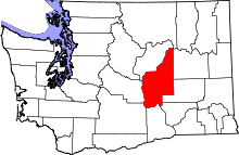 | |
| Towns | ||
| CDPs | ||
| Unincorporated communities | ||
| Ghost towns | ||
| Footnotes | ‡This populated place also has portions in an adjacent county or counties | |