Harrietville, Victoria
| Harrietville Victoria | |||||||
|---|---|---|---|---|---|---|---|
 The Great Alpine Road passing through Harrietville in June 2014. | |||||||
 Harrietville | |||||||
| Coordinates | 36°55′0″S 147°04′0″E / 36.91667°S 147.06667°ECoordinates: 36°55′0″S 147°04′0″E / 36.91667°S 147.06667°E | ||||||
| Population | 402 (2011 census)[1] | ||||||
| Postcode(s) | 3741 | ||||||
| Elevation | 510 m (1,673 ft) | ||||||
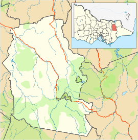
| Location |
| ||||||
| LGA(s) | Alpine Shire | ||||||
| State electorate(s) | Ovens Valley | ||||||
| Federal Division(s) | Indi | ||||||
| |||||||

Harrietville is a town in Victoria, Australia, located on the Great Alpine Road, in the Alpine Shire. At the 2011 census, Harrietville and the surrounding area had a population of 402.[1]
The town began as a goldmining settlement during the Victorian Gold Rush, the Post Office opening on 5 July 1865.[2] Alluvial gold was mined initially. Many of the early miners were Chinese. Later, the mining shifted to deep reefs accessed via shafts. A large dredge, known as the Tronoh Monster, also worked extracting alluvial gold from the Ovens River flats. The dredge extracted gravel and created the hole it floated in, dumping the tailings behind it. It made slow progress along the river flats, eventually stopping when rock reefs were contacted at the base of the surrounding mountains. Three large and deep lakes remain near Harrietville where dredging operations ceased.
Harrietville today provides some accommodation for skiers visiting nearby Mount Hotham. The town hosts a bush market in January and on Easter Sunday. Also in January are a European classical music competition, and a lawn mower grand prix. In June the annual Harry T Ville and the Boys Blues Band concert is held at the old Chinese Hotel. In November, the town hosts an annual Bluegrass convention, attracting some hundreds of performers and aficionados.
References
- 1 2 Australian Bureau of Statistics (31 October 2012). "Harrietville (State Suburb)". 2011 Census QuickStats. Retrieved 2 December 2014.
- ↑ Premier Postal History, Post Office List, retrieved 2008-04-11
External links
![]() Media related to Harrietville, Victoria at Wikimedia Commons
Media related to Harrietville, Victoria at Wikimedia Commons
- Harrietville Gold Field Victoria Geol. Survey 1904, W.M. Bradford