Alpine Shire
| Alpine Shire Victoria | |||||||||||||
|---|---|---|---|---|---|---|---|---|---|---|---|---|---|
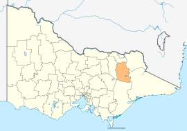 Location in Victoria | |||||||||||||
| Population | 11,858 (2015 est)[1] | ||||||||||||
| • Density | 2.4771/km2 (6.4157/sq mi) | ||||||||||||
| Established | 1994 | ||||||||||||
| Gazetted | 18 November 1994[2] | ||||||||||||
| Area | 4,787 km2 (1,848.3 sq mi) | ||||||||||||
| Mayor | Cr Jan Vonarx | ||||||||||||
| Council seat | Bright | ||||||||||||
| Region | Hume | ||||||||||||
| State electorate(s) | |||||||||||||
| Federal Division(s) | Indi | ||||||||||||
|
| |||||||||||||
| Website | Alpine Shire | ||||||||||||
| |||||||||||||
The Alpine Shire is a local government area in the Hume region of Victoria, Australia, located in the north-east part of the state. It covers an area of 4,787 square kilometres (1,848 sq mi) and, at the 2011 Census, had a population of 11,881.[3] It includes the towns of Bright, Dinner Plain, Mount Beauty and Myrtleford. There are two unincorporated areas within the shire: the areas around Mount Hotham and Falls Creek. It was formed in 1994 from the amalgamation of the Shire of Bright, Shire of Myrtleford, and parts of the United Shire of Beechworth, Shire of Oxley, Shire of Yackandandah and Shire of Omeo.[2]
The Shire is governed and administered by the Alpine Shire Council; its seat of local government and administrative centre is located at the council headquarters in Bright, it also has service centres located in Dinner Plain, Mount Beauty and Myrtleford. The Shire is named after its location in the popular alpine region of Victoria.
Council
Current composition
The council is composed of seven councillors elected to represent an unsubdivided municipality.[4]
| Ward | Councillor | Notes | |
|---|---|---|---|
| Unsubdivided | John Forsyth | ||
| Ron Janas | |||
| Tony Keeble | |||
| Kitty Knappstein | |||
| Sarah Nicholas | |||
| Daryl Pearce | |||
| Peter Roper | |||
Administration and governance
The council meets in the council chambers at the council headquarters in the Bright Municipal Offices, which is also the location of the council's administrative activities. It also provides customer services at both its administrative centre in Bright, and its service centres in Dinner Plain, Mt Beauty and Myrtleford.
See also
References
- ↑ "3218.0 – Regional Population Growth, Australia, 2014–15". Australian Bureau of Statistics. Retrieved 29 September 2016.
- 1 2 "Local Government Act 1989 – Order Constituting the Shires of Towong, Indigo, Milawa, Delatite, Strathbogie, Murrindindi, Mitchell, Moira and (etc.) – Part 6: Alpine Shire". Victoria Government Gazette (Online Archive). State Government of Victoria (S87): 3–4. 18 November 1994. Retrieved 10 January 2014 – via State Library of Victoria.
- ↑ Census QuickStats (2011). "Alpine (S) – LGA20110". Australian Bureau of Statistics. Government of Australia. Retrieved 10 January 2014.
- ↑ Local Government in Victoria. "Alpine Shire Council". Department of Transport, Planning and Local Infrastructure. State Government of Victoria. Retrieved 10 January 2014.
External links
- Alpine Shire Council official website
- Metlink local public transport map
- Link to Land Victoria interactive maps