Harbor Hills, Ohio
| Harbor Hills, Ohio | |
|---|---|
| CDP | |
 Location of Harbor Hills, Ohio | |
| Coordinates: 39°55′58″N 82°26′15″W / 39.93278°N 82.43750°WCoordinates: 39°55′58″N 82°26′15″W / 39.93278°N 82.43750°W | |
| Country | United States |
| State | Ohio |
| County | Licking |
| Area | |
| • Total | 3.4 sq mi (8.9 km2) |
| • Land | 2.7 sq mi (7.1 km2) |
| • Water | 0.7 sq mi (1.9 km2) |
| Elevation[1] | 928 ft (283 m) |
| Population (2000) | |
| • Total | 1,303 |
| • Density | 478.1/sq mi (184.6/km2) |
| Time zone | Eastern (EST) (UTC-5) |
| • Summer (DST) | EDT (UTC-4) |
| FIPS code | 39-33362[2] |
| GNIS feature ID | 1867456[1] |
Harbor Hills is a census-designated place (CDP) in Licking County, Ohio, United States. The population was 1,303 at the 2000 census.
A post office called Harbor Hills was established in 1927, and remained in operation until 1943.[3]
Geography
Harbor Hills is located at 39°55′58″N 82°26′15″W / 39.93278°N 82.43750°W (39.932782, -82.437381).[4]
According to the United States Census Bureau, the CDP has a total area of 3.5 square miles (9.1 km2), of which 2.7 square miles (7.0 km2) is land and 0.7 square miles (1.8 km2) (20.87%) is water.
Demographics
As of the census[2] of 2000, there were 1,303 people, 575 households, and 411 families residing in the CDP. The population density was 478.1 people per square mile (184.3/km²). There were 676 housing units at an average density of 248.0/sq mi (95.6/km²). The racial makeup of the CDP was 98.39% White, 0.15% African American, 0.15% Asian, 0.15% Pacific Islander, and 1.15% from two or more races. Hispanic or Latino of any race were 0.15% of the population.
There were 575 households out of which 19.8% had children under the age of 18 living with them, 63.1% were married couples living together, 5.7% had a female householder with no husband present, and 28.5% were non-families. 22.8% of all households were made up of individuals and 10.1% had someone living alone who was 65 years of age or older. The average household size was 2.27 and the average family size was 2.66.
In the CDP the population was spread out with 16.4% under the age of 18, 6.9% from 18 to 24, 22.3% from 25 to 44, 35.1% from 45 to 64, and 19.3% who were 65 years of age or older. The median age was 48 years. For every 100 females there were 101.4 males. For every 100 females age 18 and over, there were 101.7 males.
The median income for a household in the CDP was $48,510, and the median income for a family was $51,429. Males had a median income of $43,594 versus $27,361 for females. The per capita income for the CDP was $26,095. About 2.1% of families and 2.4% of the population were below the poverty line, including none of those under age 18 and 5.2% of those age 65 or over.
References
- 1 2 "US Board on Geographic Names". United States Geological Survey. 2007-10-25. Retrieved 2008-01-31.
- 1 2 "American FactFinder". United States Census Bureau. Retrieved 2008-01-31.
- ↑ "Licking County". Jim Forte Postal History. Retrieved 6 December 2015.
- ↑ "US Gazetteer files: 2010, 2000, and 1990". United States Census Bureau. 2011-02-12. Retrieved 2011-04-23.
Municipalities and communities of Licking County, Ohio, United States | ||
|---|---|---|
| Cities | 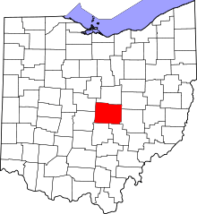 | |
| Villages | ||
| Townships | ||
| CDPs | ||
| Unincorporated communities | ||
| Ghost towns | ||
| Footnotes | ‡This populated place also has portions in an adjacent county or counties | |