Hanover, Ohio
| Hanover, Ohio | |
|---|---|
| Village | |
|
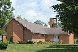
Presbyterian church | |
 Location of Hanover, Ohio | |
 Location within Licking County | |
| Coordinates: 40°4′41″N 82°16′12″W / 40.07806°N 82.27000°WCoordinates: 40°4′41″N 82°16′12″W / 40.07806°N 82.27000°W | |
| Country | United States |
| State | Ohio |
| County | Licking |
| Area[1] | |
| • Total | 1.68 sq mi (4.35 km2) |
| • Land | 1.66 sq mi (4.30 km2) |
| • Water | 0.02 sq mi (0.05 km2) |
| Elevation[2] | 823 ft (251 m) |
| Population (2010)[3] | |
| • Total | 921 |
| • Estimate (2012[4]) | 1,002 |
| • Density | 554.8/sq mi (214.2/km2) |
| Time zone | Eastern (EST) (UTC-5) |
| • Summer (DST) | EDT (UTC-4) |
| FIPS code | 39-33292[5] |
| GNIS feature ID | 1064788[2] |
Hanover is a village in Licking County, Ohio, United States. The population was 921 at the 2010 census. The village lies along SR 16.
History
Hanover was laid out in 1849, although there had been business activity at the site for some time.[6] An early variant name was Fleming, for John Fleming, the original owner of the town site.[7]
Geography
Hanover is located at 40°4′41″N 82°16′12″W / 40.07806°N 82.27000°W (40.078109, -82.269869).[8]
According to the United States Census Bureau, the village has a total area of 1.68 square miles (4.35 km2), of which 1.66 square miles (4.30 km2) is land and 0.02 square miles (0.05 km2) is water.[1]
Demographics
| Historical population | |||
|---|---|---|---|
| Census | Pop. | %± | |
| 1870 | 322 | — | |
| 1880 | 302 | −6.2% | |
| 1890 | 288 | −4.6% | |
| 1900 | 314 | 9.0% | |
| 1910 | 331 | 5.4% | |
| 1920 | 321 | −3.0% | |
| 1930 | 355 | 10.6% | |
| 1940 | 325 | −8.5% | |
| 1950 | 308 | −5.2% | |
| 1960 | 267 | −13.3% | |
| 1970 | 626 | 134.5% | |
| 1980 | 926 | 47.9% | |
| 1990 | 803 | −13.3% | |
| 2000 | 885 | 10.2% | |
| 2010 | 921 | 4.1% | |
| Est. 2015 | 1,131 | [9] | 22.8% |
2010 census
As of the census[3] of 2010, there were 921 people, 323 households, and 253 families residing in the village. The population density was 554.8 inhabitants per square mile (214.2/km2). There were 334 housing units at an average density of 201.2 per square mile (77.7/km2). The racial makeup of the village was 97.5% White, 1.0% African American, 0.3% Native American, 0.2% Asian, 0.4% from other races, and 0.5% from two or more races. Hispanic or Latino of any race were 0.7% of the population.
There were 323 households of which 42.7% had children under the age of 18 living with them, 64.1% were married couples living together, 11.5% had a female householder with no husband present, 2.8% had a male householder with no wife present, and 21.7% were non-families. 17.0% of all households were made up of individuals and 9.3% had someone living alone who was 65 years of age or older. The average household size was 2.85 and the average family size was 3.21.
The median age in the village was 37.5 years. 29.3% of residents were under the age of 18; 6.9% were between the ages of 18 and 24; 23.7% were from 25 to 44; 26.3% were from 45 to 64; and 13.8% were 65 years of age or older. The gender makeup of the village was 51.8% male and 48.2% female.
2000 census
As of the census[5] of 2000, there were 885 people, 314 households, and 258 families residing in the village. The population density was 885.2 people per square mile (341.7/km²). There were 328 housing units at an average density of 328.1 per square mile (126.6/km²). The racial makeup of the village was 98.53% White, 0.45% African American, 0.23% Native American, 0.23% from other races, and 0.56% from two or more races. Hispanic or Latino of any race were 0.23% of the population.
There were 314 households out of which 41.4% had children under the age of 18 living with them, 69.4% were married couples living together, 10.2% had a female householder with no husband present, and 17.8% were non-families. 15.0% of all households were made up of individuals and 6.7% had someone living alone who was 65 years of age or older. The average household size was 2.82 and the average family size was 3.10.
In the village the population was spread out with 27.7% under the age of 18, 9.3% from 18 to 24, 27.9% from 25 to 44, 24.7% from 45 to 64, and 10.4% who were 65 years of age or older. The median age was 37 years. For every 100 females there were 102.5 males. For every 100 females age 18 and over, there were 95.7 males.
The median income for a household in the village was $50,313, and the median income for a family was $53,438. Males had a median income of $39,048 versus $23,854 for females. The per capita income for the village was $20,679. About 3.9% of families and 4.4% of the population were below the poverty line, including 4.5% of those under age 18 and 5.0% of those age 65 or over.
References
- 1 2 "US Gazetteer files 2010". United States Census Bureau. Retrieved 2013-01-06.
- 1 2 "US Board on Geographic Names". United States Geological Survey. 2007-10-25. Retrieved 2008-01-31.
- 1 2 "American FactFinder". United States Census Bureau. Retrieved 2013-01-06.
- ↑ "Population Estimates". United States Census Bureau. Retrieved 2013-06-17.
- 1 2 "American FactFinder". United States Census Bureau. Retrieved 2008-01-31.
- ↑ Brister, Edwin M. P. (1909). Centennial History of the City of Newark and Licking County, Ohio. S.J. Clarke Publishing Company. p. 255.
- ↑ Overman, William Daniel (1958). Ohio Town Names. Akron, OH: Atlantic Press. p. 57.
- ↑ "US Gazetteer files: 2010, 2000, and 1990". United States Census Bureau. 2011-02-12. Retrieved 2011-04-23.
- ↑ "Annual Estimates of the Resident Population for Incorporated Places: April 1, 2010 to July 1, 2015". Retrieved July 2, 2016.
- ↑ "Census of Population and Housing". Census.gov. Retrieved June 4, 2015.
External links
Municipalities and communities of Licking County, Ohio, United States | ||
|---|---|---|
| Cities | 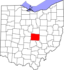 | |
| Villages | ||
| Townships | ||
| CDPs | ||
| Unincorporated communities | ||
| Ghost towns | ||
| Footnotes | ‡This populated place also has portions in an adjacent county or counties | |