Hadda, Pakistan
Hadda is a small village in the Punjab province of Pakistan. It is more than 300 years old and the native inhabitants speak the Jhang dialect of the Punjabi language. The area used to be savannah before allotment of lands in 1875 and construction of irrigation canals in 1905. The earliest bungalow built by the British in 1900 is also named after the village although it is about 5 km (3.1 mi) to the south along the south branch of the canal.
There are two mosques and Imam Bargah and people live a simple life. There is primary school for both boys and girls. The literacy rate remained static for many years after partition but has increased in recent years. The population is about 4,000. These people are actually the original inhabitants of Kirana Bar before the irrigation canals were constructed and new villages called chaks were created in the whole area by the British Government.
Location
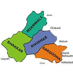
Hadda is about 18 km (11 mi)from the Pakistani city of Sargodha. The nearest villages are Chak 86 SB to the east, Chak 84SB to the west, Chak 81SB to the north and Chak 89SB to the south. The villagers are hard working and most earn their livelihood through farming. There are several different ethnic groups in the village including Ghug, Nisowana, Khokhar, Pathan and Gondal.
Notable residents
Mahar Kabir Ali Ghugh from the village was son of Maher Shair Muhammad Ghugh. Maher Sher Muhammad had seven sons (Shash Muhammad,Shahadat khan, Ajmair Khan,Nasruldin, Muhammad Bahlak,Muhammad Hayat).Maher kabir Ali graduated in 1936 from the University of the Punjab Lahore and later served in the British Government for some time before joining the Pakistan Muslim League. He made a great contribution to the resettlement of Muslim refugees coming from India after 1947. Two young men from the village served in the British Army during World War II. one of the brothers Maher Ajmair Khan Ghugh also offered services in education dep. He was the Head of Govt High School Bhagtanwala(choki)
External links
Coordinates: 32°01′N 72°52′E / 32.017°N 72.867°E