Haveli Majoka
| Haveli Majoka حویلی مجوکہ | |
|---|---|
| Village | |
 Haveli Majoka Location of Haveli Majoka in Pakistan | |
| Coordinates: 31°49′37″N 72°15′39″E / 31.82694°N 72.26083°E | |
| Country |
|
| Time zone | PST (UTC+5) |
Haveli Majoka is a small village located at the Jhelum River in Pakistan. The geographical coordinates are 31° 49' 37" North, 72° 15' 39" East. The village comprises almost only a single tribe, the Majoka. That is also the reason for the name, Haveli being the word of for a large house with courtyard.
The original village was located on the western bank of the river Jehlum. This is traditionally called Haveli Majoka. Whereas the inhabitants shifted to the eastern bank due to the fertile land there. This part is traditionally called "Kacha Majoka". Owing to its ihabitants, now Kacha Majoka is also referred to as Haveli Majoka.
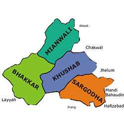
Haveli Majoka is included in the Khushab Tehsil of Khushab district, whereas Kacha Majoka is included in Shahpur Tehsil of the Sargodha district in the Punjab province in Pakistan.
Expatriates from this village are now living in many parts of Pakistan, the USA, Canada, UK, Germany and the Middle East.
External links
Coordinates: 31°50′N 72°16′E / 31.833°N 72.267°E