Grayson, Georgia
| Grayson, Georgia | |
|---|---|
| City | |
| Motto: "Steadfast and True"[1] | |
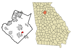 Location in Gwinnett County and the state of Georgia | |
| Coordinates: 33°53′36″N 83°57′20″W / 33.89333°N 83.95556°WCoordinates: 33°53′36″N 83°57′20″W / 33.89333°N 83.95556°W | |
| Country | United States |
| State | Georgia |
| County | Gwinnett |
| Area | |
| • Total | 2.53 sq mi (6.55 km2) |
| • Land | 2.47 sq mi (6.40 km2) |
| • Water | 0.06 sq mi (0.15 km2) |
| Elevation | 1,096 ft (334 m) |
| Population (2010) | |
| • Total | 2,666 |
| • Density | 1,079/sq mi (416.7/km2) |
| Time zone | Eastern (EST) (UTC-5) |
| • Summer (DST) | EDT (UTC-4) |
| ZIP code | 30017 |
| Area code(s) | 770 |
| FIPS code | 13-34596[2] |
| GNIS feature ID | 0314805[3] |
| Website |
www |
Grayson is a city in Gwinnett County, Georgia, United States. The population was 2,666 at the 2010 census,[4] up from 765 at the 2000 census.
Geography
Grayson is located southeast of the center of Gwinnett County at 33°53′36″N 83°57′20″W / 33.89333°N 83.95556°W (33.893306, -83.955420).[5] Georgia State Route 20 is the main highway through town, leading north 5 miles (8 km) into Lawrenceville, the county seat, and southeast 5 miles to Loganville. Georgia State Route 84 (Grayson Parkway) leads southwest 5 miles to Snellville. According to the United States Census Bureau, the city has a total area of 2.53 square miles (6.55 km2), of which 2.47 square miles (6.40 km2) is land and 0.06 square miles (0.15 km2), or 2.30%, is water.[4]
Grayson suffered a damaging tornado on June 27, 1994, killing a 10-year-old girl. The city has been benefitting from exurban growth in eastern Gwinnett County, especially in the late 1990s and through the 2000s.
Government
The city government of Grayson consists of a mayor and four council members. The current mayor is Allison Wilkerson, and the city council includes Trenton Arnold, Laurie Anderson, James Gillespie, and Linda Jenkins.
Demographics
| Historical population | |||
|---|---|---|---|
| Census | Pop. | %± | |
| 1910 | 278 | — | |
| 1920 | 322 | 15.8% | |
| 1930 | 245 | −23.9% | |
| 1940 | 228 | −6.9% | |
| 1950 | 227 | −0.4% | |
| 1960 | 282 | 24.2% | |
| 1970 | 366 | 29.8% | |
| 1980 | 464 | 26.8% | |
| 1990 | 529 | 14.0% | |
| 2000 | 765 | 44.6% | |
| 2010 | 2,666 | 248.5% | |
| Est. 2015 | 3,147 | [6] | 18.0% |
As of 2010, Grayson had a population of 2,666. The racial and ethnic composition of the population was 62.8% white, 23.8% black or African American, 0.4% Native American, 9.0% Asian, and 4% from other races. 4.8% of the population was Hispanic or Latino of any race.[8]
As of the census[2] of 2000, there were 765 people, 276 households, and 226 families residing in the city. The population density was 435.8 people per square mile (167.8/km²). There were 288 housing units at an average density of 164.1 per square mile (63.2/km²). The racial makeup of the city was 94.77% White, 3.53% African American, 0.39% Asian, 0.65% Pacific Islander, 0.26% from other races, and 0.39% from two or more races. Hispanic or Latino of any race were 0.92% of the population.
There were 276 households out of which 44.6% had children under the age of 18 living with them, 68.1% were married couples living together, 9.1% had a female householder with no husband present, and 17.8% were non-families. 15.2% of all households were made up of individuals and 7.6% had someone living alone who was 65 years of age or older. The average household size was 2.77 and the average family size was 3.02.
In the city the population was spread out with 29.5% under the age of 18, 4.6% from 18 to 24, 34.0% from 25 to 44, 22.5% from 45 to 64, and 9.4% who were 65 years of age or older. The median age was 35 years. For every 100 females, there were 99.7 males. For every 100 females age 18 and over, there were 91.8 males.
The median income for a household in the city was $51,750, and the median income for a family was $61,618. Males had a median income of $37,500 versus $36,250 for females. The per capita income for the city was $22,695. About 6.3% of families and 8.2% of the population were below the poverty line, including 5.2% of those under age 18 and 13.6% of those age 65 or over.
Grayson Day
Modeled after Snellville Days in nearby Snellville, Grayson Day, held annually on a Saturday at the end of April, features a parade down Main Street, food vendors, crafts, and live music. The city and local businesses sponsor the event, which takes place mostly in the centrally located Grayson City Park. The football team, marching band, and cheerleaders from Grayson High School, as well as other local organizations, politicians, and groups make the parade a favorite tradition among residents.
History
- The first settlers came into an area that is now Grayson in 1820.
- The town of Grayson was founded in 1879 by James Patterson McConnell. He purchased 80 acres (320,000 m2) of land from his uncle Stephen Billue, which became part of the town.
- On April 5, 1881, McConnell built a building that consisted of the first post office and held other companies. J.D. Spence, a merchant and public figure in Lawrenceville, a nearby city, named the area "Trip" because it was a "trip" to McConnell's country store. McConnell began clearing land and building homes to make the area more attractive. Trip was once called the "Garden Spot of Gwinnett County". The first residents included the families of the Billues, McConnells, Jacobs, Carroll, Cates, Rawlins, Petty, Kennerly, Ford, Gower, Hawthrone, Cooper, Tribble, and Chandler.
- By the end of 1907, the town of Trip was an official incorporated town called Grayson.
- In 1951, natural gas and electricity began running through the area. Therefore, gas stoves came into people's homes. According to Steven Starling, an official historian of the city of Grayson who contributed to Historic Grayson, Georgia wrote, "The Southern part of Gwinnett County was formed on either end of what is now considered Grayson. The New Hope, or Tribble's Mill, area and the Haynes Creek, or Midway Area, were thriving settlements in the early to middle nineteenth century. Prior to these settlements the Creek Indians has lived on this land."
History of the name
The city of Grayson was first called Trip. In 1901, John Ellery Jacobs, the postmaster and civic leader, wrote to the post office department requesting that Trip, Georgia be changed to Berkley, Georgia. On December 6, 1901, the General Assembly of Georgia approved an act to incorporate the town and change the name. Shortly after, Ellery Jacobs was notified that there was already a Berkley, Georgia. He then suggested Graymount (because there was a clear view of Stone Mountain), but it was also taken. He then suggested the name of Grayson, Georgia.
Education
The county operates Gwinnett County Public Schools.
Gwinnett County Public Library operates the Grayson Branch in Grayson.[9]
In popular culture
- Grayson was feature in Outbreak, authored by Robin Cook, which was published in 1987.https://books.google.co.in/books?id=3GxuBAAAQBAJ&lpg=PT117&ots=XlSNZuUyfw&dq=Grayson%2C%20Georgia%20outbreak%20cook&pg=PT117#v=onepage&q=grayson&f=false
References
- ↑ "Welcome to the City of Grayson, GA!". City of Grayson. Retrieved November 29, 2016.
- 1 2 "American FactFinder". United States Census Bureau. Retrieved 2008-01-31.
- ↑ "US Board on Geographic Names". United States Geological Survey. 2007-10-25. Retrieved 2008-01-31.
- 1 2 "Geographic Identifiers: 2010 Demographic Profile Data (G001): Grayson city, Georgia". American Factfinder. U.S. Census Bureau. Retrieved November 29, 2016.
- ↑ "US Gazetteer files: 2010, 2000, and 1990". United States Census Bureau. 2011-02-12. Retrieved 2011-04-23.
- ↑ "Annual Estimates of the Resident Population for Incorporated Places: April 1, 2010 to July 1, 2015". Retrieved July 2, 2016.
- ↑ "Census of Population and Housing". Census.gov. Retrieved June 4, 2015.
- ↑ 2010 general profile of population and housing characteristics of Grayson from the US Census
- ↑ "Hours & Locations." Gwinnett County Public Library. Retrieved on February 24, 2010.
External links
Municipalities and communities of Gwinnett County, Georgia, United States | ||
|---|---|---|
| Cities | 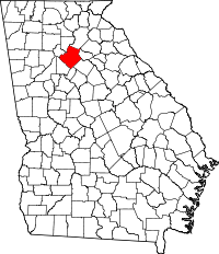 | |
| Towns | ||
| CDP | ||
| Unincorporated communities | ||
| Footnotes | ‡This populated place also has portions in an adjacent county or counties | |