Dacula, Georgia
| Dacula, Georgia | |
|---|---|
| City | |
| Motto: "A treasure in time...on track for tomorrow"[1] | |
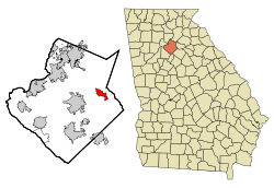 Location in Gwinnett County and the state of Georgia | |
| Coordinates: 33°59′15″N 83°53′31″W / 33.98750°N 83.89194°WCoordinates: 33°59′15″N 83°53′31″W / 33.98750°N 83.89194°W | |
| Country | United States |
| State | Georgia |
| County | Gwinnett |
| Area | |
| • Total | 4.99 sq mi (12.92 km2) |
| • Land | 4.96 sq mi (12.85 km2) |
| • Water | 0.03 sq mi (0.08 km2) |
| Elevation | 1,050 ft (320 m) |
| Population (2010) | |
| • Total | 4,442 |
| • Density | 895/sq mi (345.7/km2) |
| Time zone | Eastern (EST) (UTC-5) |
| • Summer (DST) | EDT (UTC-4) |
| ZIP code | 30019 |
| Area code(s) | 770 |
| FIPS code | 13-21184[2] |
| GNIS feature ID | 0333990[3] |
| Website |
daculaga |
Dacula (duh-KYOO-luh) is a city in Gwinnett County, Georgia, United States. The population as of the 2010 census was 4,442,[4] and the U.S. Census Bureau estimated the population to be 5,330 as of 2015.[5]
History
The vicinity of Dacula was one of the first areas in present-day metropolitan Atlanta to be settled by whites (around the time of the War of 1812), but the area remained mostly undeveloped until the late 20th century. The Dacula area is home to some of the oldest buildings in greater Atlanta, such as the Elisha Winn House, which originally acted as the courthouse for Gwinnett County. Dacula itself began in the late 1800s near the community of Chinquapin Grove, where Dacula Elementary now stands. The town was originally named "Hoke", after a Seaboard Air Line Railroad executive, but that name was changed due to the Post Office Department's protest.. Dacula's name was formed from letters in Decatur and Atlanta,[6] two cities to the west that were already prospering at the time of Dacula's founding. The city was once home to a train station on a CSX line through northeast Georgia, although the station closed in the mid-1950s.
Geography
Dacula is located in eastern Gwinnett County, with U.S. Route 29 Business/Georgia State Route 8 (Winder Highway) the main road through the center of town. Business 29/SR 8 leads west 6 miles (10 km) to Lawrenceville, the county seat, and east 11 miles (18 km) to Winder. U.S. Route 29 (University Parkway) is a four-lane highway that bypasses Dacula to the south, with access from Harbins Road. University Parkway leads east 34 miles (55 km) to Athens and west 12 miles (19 km) to Interstate 85, which leads an additional 25 miles (40 km) southwest to downtown Atlanta.
According to the United States Census Bureau, Dacula has a total area of 5.0 square miles (12.9 km2), of which 0.031 square miles (0.08 km2), or 0.59%, is water.[4]
The Dacula 30019 ZIP Code goes well beyond their city limits, resulting in mail delivery as far north as unincorporated Hamilton Mill.
Demographics
| Historical population | |||
|---|---|---|---|
| Census | Pop. | %± | |
| 1910 | 169 | — | |
| 1920 | 244 | 44.4% | |
| 1930 | 304 | 24.6% | |
| 1940 | 315 | 3.6% | |
| 1950 | 369 | 17.1% | |
| 1960 | 440 | 19.2% | |
| 1970 | 782 | 77.7% | |
| 1980 | 1,577 | 101.7% | |
| 1990 | 2,217 | 40.6% | |
| 2000 | 3,848 | 73.6% | |
| 2010 | 4,442 | 15.4% | |
| Est. 2015 | 5,330 | [5] | 20.0% |
As of 2010 Dacula had a population of 4,442. the median age was 35.2. There were 1,472 households with 92.0% of housing units occupied. The racial and ethnic composition of the population was 76.6% white (70.3% non-Hispanic white), 11.3% black or African American, 0.3% Native American, 0.4% Asian Indian, 2.8% other Asian, 0.1% Pacific Islander, 5.4% from some other race (0.1% non-Hispanic from some other race) and 3.1% from two or more races. 13.6% of the population was Hispanic or Latino.[8]
As of the census[2] of 2000, there were 3,848 people, 1,283 households, and 1,077 families residing in the city. The population density was 1,333.0 people per square mile (514.1/km²). There were 1,320 housing units at an average density of 456.9 per square mile (176.2/km²). The racial makeup of the city was 91.37% White, 4.24% African American, 0.34% Native American, 1.53% Asian, 0.03% Pacific Islander, 1.25% from other races, and 1.25% from two or more races. Hispanic or Latino of any race were 3.72% of the population.
There were 1,283 households out of which 44.3% had children under the age of 18 living with them, 68.9% were married couples living together, 11.1% had a female householder with no husband present, and 16.0% were non-families. 12.5% of all households were made up of individuals and 3.4% had someone living alone who was 65 years of age or older. 0.5% of all households were lesbian couples, and 0.2% of all households were gay male couples.[9] The average household size was 3.00 and the average family size was 3.27.
In the city the population was spread out with 29.2% under the age of 18, 7.7% from 18 to 24, 36.9% from 25 to 44, 19.7% from 45 to 64, and 6.5% who were 65 years of age or older. The median age was 33 years. For every 100 females there were 96.2 males. For every 100 females age 18 and over, there were 91.0 males.
The median income for a household in the city was $57,525, and the median income for a family was $58,603. Males had a median income of $40,616 versus $27,380 for females. The per capita income for the city was $19,720. About 0.9% of families and 1.5% of the population were below the poverty line, including 1.0% of those under age 18 and 2.3% of those age 65 or over.
Dacula has experienced rapid growth, and with the addition of commercial businesses, commerce has exploded. A 2008 demographic study completed by the developers of the Dacula Town Center showed the population has increased greatly. According to the study, the population is now 31,466 in a 3-mile radius around Dacula. The same survey reveals that in a 5-mile radius within the 30019 zipcode the population is 82,719.[10]
Education
The county operates Gwinnett County Public Schools.[11]
Gwinnett County Public Library operates the Dacula and Hamilton Mill Branch in a nearby unincorporated area.[12]
Media
The town of Dacula is served by two newspapers: the Gwinnett Daily Post (based in nearby Lawrenceville) and the Hamilton Mill Neighborhood News.
References
- ↑ "City of Dacula Georgia Website". City of Dacula Georgia Website. Retrieved September 6, 2012.
- 1 2 "American FactFinder". United States Census Bureau. Retrieved 2008-01-31.
- ↑ "US Board on Geographic Names". United States Geological Survey. 2007-10-25. Retrieved 2008-01-31.
- 1 2 "Geographic Identifiers: 2010 Demographic Profile Data (G001): Dacula city, Georgia". American Factfinder. U.S. Census Bureau. Retrieved November 29, 2016.
- 1 2 "Annual Estimates of the Resident Population for Incorporated Places: April 1, 2010 to July 1, 2015". Retrieved July 2, 2016.
- ↑ "Dacula". Gwinnett Chamber. Retrieved 2010-06-28.
- ↑ "Census of Population and Housing". Census.gov. Retrieved June 4, 2015.
- ↑ 2010 profile of general population and housing characteristics of Dacula from the US Census
- ↑ "Dacula, Georgia". Retrieved 29 January 2012.
- ↑ DemographicsNow.com
- ↑ "Gwinnett County Public Schools". Gwinnett County Public Schools. Retrieved September 6, 2012.
- ↑ "Hours & Locations." Gwinnett County Public Library. Retrieved on February 24, 2010.
External links
| Wikimedia Commons has media related to Dacula, Georgia. |
- City of Dacula official website
- Dacula at City-data.com
- Dacula High School
- Harbins Elementary School
- Dacula Athletic Association
- DaculaWeather.com
Municipalities and communities of Gwinnett County, Georgia, United States | ||
|---|---|---|
| Cities |  | |
| Towns | ||
| CDP | ||
| Unincorporated communities | ||
| Footnotes | ‡This populated place also has portions in an adjacent county or counties | |