Grade II* listed buildings in Pembrokeshire
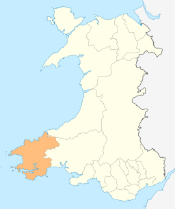
Pembrokeshire shown within Wales
In the United Kingdom, the term listed building refers to a building or other structure officially designated as being of special architectural, historical, or cultural significance; Grade II* structures are those considered to be "particularly important buildings of more than special interest".[1] Listing was begun by a provision in the Town and Country Planning Act 1947. Once listed, strict limitations are imposed on the modifications allowed to a building's structure or fittings. In Wales, the authority for listing under the Planning (Listed Buildings and Conservation Areas) Act 1990[2] rests with Cadw.
Buildings
| Name | Location | Date Listed | Grid Ref.[note 1] Geo-coordinates |
Function | Notes | HB No[note 2] | Image |
|---|---|---|---|---|---|---|---|
| Dovecote | Angle | 14 May 1970 | SM8660603075 51°41′09″N 5°05′19″W / 51.685729086453°N 5.0885018117454°W |
Dovecote | In field immediately N of Castle Farm. | 5922 | 
|
| St. Michael and All Angel's Church | Bosherston, Stackpole | 14 May 1970 | SR9661194826 51°36′55″N 4°56′21″W / 51.615385933141°N 4.9391747248022°W |
Church | 5927 | 
| |
| Church of Saint David | Caldey Island, Tenby | 14 May 1970 | SS1428296641 51°38′16″N 4°41′07″W / 51.637815693691°N 4.6852118879914°W |
Church | Situated some 50m W of Caldey Abbey chapel. | 5933 | 
|
| Carew Bridge | Carew | 14 May 1970 | SN0476103827 51°41′57″N 4°49′36″W / 51.699112992037°N 4.8266410667377°W |
Bridge | About 500 m E of Carew Castle carrying the Carew to Cresselly A4075 road across the estuary of the Carew River. | 5939 | 
|
| The Fortified Rectory | Carew | 14 May 1972 | SN0445202733 51°41′21″N 4°49′50″W / 51.689180781489°N 4.8304931768052°W |
Rectory | 100 m SW of St Mary's churchyard. | 5947 |
|
| The Old Vicarage (remains) | Castlemartin | 14 May 1970 | SR9109998888 51°38′59″N 5°01′16″W / 51.649831581935°N 5.0210974921216°W |
Vicarage (ruin) | Within St Michael's churchyard, about 40 m E of the church. | 5949 |
|
| Church of St Lawrence | Gumfreston, St Florence | 5 April 1970 | SN1092501102 51°40′36″N 4°44′10″W / 51.676757628649°N 4.7360784284226°W |
Church | 150 m S of the B4318 in Gumfreston. | 5958 | 
|
| Hodgeston Parish Church | Hodgeston, Lamphey | 14 May 1970 | SS0294699378 51°39′31″N 4°51′01″W / 51.658524509624°N 4.8503587441771°W |
Church | In village of Hodgeston, E of Lamphey | 5959 | 
|
| Lamphey Court | Lamphey | 14 May 1970 | SN0171201104 51°40′25″N 4°52′09″W / 51.673588303338°N 4.8691553556265°W |
Hotel | To the N of Lamphey Village. | 5968 | 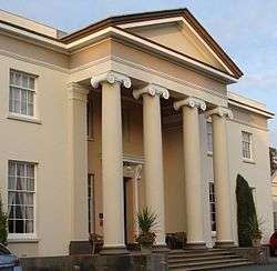
|
| Church of St Caradoc | Lawrenny, Martletwy | 14 May 1970 | SN0164806892 51°43′32″N 4°52′24″W / 51.725540747131°N 4.8733727628831°W |
Church | At the W of Lawrenny village, at the entrance to the grounds of the former Lawrenny Castle. | 5971 | 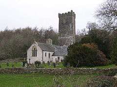
|
| Dovecote | Manorbier | 14 May 1970 | SS0626797855 51°38′46″N 4°48′06″W / 51.646005780035°N 4.8015629324996°W |
Dovecote | 5977 | 
| |
| Sunny Hill Farmhouse | Manorbier | 14 May 1970 | SS0622499974 51°39′54″N 4°48′12″W / 51.66502040927°N 4.8033584582147°W |
Farmhouse | 300 m S of the Ridgeway, 500 m W of turning to St Florence. | 5984 |
|
| Norchard | Manorbier | 14 May 1970 | SS0818599465 51°39′40″N 4°46′29″W / 51.661124338356°N 4.7747594068906°W |
House | 5986 |
| |
| Church of St Nicholas | Penally | 14 May 1970 | SS1177299177 51°39′35″N 4°43′22″W / 51.659754603227°N 4.7228053364522°W |
Church | In the centre of the village of Penally. The churchyard is enclosed within a rubble masonry wall with simple iron gates. | 5992 | 
|
| Carswell Mediaeval House | Penally | 14 May 1970 | SN0980201058 51°40′34″N 4°45′08″W / 51.675982100032°N 4.7522767609135°W |
House (ruin) | 50 m N of Carswell Farm House, in the farmyard. It is the western of the two ruined buildings. | 6005 |
|
| Church of St Florence | St Florence | 14 May 1970 | SN0823101159 51°40′35″N 4°46′30″W / 51.67635324112°N 4.7750253404422°W |
Church | Centrally placed in a compact village. | 6008 | .jpg)
|
| St. Twynnell's Church | Stackpole | 14 May 1970 | SR9495497592 51°38′23″N 4°57′53″W / 51.639619036118°N 4.9646942398162°W |
Church | 6018 | 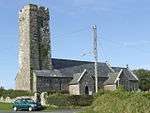
| |
| Park House | Stackpole | 14 May 1970 | SR9810296166 51°37′41″N 4°55′06″W / 51.627957199475°N 4.9184412628832°W |
House | 6021 |
| |
| St. Mary's Church | Castlemartin | 14 May 1970 | SR9323197505 51°38′18″N 4°59′22″W / 51.638204773636°N 4.989506982954°W |
Church | 2 km E of Castlemartin. | 6035 | 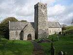
|
| Carew Tidal Mill and Tidal Barrier | Carew | 29 September 1971 | SN0415503831 51°41′56″N 4°50′07″W / 51.69893705967°N 4.8354009750078°W |
Mill/Tidal barrier | The Tidal Barrier lies across the estuary of the Carew River about 300 m W of Carew Castle. The tidal mill stands on it near to the left (S) bank, over the deeper water where the natural river channel lies. | 6038 | .jpg)
|
| St Elidyr's Church | Amroth | 21 June 1971 | SN1631507898 51°44′23″N 4°39′42″W / 51.739589505939°N 4.6617951788039°W |
Church | 1 km N of Amroth Village, in an isolated group with Amroth Farm and the old village school. The group is called 'Castle Back'. The church is in a roundish graveyard surrounded by walls and hedges. | 6044 | 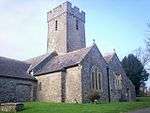
|
| Church of St. Mary | Kilgetty-Begelly | 21 June 1971 | SN1181507311 51°43′58″N 4°43′36″W / 51.732820076623°N 4.7265744391592°W |
Church | In village of Begelly, 0.5 km N of the A477(T). The church is in a large churchyard with low stone wall, stile and lychgate to N. | 6045 | 
|
| Church of Saint Mary | Bletherston, New Moat | 21 June 1971 | SN0703421206 51°51′21″N 4°48′12″W / 51.855969636007°N 4.803454994333°W |
Church | In a prominent position in the centre of Bletherston village. | 6046 | 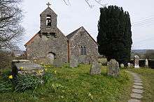
|
| Church of St. Elidyr | Lampeter Velfrey | 21 June 1971 | SN1411910913 51°45′57″N 4°41′43″W / 51.765941158729°N 4.6951756859274°W |
Church | 4 km S of village of Lampeter Velfrey, about 400 m N of Ludchurch village, in a square churchyard partly walled. | 6050 | 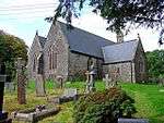
|
| Church of St Jeffrey and St Oswald | Jeffreyston | 21 June 1971 | SN0894806525 51°43′29″N 4°46′03″W / 51.724788412767°N 4.7676090819266°W |
Church | In the centre of the village of Jeffreyston. The churchyard is circular with late C19 extensions N and E. There is a preaching cross (separately listed) to the S side and a small free-standing mortuary chapel to the N side. | 6052 | 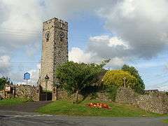
|
| Church of St Aidan | Llawhaden | 21 June 1971 | SN0752017468 51°49′21″N 4°47′40″W / 51.822570078996°N 4.7943262931519°W |
Church | In a square churchyard on the right bank of the Eastern Cleddau, 300 m N of Llawhaden Bridge. | 6062 | 
|
| Llawhaden Bridge and River Bank Wall | Llawhaden | 21 June 1971 | SN0747317251 51°49′14″N 4°47′42″W / 51.820605125709°N 4.7948867054676°W |
Bridge | On Eastern Cleddau ? km E of Llawhaden Village | 6064 | 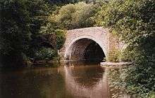
|
| Vaynor | Llawhaden | 21 June 1971 | SN0980517513 51°49′26″N 4°45′40″W / 51.823759234778°N 4.7612370916763°W |
House | Reached by a private drive on the E side of the B4313 Pont Sh?n to Bethesda road | 6072 |
|
| Church of St Leonard | Loveston, Jeffreyston | 21 June 1971 | SN0841108477 51°44′32″N 4°46′35″W / 51.742134520881°N 4.7764492366699°W |
Church | Loveston | 6076 | 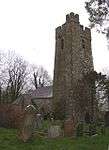
|
| Parish Church of Saint Nicholas | New Moat | 21 June 1971 | SN0624325241 51°53′31″N 4°49′02″W / 51.891928865935°N 4.8171914507809°W |
Church | Prominently situated on S side of village on W side of road; raised rounded graveyard. | 6086 | 
|
| Blackpool Bridge | Martletwy | 21 June 1971 | SN0601214514 51°47′44″N 4°48′52″W / 51.795519686944°N 4.8145250454696°W |
Bridge | Crossing the Eastern Cleddau adjacent to Blackpool Mill, closest to the highest navigable point of the river. Also in Slebech | 6089 | 
|
| Blackpool Mill | Martletwy | 21 June 1971 | SN0599914489 51°47′43″N 4°48′53″W / 51.795290660154°N 4.81469933008°W |
Mill | On the left bank of the Eastern Cleddau 1 km SW of Canaston Bridge. | 6090 | 
|
| St Issell's Church | Saundersfoot | 21 June 1971 | SN1325305818 51°43′12″N 4°42′18″W / 51.71989382254°N 4.7049743782643°W |
1km N of the village of Saundersfoot. The church stands in a large undulating graveyard through which a stream passes. | 6093 | .jpg)
| |
| Slebech Park | Slebech | 21 June 1971 | SN0314113977 51°47′23″N 4°51′21″W / 51.789691021696°N 4.8557985879011°W |
Country house | In extensive grounds 2 km E of Picton Castle, overlooking the Eastern Cleddau. | 6102 | 
|
| Tenby Castle remains | Tenby | 19 March 1951 | SN1371400501 51°40′20″N 4°41′44″W / 51.672294836059°N 4.6954676719624°W |
Castle ruin | Remains are situated at various locations on Castle Hill, on the NE side of the town. | 6111 | 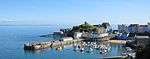
|
| Laston House | Tenby | 19 March 1951 | SN1365600550 51°40′22″N 4°41′47″W / 51.672715617758°N 4.6963316175195°W |
House | Situated on the N side of Castle Square facing S to St Julian's Street. | 6119 | .JPG)
|
| The Prize House | Tenby | 31 May 1954 | SN1331900585 51°40′23″N 4°42′04″W / 51.672917716332°N 4.7012182318833°W |
House | Facing the sea next to the Royal Lion Hotel just S of the junction of the High Street and White Lion Street. | 6165 | 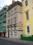
|
| Medieval structure in the churchyard | Tenby | 19 March 1951 | SN1338900457 51°40′18″N 4°42′00″W / 51.671791458499°N 4.700138679336°W |
Situated some 20m W of the Church of Saint Mary in Liberty. | 6175 |
| |
| Norton House, including garden wall to street | Tenby | 19 March 1951 | SN1315900880 51°40′32″N 4°42′13″W / 51.675513790048°N 4.7036872841811°W |
House | Situated on the W side of The Norton some 110m N of the junction with St John's Hill. | 6211 | 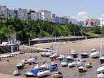
|
| The Former Assembly Rooms | Tenby | 19 March 1951 | SN1364200561 51°40′22″N 4°41′48″W / 51.672809752045°N 4.6965397167614°W |
Situated in a prominent position between the harbour and the sea at the N end of Pier Hill. | 6223 | 
| |
| Plantagenet House | Tenby | 19 March 1951 | SN1352500433 51°40′18″N 4°41′53″W / 51.671621212663°N 4.6981614051553°W |
Situated on the W side of Quay Hill between Tudor Square and Bridge Street. | 6227 | 
| |
| Saint Catherine's Fort | Tenby | 19 March 1951 | SN1395200307 51°40′14″N 4°41′31″W / 51.67063159829°N 4.6919264492501°W |
Situated in a prominent position on Saint Catherine's Island to the E of the town and SE of Castle Hill. | 6229 | 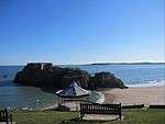
| |
| No 3 Rock Terrace including railings | Tenby | 19 March 1951 | SN1360100345 51°40′15″N 4°41′49″W / 51.670856169411°N 4.6970166468965°W |
Houses | Set back from the street line on the S side of St Julian's Street opposite Slate House with rear facade overlooking Iron Bar Sands. | 6261 | 
|
| No 1 Lexden Terrace, including area railings | Tenby | 19 March 1951 | SN1365100382 51°40′16″N 4°41′47″W / 51.671205113285°N 4.6963141796966°W |
Houses | Lexden Terrace lies at a tangent to the E side of St Julian's Street, the rear overlooking Castle Sands, all set back behind a forecourt wall. | 6268 | 
|
| Dovecote in field to NW of Priory Farmhouse | Pembroke | 14 July 1981 | SM9765201754 51°40′41″N 4°55′41″W / 51.677972081061°N 4.9281682787577°W |
Dovecote | Situated near the centre of a field some 350m NW of Priory Farmhouse. | 6327 |
|
| Priory Farmhouse | Pembroke | 10 February 1951 | SM9787801478 51°40′32″N 4°55′29″W / 51.675575426862°N 4.9247442047819°W |
Situated in Monkton approximately 50m W of the Priory Church of Saint Nicholas. | 6328 |
| |
| Pembroke Town Walls | Pembroke | 9 June 1976 | SM9876601234 51°40′25″N 4°54′42″W / 51.673704385873°N 4.9117781194389°W |
Wall | On the S side of the town extending some 225m E from no. 5 Common Road to Rock Terrace. | 6342 | .jpg)
|
| Outbuilding range at Kingston Farm to SE of old farmhouse | Pembroke | 14 July 1981 | SR9945799468 51°39′29″N 4°54′03″W / 51.658094356686°N 4.9007843989951°W |
Situated SE of the house at Kingston Farm some 2km SE of the centre of Pembroke. | 6363 |
| |
| Nos 89/91 Main Street | Pembroke | 10 February 1951 | SM9867501353 51°40′29″N 4°54′47″W / 51.674740226648°N 4.9131610040898°W |
On the S side of Main Street some 35m E of its W junction with East Back. | 6385 |
| |
| 111 Main Street | Pembroke | 14 July 1981 | SM9881701310 51°40′28″N 4°54′40″W / 51.674405162175°N 4.91108534251°W |
House | On the S side of Main Street near its E junction with East Back and opposite the entrance to the Church of Saint Michael. | 6395 |
|
| Zion Free Church, Meyrick Street | Pembroke Dock | 14 July 1981 | SM9667403435 51°41′34″N 4°56′36″W / 51.692711760614°N 4.943273567296°W |
Church | Formerly listed as Wesleyan Methodist Chapel | 6415 | .jpg)
|
| Former Guard House, the Dockyard | Pembroke Dock | 18 January 1974 | SM9603603636 51°41′39″N 4°57′09″W / 51.694284295682°N 4.952608975907°W |
6436 | .jpg)
| ||
| The Old Storehouse, the Dockyard | Pembroke Dock | 18 January 1974 | SM9602503742 51°41′43″N 4°57′10″W / 51.695232075417°N 4.9528299082564°W |
formerly listed as Main Stores of R Hayes Investments Ltd | 6441 | 
| |
| The Defensible Barracks Presely View (W End) | Pembroke Dock | 18 January 1974 | SM9606703083 51°41′22″N 4°57′07″W / 51.689330116781°N 4.9518377478342°W |
Barracks | 6448 | .jpg)
| |
| No 1, The Terrace | Pembroke Dock | 18 January 1974 | SM9603803521 51°41′36″N 4°57′09″W / 51.693252420968°N 4.9525128244509°W |
formerly listed together with the Commodore Club | House | 6454 |
|
| No 2, The Terrace, The Dockyard | Pembroke Dock | 18 January 1974 | SM9606303504 51°41′35″N 4°57′08″W / 51.693108890757°N 4.9521416787765°W |
House | 6455 |
| |
| Garrison Chapel | Pembroke Dock | 18 January 1974 | SM9628003484 51°41′35″N 4°56′56″W / 51.6930083834°N 4.9489947374375°W |
Formerly listed as premises occupied by Pembroke Motor Museum | 6458 |
| |
| Flemish Cottage | Pembroke | 14 July 1981 | SM9818701527 51°40′34″N 4°55′13″W / 51.676126918796°N 4.9203096471182°W |
On the S side of the road opposite Pembroke Castle and some 65m E of Monkton Bridge. | 6468 |
| |
| Panteg farmhouse | Llanddewi Velfrey | 2 April 1986 | SN1570916121 51°48′48″N 4°40′30″W / 51.813242415524°N 4.674928409681°W |
Farmhouse | On an elevated site to SE of village, overlooking Lampeter Vale. Reached by a long curving track along wooded hillside. | 6547 |
|
| Orielton Field Centre | Orielton, Hundleton | 14 May 1970 | SR9545399036 51°39′10″N 4°57′30″W / 51.652767352549°N 4.9583377113403°W |
Field Centre | Clay Lane, Orielton | 6573 | 
|
| Former Banqueting Tower | Orielton, Hundleton | 14 May 1970 | SR9543598750 51°39′01″N 4°57′30″W / 51.650192733117°N 4.958430203141°W |
Tower | about 300m SE OF Orielton Field Centre | 6586 | .jpg)
|
| Former Church of Saint Mary, Pwllcrochan | Pwllcrochan, Hundleton | 14 May 1970 | SM9205102657 51°41′02″N 5°00′35″W / 51.684026714553°N 5.0096004206368°W |
6587 | 
| ||
| Dovecote and attached Courtyard Ranges of Outbuildings | West Orielton, Hundleton | 29 September 1993 | SR9529698961 51°39′07″N 4°57′38″W / 51.652036561231°N 4.9605601271701°W |
Dovecote | Farm Buildings E of West Orielton | 6600 |
|
| Llechryd Bridge | Manordeifi | 21 September 1964 | SN2179743627 52°03′44″N 4°36′03″W / 52.062268626237°N 4.6009663352119°W |
Bridge | Situated across Afon Teifi between Llechryd and Castell Malgwyn lodge. | 9895 | 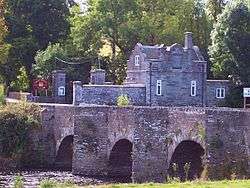
|
| Church of St Llawddog | Cilgerran | 16 January 1952 | SN1906543074 52°03′23″N 4°38′26″W / 52.056413927067°N 4.6404810300321°W |
Church | Church Street (S side) | 11972 | .jpg)
|
| Glandovan | Cilgerran | 16 January 1952 | SN1992441504 52°02′33″N 4°37′38″W / 52.042594249351°N 4.6271385206755°W |
House | 11973 |
| |
| Benton Castle | Burton | 13 December 1951 | SN0053806887 51°43′30″N 4°53′22″W / 51.725100718444°N 4.8894197743197°W |
Castle | Built on a spectacular position high above the W side of the Daugleddau some 2.3km NE of the church at Burton. | 11981 | .jpg)
|
| Rosemarket dovecote | Rosemarket | 13 December 1951 | SM9539008241 51°44′07″N 4°57′53″W / 51.735396852343°N 4.9646475900588°W |
Dovecote | In the centre of a field known as Pigeon Hay some 100m NE of the crossroads near the Church of Saint Ismael. | 11983 |
|
| Scolton Manor | Scolton, Spittal | 13 December 1951 | SM9900022038 51°51′38″N 4°55′14″W / 51.860595091642°N 4.9204398641625°W |
Museum | Situated in own grounds on W side of B4329 some 1.5 km SE of Spittal village. | 11984 | 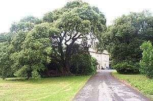
|
| Church of Saint Mary | Burton | 3 January 1963 | SM9854105649 51°42′48″N 4°55′03″W / 51.71326776774°N 4.9175779664338°W |
Church | On the N side of Burton at the end of Church Road. | 11987 | .jpg)
|
| Church of St Ishmael | Camrose | 3 January 1963 | SM9271220066 51°50′26″N 5°00′38″W / 51.840580929917°N 5.0104407481316°W |
Church | Situated in churchyard in centre of Camrose village. | 11988 | 
|
| Camrose House | Camrose | 3 January 1963 | SM9269719787 51°50′17″N 5°00′38″W / 51.83807034928°N 5.0104909274838°W |
House | Situated on the S side of the village, the drive to Camrose House and Home Farm off a minor road just S of the bridge over Camrose Brook. | 11989 |
|
| Clareston | Freystrop | 3 January 1963 | SM9572010472 51°45′20″N 4°57′40″W / 51.755549851009°N 4.961185972529°W |
House | At the end of a drive running SW off the road through Freystrop just S of Puddleduck Bridge. | 11991 |
|
| Church of St Peter | Johnston | 3 January 1963 | SM9321210406 51°45′15″N 4°59′51″W / 51.754033587062°N 4.9974313947395°W |
Church | In centre of village, in churchyard to E of main road. | 11996 | .jpg)
|
| Nolton Rectory | Nolton and Roch | 3 January 1963 | SM8667718128 51°49′15″N 5°05′48″W / 51.82090065132°N 5.0967149481249°W |
Rectory | Situated opposite Nolton church in Nolton village. | 12000 |
|
| Cottesmore including attached E conservatory and NW wing. | Rudbaxton | 3 January 1963 | SM9484218604 51°49′42″N 4°58′43″W / 51.828243549483°N 4.9786995673515°W |
House | Reached by a drive of some 650m W off the A40 at Tangiers. | 12002 |
|
| Church of Saint Andrew | Walwyn's Castle | 3 January 1963 | SM8847909593 51°44′42″N 5°03′55″W / 51.744960487794°N 5.0654056118178°W |
Church | On the S side of the minor road through Robeston West. | 12005 | 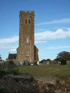
|
| Poyston including attached service ranges to NW. | Rudbaxton | 3 January 1963 | SM9675119815 51°50′23″N 4°57′06″W / 51.83981739744°N 4.9517471784836°W |
House | Situated some 1.3 km E of the A40 and just N of the airfield at Withybush. | 12010 |
|
| Church of St Dogfael | St Dogswells, Wolfscastle | 3 January 1963 | SM9689228005 51°54′48″N 4°57′16″W / 51.913405977564°N 4.954523851847°W |
Church | Situated S of the Afon Anghof some 150m E of Sealyham Bridge and some 400m N of St Dogwells Farm. | 12011 | 
|
| Church of St Mary | Wiston | 3 January 1963 | SN0221817959 51°49′30″N 4°52′17″W / 51.825121315394°N 4.8714368949105°W |
Church | In a prominent position on the S side of the road through Wiston and some 200m S of Wiston Castle. | 12017 | 
|
| New Bridge and four lamp standards | Haverfordwest | 7 January 1974 | SM9551915689 51°48′08″N 4°58′02″W / 51.802319308382°N 4.9671679090592°W |
Bridge | Situated between Picton Place and Victoria Place, across the Western Cleddau river. | 12020 | 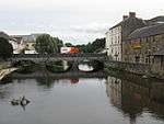
|
| The Old Bridge | Haverfordwest | 10 December 1951 | SM9540415876 51°48′14″N 4°58′08″W / 51.803956137662°N 4.9689438331395°W |
Bridge | Situated across river between N end of Bridge Street and Old Bridge. | 12021 | 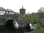
|
| Church of Saint Martin of Tours | Haverfordwest | 10 December 1951 | SM9516915733 51°48′09″N 4°58′20″W / 51.802585812763°N 4.9722628934344°W |
Church | Situated in churchyard raised above Church Street and Chapel Lane. | 12041 | 
|
| Tabernacle Congregational Church | Haverfordwest | 7 January 1974 | SM9509715744 51°48′10″N 4°58′24″W / 51.802658104611°N 4.9733121629259°W |
Church | Situated on SW corner of City Road/Barn St, facing across main road to St Martin's Church. | 12044 | 
|
| Tabernacle Church School | Haverfordwest | 7 January 1974 | SM9510715761 51°48′10″N 4°58′23″W / 51.802814422403°N 4.9731773846173°W |
School | Situated adjoining Tabernacle Church to N, overlooking junction of City Road and Perrots Road. | 12045 |
|
| Forecourt dwarf wall and railings to Tabernacle Church and to Tabernacle Church School | Haverfordwest | 7 January 1974 | SM9511815744 51°48′10″N 4°58′23″W / 51.802665827555°N 4.9730080223596°W |
Situated across the E fronts of the chapel and school, overlooking junction with Perrots Road. | 12046 | 
| |
| Williamston House including area railings | Haverfordwest | 7 January 1974 | SM9531215463 51°48′01″N 4°58′12″W / 51.800214076635°N 4.9700323854749°W |
House | On the S side of Goat Street some 45m E of its junction with Market Street. | 12081 |
|
| 8 Goat Street | Haverfordwest | 10 December 1951 | SM9530115483 51°48′01″N 4°58′13″W / 51.80039°N 4.97020°W |
House | Large 18th-century terraced house, attached to the similar Grade II* listed No. 10 | 12090 |
|
| Foley House | Haverfordwest | 10 December 1951 | SM9533215505 51°48′02″N 4°58′11″W / 51.8005985356°N 4.969767542701°W |
House | Situated in own grounds on sloping site half way down street, set back in terraced forecourt. | 12092 | 
|
| Hermon's Hill House | Haverfordwest | 10 December 1951 | SM9541715492 51°48′02″N 4°58′07″W / 51.800513026567°N 4.9685288757473°W |
Situated at top end of Hill Lane to S of No 27 Hill Lane. | 12097 |
| |
| 15 High Street | Haverfordwest | 10 December 1951 | SM9527315580 51°48′05″N 4°58′14″W / 51.801250274155°N 4.9706662958888°W |
Shop | On the S side of the High Street opposite its junction with Dark Street. | 12104 |
|
| The Shire Hall | Haverfordwest | 10 December 1951 | SM9541415609 51°48′06″N 4°58′07″W / 51.801562452776°N 4.9686413833839°W |
Restaurant | On the S side of the High Street some 25m W of its junction with Quay Street. | 12110 | 
|
| Railings, gates, steps and retaining wall to the Shire Hall | Haverfordwest | 7 January 1974 | SM9541115623 51°48′06″N 4°58′07″W / 51.801687055344°N 4.9686930952517°W |
Railings/gates/steps | On the S side of the High Street some 25m W of its junction with Quay Street. | 12111 |
|
| 12 High Street | Haverfordwest | 7 January 1974 | SM9526215611 51°48′05″N 4°58′15″W / 51.801524576557°N 4.9708439151064°W |
Office | Situated attached to No 1 Dark Street, at junction of High Street and Dark Street. | 12116 | 
|
| 22 High Street | Haverfordwest | 7 January 1974 | SM9530615609 51°48′05″N 4°58′13″W / 51.801522785583°N 4.9702055014229°W |
House | Situated two doors down from set-back for C20 National Westminster Bank. | 12118 |
|
| 36 and 38 High Street | Haverfordwest | 10 December 1951 | SM9536515628 51°48′06″N 4°58′10″W / 51.801715056612°N 4.9693622480567°W |
Shops | On the N side of the High Street some 60m W of its junction with Quay Street. | 12122 |
|
| 40 High Street | Haverfordwest | 10 December 1951 | SM9537415632 51°48′06″N 4°58′09″W / 51.801754277531°N 4.969234265982°W |
Offices | On the N side of the High Street some 50m W of its junction with Quay Street. | 12123 / 12137 |
|
| Palace Cinema and 2 Hill Street | Haverfordwest | 7 January 1974 | SM9525515424 51°47′59″N 4°58′15″W / 51.79984295905°N 4.970834830204°W |
Cinema and house | Situated on corner of Upper Market Street with facades to both streets. | 12148 | 
|
| Hillborough House and area railings | Haverfordwest | 7 January 1974 | SM9518015411 51°47′59″N 4°58′19″W / 51.799698669815°N 4.9719132985679°W |
Some 30m S of the junction of Hill Street and Horn's Lane. | 12152 |
| |
| The Crypt | Haverfordwest | 10 December 1951 | SM9522615560 51°48′04″N 4°58′17″W / 51.801053425455°N 4.9713351551955°W |
Crypt | Situated on the corner of Market Street and High St, opposite St Mary's Church. | 12172 | 
|
| Plas Glyn-y-Mel, including quadrant wall & gatepier to W service court | Fishguard, Fishguard and Goodwick | 24 November 1978 | SM9661236965 51°59′38″N 4°57′50″W / 51.993752543114°N 4.9638936844606°W |
House | Situated in its own grounds at the end of Glyn-y-Mel Road. | 12256 |
|
| Hermon Baptist Church including forecourt walls and steps | Fishguard, Fishguard and Goodwick | 24 November 1978 | SM9567436903 51°59′34″N 4°58′39″W / 51.992850314581°N 4.977499401749°W |
Chapel | Situated set back from the street line W of No 21, in raised paved forecourt. | 12273 | 
|
| Church of St Hywel, Llanhowell | Llanrhian | 2 April 1991 | SM8189427427 51°54′09″N 5°10′19″W / 51.902524923629°N 5.1718743862473°W |
Church | 12423 | 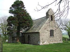
| |
| Church of St Mary | Newport | 16 January 1952 | SN0579738964 52°00′54″N 4°49′53″W / 52.015002417758°N 4.831422397569°W |
Church | Church Street (east side) | 12483 | 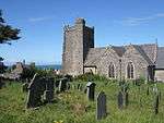
|
| Ebenezer Congregational Chapel (Capel Ebenezer) | Newport | 14 April 1992 | SN0580939176 52°01′01″N 4°49′53″W / 52.016910314481°N 4.8313680373796°W |
Chapel | Lower St Mary's Street | 12497 | 
|
| The Close Wall | St Davids and the Cathedral Close | 3 January 1963 | SM7510625315 51°52′51″N 5°16′08″W / 51.880857810689°N 5.2689987009069°W |
Wall | Encircling the Cathedral Close, formerly listed with Porth-y-Tŵr. | 12542 | 
|
| Pont Cerwyn Dewi / Merryvale Bridge and attached tower | St Davids and the Cathedral Close | 3 January 1963 | SM7495325356 51°52′52″N 5°16′16″W / 51.881163842743°N 5.2712445380794°W |
Bridge | the Cathedral Close | 12543 | 
|
| The City Cross | St Davids | 3 January 1963 | SM7534025320 51°52′52″N 5°15′56″W / 51.880997417581°N 5.2656080304212°W |
Cross | Cross Square (in centre) | 12575 | 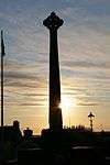
|
| Capel Caerfarchell and outbuilding to north-eastern corner of forecourt, Caerfarchell | Caerfarchell | 28 July 1992 | SM7946527001 51°53′52″N 5°12′25″W / 51.897740865467°N 5.2068511443815°W |
Chapel | 12664 | 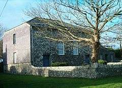
| |
| Rhosson Uchaf / Rhosson Farmhouse, Rhosson | St Davids | 13 December 1951 | SM7292525267 51°52′46″N 5°18′02″W / 51.879539314535°N 5.300599348183°W |
Farmhouse | 12708 |
| |
| St Non's Well, St Non's | St Davids | 3 January 1963 | SM7510424369 51°52′21″N 5°16′06″W / 51.872365544167°N 5.2684112622563°W |
Well | 12712 | 
| |
| Treleddyn Uchaf / Upper Treleddyn, including gardens walls with crosshead | Treleddyn, St Davids | 13 December 1951 | SM7319525948 51°53′09″N 5°17′50″W / 51.885762258589°N 5.297131199723°W |
12737 |
| ||
| Church of St Brynarch | Nevern | 16 January 1952 | SN0833240029 52°01′32″N 4°47′42″W / 52.025450336016°N 4.7951257143793°W |
Church | B4582 (N side) | 12746 | 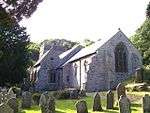
|
| Churchyard of church of St Brynarch, including wall and gates | Nevern | 16 January 1952 | SN0833440017 52°01′31″N 4°47′42″W / 52.025343270487°N 4.795089876899°W |
Churchyard | B4582 (N. side) | 12747 |
|
| Church of St Andrew | Bayvil, Nevern | 16 January 1952 | SN1016340620 52°01′53″N 4°46′08″W / 52.031389275695°N 4.7687993727545°W |
Church | B4582 (N. side) Bayvil/Beifil | 12756 | 
|
| Berry Hill House | Berry Hill, Nevern | 27 October 1992 | SN0683340192 52°01′35″N 4°49′01″W / 52.026392349352°N 4.81703838876°W |
Berry Hill | 12757 | 
| |
| Llwyngoras, including garden walls with gate piers | Moylgrove, Nevern | 27 October 1992 | SN0920639504 52°01′16″N 4°46′56″W / 52.021038123186°N 4.7821099934066°W |
House | Glanrhyd Road, Llwyngoras | 12772 | 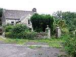
|
| Trewern | Trewern, Nevern | 4 September 1980 | SN0882638106 52°00′30″N 4°47′13″W / 52.008352871536°N 4.7868603693819°W |
House | 12808 |
| |
| Church of St Katharine | Milford Haven | 17 July 1951 | SM9086305754 51°42′41″N 5°01′43″W / 51.711390414596°N 5.0286177800207°W |
Church | Sandhurst Road | 12905 | 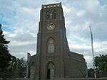
|
| Fort Hubberston | Hakin, Milford Haven | 22 February 1993 | SM8907505508 51°42′31″N 5°03′16″W / 51.708509822004°N 5.0543103066121°W |
Fort | Situated on headland, approached by access drive running S from Primary School in Picton Road. | 12920 | .jpg)
|
| The Observatory | Milford | 6 March 1964 | SM8921105956 51°42′45″N 5°03′09″W / 51.712583412118°N 5.0526158913072°W |
Observatory (ruined) | Picton Road, Hakin | 12922 | 
|
| Pill Priory Ruins | Lower Priory, Milford Haven | 28 January 1963 | SM9027707263 51°43′29″N 5°02′17″W / 51.724719272321°N 5.0379958349388°W |
Priory (ruined) | Lower Priory | 12927 | 
|
| The Steps, (including property formerly known as Brook Villa) | Lower Priory, Milford Haven | 28 January 1963 | SM9027807244 51°43′28″N 5°02′17″W / 51.72454905792°N 5.0379699324035°W |
House | Lower Priory | 12928 |
|
| The Priory Inn (including 3 properties formerly known as Priory Farmhouse) | Milford Haven | 28 January 1963 | SM9026407226 51°43′28″N 5°02′17″W / 51.72438219039°N 5.0381614874752°W |
Inn | The Steps above Priory Farm | 12929 | 
|
| Church of St Peter & St Cewydd | Steynton, Milford Haven | 22 February 1993 | SM9177807820 51°43′49″N 5°01′00″W / 51.730281842993°N 5.0166285597759°W |
Church | Situated on E side of main road in Steynton village. | 12934 | 
|
| Church of St. Gwyndaf | Llanwnda, Pencaer | 14 July 1993 | SM9321839584 52°00′58″N 5°00′53″W / 52.016008492332°N 5.0148372147956°W |
Church | 12980 | 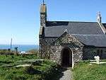
| |
| Tregwnt, Tregwynt, Granston/Treopert | Pencaer | 3 January 1963 | SM8896634617 51°58′11″N 5°04′25″W / 51.969809591581°N 5.0736478181863°W |
House | 12996 | 
| |
| North Wing & Low Farm Range to W. of Tregwynt | Tregwynt, Granston/Treopert, Pencaer | 3 January 1963 | SM8893734630 51°58′12″N 5°04′27″W / 51.969915248774°N 5.0740773374954°W |
House | 12997 |
| |
| St Brides Castle | Marloes and St Brides | 29 October 1979 | SM7961910706 51°45′05″N 5°11′39″W / 51.751523967231°N 5.1942423564651°W |
Guest house | Situated in wooded parkland, overlooking and some 700m SW of St Brides Haven. | 13018 | 
|
| The Pigeon House and Railings at Cilwendeg Farm | Capel Colman, Boncath | 23 January 1976 | SN2222538823 52°01′09″N 4°35′32″W / 52.019260009557°N 4.5922307785224°W |
Situated at rear NE end of farm complex, below barn. | 13024 |
| |
| The Shell House, Cilwendeg Farm | Capel Colman, Boncath | 23 January 1976 | SN2219438685 52°01′05″N 4°35′33″W / 52.018010610975°N 4.5926103521015°W |
Shell House | Situated in undergrowth backing onto track running SW from Cilwendeg Farm some 70m SW of Counting House. | 13025 | 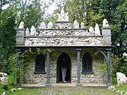
|
| Farm buildings W of Temple Druid | Maenclochog | 28 September 1989 | SN0959827206 51°54′39″N 4°46′10″W / 51.910735162584°N 4.7695827104197°W |
To the rear of Temple Druid Cottages and just W of the house at Temple Druid. | 13054 |
| |
| Court / Cwrt including screen wall and outside kitchen to service court | Cwm Gwaun | 20 July 1992 | SM9892435672 51°58′59″N 4°55′46″W / 51.982987768488°N 4.9295074366116°W |
Approximately 0.5 km NE of Llanychaer, situated on fine elevated site facing W towards Fishguard. Reached by a steep track from the bridge over Afon Gwaun. | 13067 |
| |
| Rickeston Hall | Rickeston, Brawdy | 8 October 1993 | SM8469825387 51°53′07″N 5°07′48″W / 51.885306036272°N 5.1299066521672°W |
Farmhouse | Situated immediately W of Brawdy Airfield, some 2km N of A487. | 13077 | 
|
| Y Felin | St Dogmaels (part) | 15 November 1993 | SN1652745912 52°04′52″N 4°40′44″W / 52.081064097426°N 4.6789821171298°W |
Mill | Situated some 100m ENE of the abbey ruins. | 13096 | 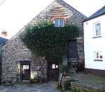
|
| The South West Martello Tower | Pembroke Dock | 18 February 1994 | SM9551803606 51°41′38″N 4°57′36″W / 51.693825784819°N 4.9600756864769°W |
Martello tower | Fort Road (W End) | 14353 | _-_geograph.org.uk_-_462600.jpg)
|
| North East Martello Tower | Pembroke Dock | 18 February 1994 | SM9640603835 51°41′46″N 4°56′51″W / 51.696205961495°N 4.9473791773459°W |
Martello tower | Front Street (N Side) | 14354 | 
|
| Dry-Moat Walls, Presely View (W end) | Pembroke Dock | 18 January 1974 | SM9606703083 51°41′22″N 4°57′07″W / 51.689330116781°N 4.9518377478342°W |
14371 |
| ||
| Barracks Platform, Presely View (W Side) | Pembroke Dock | 18 January 1994 | SM9606703083 51°41′22″N 4°57′07″W / 51.689330116781°N 4.9518377478342°W |
14372 |
| ||
| Dockyard Gates, the Dockyard | Pembroke Dock | 18 January 1974 | SM9602803524 51°41′36″N 4°57′10″W / 51.693275711881°N 4.9526590610043°W |
14377 |
| ||
| Piers and Lodges (formerly listed with Dockyard Wall), the Dockyard | Pembroke Dock | 18 January 1974 | SM9601403529 51°41′36″N 4°57′10″W / 51.693315502177°N 4.9528642603192°W |
14378 |
| ||
| The Port Hotel (formerly listed as the Commodore Club), the Dockyard | Pembroke Dock | 18 January 1974 | SM9599803533 51°41′36″N 4°57′11″W / 51.693345583501°N 4.9530977715249°W |
14379 |
| ||
| Long Stable Range to South, the Dockyard | Pembroke Dock | 18 January 1974 | SM9599103507 51°41′35″N 4°57′11″W / 51.693109572209°N 4.9531837007604°W |
14380 |
| ||
| No 3, The Terrace, The Dockyard | Pembroke Dock | 18 January 1974 | SM9607403501 51°41′35″N 4°57′07″W / 51.693085963764°N 4.9519809948437°W |
14381 |
| ||
| The Graving Dock including Bollards and Capstans (formerly listed with 13 Building Slips and Carr Jet | Pembroke Dock | 18 January 1974 | SM9583903927 51°41′49″N 4°57′20″W / 51.696825350907°N 4.955625697233°W |
Graving Dock | 14393 |
| |
| Church of Saint David | Brawdy | 3 January 1963 | SM8580424040 51°52′25″N 5°06′47″W / 51.873640991265°N 5.1130251700383°W |
Church | 14396 | 
| |
| Forecourt, Railings, Piers and Gates, Meyrick Street (W side) | Pembroke Dock | 14 July 1981 | SM9669403432 51°41′34″N 4°56′35″W / 51.692692092504°N 4.9429828554186°W |
14420 |
| ||
| Hescwm Mill/Felin Hescwm | Dinas Cross | 18 March 1994 | SM9976438467 52°00′30″N 4°55′08″W / 52.008388477873°N 4.9189255630438°W |
Mill | Situated some 200m inland from Aber Bach or Hesgwm cove, approached by narrow lane from Bwlchmawr. The mill lies to the south of the group of buildings. | 14535 | 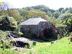
|
| Brynhenllan Chapel | Brynhenllan, Dinas Cross | 17 November 1994 | SN0091139561 52°01′07″N 4°54′10″W / 52.018625629219°N 4.9028728497803°W |
Chapel | 14942 |
| |
| Manordeifi Old Church | Manordeifi | 24 November 1994 | SN2283743162 52°03′30″N 4°35′08″W / 52.058426830413°N 4.5855706964089°W |
Church | Situated just above Teifi flood meadows, some 1.1km ESE of Llechryd Bridge. | 15115 | 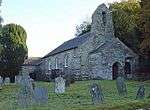
|
| Terrace, Walls and Balustrades S of Ffynone House | Manordeifi | 24 November 1994 | SN2424138585 52°01′04″N 4°33′46″W / 52.017766559928°N 4.562760209075°W |
Terrace,Walls and Balustrade | 15123 | 
| |
| Cilrhue, Boncath | Boncath | 25 January 1995 | SN1979639734 52°01′36″N 4°37′41″W / 52.026655922603°N 4.6280698165333°W |
House | 15388 | 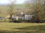
| |
| The Stable and Coach House at Cilwendeg Farm | Capel Colman, Boncath | 23 January 1976 | SN2230438777 52°01′08″N 4°35′28″W / 52.018872245523°N 4.5910568529359°W |
Stable | Situated to NE of farmhouse and N of mansion. | 15393 |
|
| Four Mediaeval House at Upper Lamphey Park Farm | Lamphey | 28 February 1995 | SN0252001320 51°40′33″N 4°51′27″W / 51.675813585886°N 4.8576074792807°W |
Houses | About 500m S of Deerpark Lane, at NW end of the farm complex. | 15663 |
|
| Cresselly House | Jeffreyston | 21 June 1971 | SN0645606543 51°43′27″N 4°48′13″W / 51.724092619343°N 4.803653981481°W |
House | Situated in its own grounds and approached along the N drive or through the stable courtyard to S. Faces E with terrace to W. | 15933 |
|
| Flimston Farmhouse | Castlemartin | 12 August 1995 | SR9242995646 51°37′16″N 5°00′00″W / 51.621216565536°N 4.9999776299568°W |
Farmhouse (ruined) | On RAC Castlemartin Range, W of road to Stack Rocks. | 16590 | 
|
| Pricaston Farmhouse | Castlemartin | 12 August 1995 | SR9177496481 51°37′42″N 5°00′36″W / 51.628471011857°N 5.0099222762133°W |
Farmhouse (ruined) | On RAC Castlemartin Range, entered by Linney Gate. | 16604 | .jpg)
|
| West Set of Kilns | Penally | 26 April 1996 | SN1205500124 51°40′06″N 4°43′09″W / 51.668354657754°N 4.7192281953739°W |
Kilns | At the S side of the main private road entering the Kiln Park caravan site, on the E side of the A4139. They are related to the extensive Black Rock quarries at their rear. | 16918 | 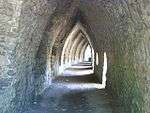
|
| The Almshouse | Angle | 14 May 1970 | SM8655002858 51°41′02″N 5°05′21″W / 51.683759484544°N 5.0891779428729°W |
Almshouse | At S of the village street, opposite the school. | 17149 |
|
| Fort Popton | Angle | 26 January 1996 | SM8944603752 51°41′34″N 5°02′52″W / 51.692883702612°N 5.047888172855°W |
Fort | On the headland at the NE corner of Angle Bay. | 17168 | 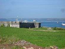
|
| Thorne Island Fort | Angle | 26 January 1996 | SM8463903828 51°41′30″N 5°07′03″W / 51.691735471353°N 5.1173773575108°W |
Fort | Off N headland of West Angle Bay. | 17169 | 
|
| Caldey Abbey | Tenby | 23 September 1996 | SS1417396605 51°38′15″N 4°41′12″W / 51.637456252152°N 4.6867660596174°W |
Abbey | On hillside above the village, about 500m SE of the harbour. | 17324 | 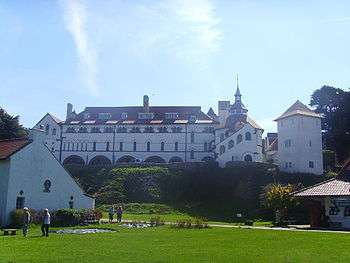
|
| Brewery | Stackpole | 2 August 1996 | SR9770296123 51°37′39″N 4°55′27″W / 51.627426898853°N 4.9241875502202°W |
Brewery | 17990 |
| |
| Eight-Arch Bridge | Stackpole | 2 August 1996 | SR9772595602 51°37′22″N 4°55′25″W / 51.622756874867°N 4.9235547371431°W |
Bridge | 18003 | 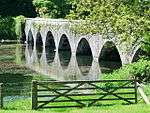
| |
| West Blockhouse Fort | Dale | 12 October 1997 | SM8181903560 51°41′18″N 5°09′29″W / 51.688236321912°N 5.1579448481414°W |
Fort | Situated on West Blockhouse Point, and reached by drive of some 1.5 km from Merryborough Farm, S of Dale. | 19148 | 
|
| Church of Saint Peter | Marloes, Marloes and St Brides | 23 February 1998 | SM7948508235 51°43′45″N 5°11′41″W / 51.729288770519°N 5.1946140255681°W |
Church | Situated at the SE end of the village of Marloes, above and to the S of the main street. | 19393 | 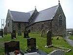
|
| Blackpool Bridge | Slebech | 26 February 1998 | SN0600614519 51°47′44″N 4°48′53″W / 51.795562499443°N 4.8146147390003°W |
Bridge | Across the Eastern Cleddau adjacent to Blackpool Mill, at the highest navigable point of the river. The bridge is half in Martletwy Community and half in Slebech Community. | 19408 |
|
| Sandy Haven House | St Ishmaels | 25 August 1998 | SM8508707614 51°43′33″N 5°06′48″W / 51.725897807613°N 5.1132406347498°W |
House | Situated just S of Sandy Haven Farm some 450m NW of Sandy Haven. | 20351 |
|
| Church of St Justinian | Trecwn | 11 October 1998 | SM9532833898 51°57′57″N 4°58′51″W / 51.965742087869°N 4.9807386955951°W |
Church | About 1km E of Scleddau, beyond farmhouse at end of track beginning on E side of A40, near old quarry, then across field to churchyard. | 20818 |
|
| Bethesda Baptist Church including vestry block attached to left | Haverfordwest | 14 May 1975 | SM9511815675 51°48′07″N 4°58′23″W / 51.802046288175°N 4.9729672321815°W |
Church | Situated near the centre of Haverfordwest, on the E side of Barn Street near its junction with City Road and Perrots Road. | 22762 | 
|
| Lofted outbuilding, wings and gin-house at Camrose Home Farm | Camrose | 30 April 2001 | SM9318919471 51°50′07″N 5°00′11″W / 51.835416226403°N 5.0031710241965°W |
Farm building | Situated on the N side of the farm court at Camrose Home Farm. | 25159 |
|
| No 2 Lexden Terrace | Tenby | 19 March 1951 | SN1365200389 51°40′17″N 4°41′47″W / 51.671268314407°N 4.6963034710655°W |
House | Lexden Terrace lies at a tangent to the E side of St Julian's Street, the rear overlooking Castle Sands, all set back behind a forecourt wall. | 26319 |
|
| No 3 Lexden Terrace | Tenby | 19 March 1951 | SN1365400395 51°40′17″N 4°41′47″W / 51.67132286708°N 4.6962777843167°W |
Lexden Terrace lies at a tangent to the E side of St Julian's Street, the rear overlooking Castle Sands, all set back behind a forecourt wall. | 26320 |
| |
| No 4 Lexden Terrace | Tenby | 19 March 1951 | SN1365600400 51°40′17″N 4°41′47″W / 51.671368438552°N 4.6962515638379°W |
Lexden Terrace lies at a tangent to the E side of St Julian's Street, the rear overlooking Castle Sands, all set back behind a forecourt wall. | 26321 |
| |
| No 5 Lexden Terrace | Tenby | 19 March 1951 | SN1365900406 51°40′17″N 4°41′46″W / 51.671423323955°N 4.6962114325282°W |
Lexden Terrace lies at a tangent to the E side of St Julian's Street, the rear overlooking Castle Sands, all set back behind a forecourt wall. | 26322 |
| |
| No 4 Rock Terrace | Tenby | 19 March 1951 | SN1361000348 51°40′15″N 4°41′49″W / 51.670886108448°N 4.6968882499392°W |
House | Set back from the street line on the S side of St Julian's Street with rear facade overlooking Iron Bar Sands. | 26340 |
|
| No 6 Lexden Terrace (Lexden House) | Tenby | 19 March 1951 | SN1366100413 51°40′17″N 4°41′46″W / 51.671486857806°N 4.6961862792468°W |
Lexden Terrace lies at a tangent to the E side of St Julian's Street, No 6, the farthest, is set back in a separate forecourt. | 26349 |
| |
| Former Tenby Market Cross and well-chamber | Tenby | 28 March 2002 | SN1310401035 51°40′37″N 4°42′16″W / 51.676887509343°N 4.70456478179°W |
Market cross | Situated at the N end of the water garden in the centre of Merlins Gardens. | 26423 |
|
| Stack Rock Fort | Herbrandston | 3 April 2004 | SM8643504946 51°42′09″N 5°05′32″W / 51.702461671581°N 5.0921174029514°W |
Fort | On Stack Rock island in Milford Haven some 2.7km S of Herbranston village. | 82592 | 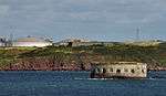
|
| The defensible barracks at South Hook Fort | Herbrandston | 3 April 2004 | SM8704405557 51°42′29″N 5°05′01″W / 51.708179596406°N 5.0836910447829°W |
Barracks | In a prominent position some 200m N of the cliffs at South Hook Point. | 82593 |
|
| Higgon's Well | Uzmaston and Boulston | 16 July 2004 | SM9614815055 51°47′49″N 4°57′28″W / 51.796857142735°N 4.9576852764667°W |
Well | On the E side of the estuary of the Cleddau Wen some 700m S of Haverfordwest station. | 82964 |
|
| Lancych | Clydau | 26 July 2004 | SN2599838382 52°00′59″N 4°32′13″W / 52.016498626171°N 4.5370794369895°W |
House | Set in its own extensive grounds on the S side of the Afon Cych some 200m W of Pont Glan Cych. | 82984 |
|
| 10 Goat Street | Haverfordwest | 7 January 1974 | SM9530915486 51°48′02″N 4°58′12″W / 51.80042°N 4.97009°W |
House | Large 18th-century terraced house, attached to the similar Grade II* listed No. 8 | 87060 |
|
| Gateway and walls to 'The Abbey' | Marloes and St Brides | 23 February 1998 | SM8035310787 51°45′09″N 5°11′01″W / 51.752540564774°N 5.1836772260989°W |
Gateway | Situated at St Brides Green, some 200m SW of St Brides Cross and some 200m SE of the coast at St Brides Haven. | 87482 |
|
| Church of St Rhian | Llanrhian | 1 March 1963 | SM8192831442 51°56′19″N 5°10′26″W / 51.938580766563°N 5.1739244827999°W |
Church | Situated in Llanrhian village about 100m NE of crossroads. | 87554 |  |
See also
Notes
- ↑ Sometimes known as OSGB36, the grid reference is based on the British national grid reference system used by the Ordnance Survey.
- ↑ The "HB Number" is a unique number assigned to each listed building by Cadw.
References
- ↑ "Buildings & Conservation Areas". Cadw. Retrieved 18 June 2013.
- ↑ "Planning (Listed Buildings and Conservation Areas) Act 1990". The National Archives. Retrieved 18 June 2013.
External links
![]() Media related to Grade II* listed buildings in Pembrokeshire at Wikimedia Commons
Media related to Grade II* listed buildings in Pembrokeshire at Wikimedia Commons
This article is issued from Wikipedia - version of the 11/28/2016. The text is available under the Creative Commons Attribution/Share Alike but additional terms may apply for the media files.