Gillette, Arizona
| Gillette, Arizona | |
|---|---|
| Populated Place | |
 Gillette  Gillette Location in the state of Arizona | |
| Coordinates: 34°01′08″N 112°09′49″W / 34.01889°N 112.16361°WCoordinates: 34°01′08″N 112°09′49″W / 34.01889°N 112.16361°W | |
| Country | United States |
| State | Arizona |
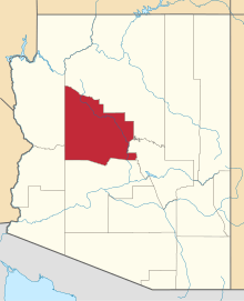
| County | Yavapai |
| Founded | 1878 |
| Abandoned | 1880 |
| Elevation[1] | 1,834 ft (559 m) |
| Population (2009) | |
| • Total | 0 |
| Time zone | MST (no DST) (UTC-7) |
| FIPS code | 04-27505 |
| GNIS feature ID | 24431 |
| Post Office opened | October 15, 1878 |
| Post Office closed | August 11, 1887 |
Gillette, Arizona, is a is a populated place situated in Maricopa County, Arizona.[2] It has an estimated elevation of 1,362 feet (415 m) above sea level.[1] Historically, it was a stagecoach station, and then a settlement formed around an ore mill serving the Tip Top Mine, on the Agua Fria River in Yavapai County in what was then Arizona Territory.[1] It was named for the mining developer of the Tip Top Mine, spelled incorrectly as Gillette on U. S. Topographic Maps and elsewhere.[1][3]:104
Gillette was founded by the superintendent of the Tip Top Mine, where he located the mill to process the ore from Tip Top, 9 miles away.[4] Its post office opened October 15, 1878.[3]:104 At its height in 1878 Gillett, had 6 streets and aside from its mill and post office, a bank, assay office, hotel, real estate office, livery stable, lumberyard, meat market, truck farm, dairy, warehouse, 2 blacksmiths, 2 stagecoach stations, 4 stores and 9 saloons or gambling houses.
After the mill was closed in 1880, and moved to Tip Top in 1884, the town was soon abandoned. It remained with a store and a stagecoach station in 1880 with a population of two.[4] Its post office had postmasters appointed up to October 1883, but it was discontinued in August 1887.[3]:104 The stage station remained until 1912, then was abandoned.[4] The Burfind Hotel was the largest structure in Gillett and ruins of it and a neglected cemetery remain.[4] Currently, it is still designated as a populated place as per the U.S. Geological Survey and the U.S. Census Bureau.[1]
References
- 1 2 3 4 5 U.S. Geological Survey Geographic Names Information System: Gillette
- ↑ "Germann (in Maricopa County, AZ) Populated Place Profile". AZ Hometown Locator. Retrieved November 21, 2016.
- 1 2 3 John and Lillian Theobald, Arizona Territory Post Offices & Postmasters, The Arizona Historical Foundation, Phoenix, 1961
- 1 2 3 4 Gillett, Arizona, Arizona Pioneer & Cemetery Research Project from apcrp.org website accessed February 28, 2015]
External links
- Gillett from ghosttowns.com