Geddes, South Dakota
| Geddes, South Dakota | |
|---|---|
| City | |
|
Main Street | |
 Location in Charles Mix County and the state of South Dakota | |
| Coordinates: 43°15′11″N 98°41′53″W / 43.25306°N 98.69806°WCoordinates: 43°15′11″N 98°41′53″W / 43.25306°N 98.69806°W | |
| Country | United States |
| State | South Dakota |
| County | Charles Mix |
| Incorporated | 1900[1] |
| Area[2] | |
| • Total | 0.61 sq mi (1.58 km2) |
| • Land | 0.61 sq mi (1.58 km2) |
| • Water | 0 sq mi (0 km2) |
| Elevation | 1,604 ft (489 m) |
| Population (2010)[3] | |
| • Total | 208 |
| • Estimate (2012[4]) | 211 |
| • Density | 341.0/sq mi (131.7/km2) |
| Time zone | Central (CST) (UTC-6) |
| • Summer (DST) | CDT (UTC-5) |
| ZIP code | 57342 |
| Area code(s) | 605 |
| FIPS code | 46-23980[5] |
| GNIS feature ID | 1255220[6] |

Geddes is a city in Charles Mix County, South Dakota, United States. The population was 208 at the 2010 census.
Geddes was laid out in 1900.[7]
Geography
Geddes is located at 43°15′11″N 98°41′53″W / 43.252950°N 98.698012°W.[8]
According to the United States Census Bureau, the city has a total area of 0.61 square miles (1.58 km2), all land.[2]
Demographics
| Historical population | |||
|---|---|---|---|
| Census | Pop. | %± | |
| 1910 | 701 | — | |
| 1920 | 695 | −0.9% | |
| 1930 | 680 | −2.2% | |
| 1940 | 581 | −14.6% | |
| 1950 | 502 | −13.6% | |
| 1960 | 380 | −24.3% | |
| 1970 | 308 | −18.9% | |
| 1980 | 303 | −1.6% | |
| 1990 | 280 | −7.6% | |
| 2000 | 252 | −10.0% | |
| 2010 | 208 | −17.5% | |
| Est. 2015 | 214 | [9] | 2.9% |
2010 census
As of the census[3] of 2010, there were 208 people, 110 households, and 57 families residing in the city. The population density was 341.0 inhabitants per square mile (131.7/km2). There were 155 housing units at an average density of 254.1 per square mile (98.1/km2). The racial makeup of the city was 96.2% White, 0.5% Native American, 0.5% Asian, 0.5% from other races, and 2.4% from two or more races. Hispanic or Latino of any race were 1.0% of the population.
There were 110 households of which 18.2% had children under the age of 18 living with them, 45.5% were married couples living together, 3.6% had a female householder with no husband present, 2.7% had a male householder with no wife present, and 48.2% were non-families. 45.5% of all households were made up of individuals and 22.7% had someone living alone who was 65 years of age or older. The average household size was 1.89 and the average family size was 2.65.
The median age in the city was 50.6 years. 16.3% of residents were under the age of 18; 4.8% were between the ages of 18 and 24; 22% were from 25 to 44; 30.3% were from 45 to 64; and 26.4% were 65 years of age or older. The gender makeup of the city was 55.8% male and 44.2% female.
2000 census
At the 2000 census,[5] there were 252 people, 122 households and 61 families residing in the city. The population density was 420.4 per square mile (162.2/km2). There were 160 housing units at an average density of 266.9 per square mile (103.0/km2). The racial makeup of the city was 98.02% White, 0.79% Native American, 0.40% Asian, 0.79% from other races. Hispanic or Latino of any race were 0.79% of the population.
There were 122 households of which 22.1% had children under the age of 18 living with them, 41.0% were married couples living together, 4.9% had a female householder with no husband present, and 50.0% were non-families. 49.2% of all households were made up of individuals and 34.4% had someone living alone who was 65 years of age or older. The average household size was 2.07 and the average family size was 2.98.
19.8% of the population were under the age of 18, 11.9% from 18 to 24, 20.6% from 25 to 44, 15.1% from 45 to 64, and 32.5% who were 65 years of age or older. The median age was 44 years. For every 100 females there were 90.9 males. For every 100 females age 18 and over, there were 100.0 males.
The median household income was $21,250, and the median family income was $36,250. Males had a median income of $20,938 versus $20,000 for females. The per capita income for the city was $12,520. About 15.5% of families and 13.6% of the population were below the poverty line, including 7.3% of those under the age of eighteen and 23.6% of those sixty five or over.
Notable people
- J. James Exon - Democratic politician, born in Geddes
- James Jones - Republican politician born in Geddes
References
- ↑ "SD Towns" (PDF). South Dakota State Historical Society. Retrieved 2010-02-12.
- 1 2 "US Gazetteer files 2010". United States Census Bureau. Archived from the original on January 24, 2012. Retrieved 2012-06-21.
- 1 2 "American FactFinder". United States Census Bureau. Retrieved 2012-06-21.
- ↑ "Population Estimates". United States Census Bureau. Archived from the original on June 17, 2013. Retrieved 2013-05-29.
- 1 2 "American FactFinder". United States Census Bureau. Archived from the original on September 11, 2013. Retrieved 2008-01-31.
- ↑ "US Board on Geographic Names". United States Geological Survey. 2007-10-25. Retrieved 2008-01-31.
- ↑ Federal Writers' Project (1940). South Dakota place-names, v.1-3. University of South Dakota. p. 38.
- ↑ "US Gazetteer files: 2010, 2000, and 1990". United States Census Bureau. 2011-02-12. Retrieved 2011-04-23.
- ↑ "Annual Estimates of the Resident Population for Incorporated Places: April 1, 2010 to July 1, 2015". Retrieved July 2, 2016.
- ↑ "Census of Population and Housing". Census.gov. Archived from the original on May 11, 2015. Retrieved June 4, 2015.
Municipalities and communities of Charles Mix County, South Dakota, United States | ||
|---|---|---|
| Cities | 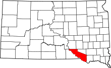 | |
| Towns | ||
| CDP | ||
| Unincorporated communities | ||
| Indian reservation | ||