Dante, South Dakota
| Dante, South Dakota | |
|---|---|
| Town | |
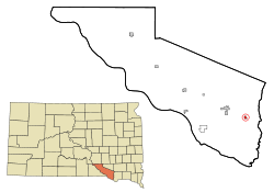 Location in Charles Mix County and the state of South Dakota | |
| Coordinates: 43°2′20″N 98°11′8″W / 43.03889°N 98.18556°WCoordinates: 43°2′20″N 98°11′8″W / 43.03889°N 98.18556°W | |
| Country | United States |
| State | South Dakota |
| County | Charles Mix |
| Incorporated | 1909[1] |
| Area[2] | |
| • Total | 0.44 sq mi (1.14 km2) |
| • Land | 0.44 sq mi (1.14 km2) |
| • Water | 0 sq mi (0 km2) |
| Elevation | 1,391 ft (424 m) |
| Population (2010)[3] | |
| • Total | 84 |
| • Estimate (2012[4]) | 85 |
| • Density | 190.9/sq mi (73.7/km2) |
| Time zone | Central (CST) (UTC-6) |
| • Summer (DST) | CDT (UTC-5) |
| ZIP code | 57329 |
| Area code(s) | 605 |
| FIPS code | 46-15420[5] |
| GNIS feature ID | 1254601[6] |
Dante is a town in Charles Mix County, South Dakota, United States. The population was 84 at the 2010 census.
Geography
Dante is located at 43°2′20″N 98°11′8″W / 43.03889°N 98.18556°W (43.038942, -98.185463).[7]
According to the United States Census Bureau, the town has a total area of 0.44 square miles (1.14 km2), all land.[2]
History
Dante was originally called Mayo, and under the latter name was laid out in 1908, and named for H.T. Mayo, a first settler.[8] However, in 1910 when the railroad came to the town, officials balked at building a depot in a town named Mayo (a name which for unclear reasons, railroad officials found undignified). The railroad requested citizens rename the town. H.T. Mayo replied that he didn't care what they renamed it, sarcastically suggesting, "You can call it Dante's Inferno for all I care."
Demographics
| Historical population | |||
|---|---|---|---|
| Census | Pop. | %± | |
| 1920 | 175 | — | |
| 1930 | 132 | −24.6% | |
| 1940 | 118 | −10.6% | |
| 1950 | 140 | 18.6% | |
| 1960 | 102 | −27.1% | |
| 1970 | 88 | −13.7% | |
| 1980 | 83 | −5.7% | |
| 1990 | 98 | 18.1% | |
| 2000 | 82 | −16.3% | |
| 2010 | 84 | 2.4% | |
| Est. 2015 | 86 | [9] | 2.4% |
2010 census
As of the census[3] of 2010, there were 84 people, 31 households, and 23 families residing in the town. The population density was 190.9 inhabitants per square mile (73.7/km2). There were 35 housing units at an average density of 79.5 per square mile (30.7/km2). The racial makeup of the town was 82.1% White, 13.1% Native American, 2.4% Asian, and 2.4% from two or more races.
There were 31 households of which 35.5% had children under the age of 18 living with them, 64.5% were married couples living together, 9.7% had a female householder with no husband present, and 25.8% were non-families. 25.8% of all households were made up of individuals and 6.5% had someone living alone who was 65 years of age or older. The average household size was 2.71 and the average family size was 3.30.
The median age in the town was 34 years. 34.5% of residents were under the age of 18; 4.8% were between the ages of 18 and 24; 23.9% were from 25 to 44; 24.9% were from 45 to 64; and 11.9% were 65 years of age or older. The gender makeup of the town was 45.2% male and 54.8% female.
2000 census
As of the census[5] of 2000, there were 82 people, 30 households, and 23 families residing in the town. The population density was 188.2 people per square mile (72.0/km²). There were 37 housing units at an average density of 84.9 per square mile (32.5/km²). The racial makeup of the town was 86.59% White and 13.41% Native American. Hispanic or Latino of any race were 2.44% of the population.
There were 30 households out of which 33.3% had children under the age of 18 living with them, 66.7% were married couples living together, 6.7% had a female householder with no husband present, and 23.3% were non-families. 23.3% of all households were made up of individuals and 6.7% had someone living alone who was 65 years of age or older. The average household size was 2.73 and the average family size was 3.22.
In the town the population was spread out with 31.7% under the age of 18, 6.1% from 18 to 24, 26.8% from 25 to 44, 24.4% from 45 to 64, and 11.0% who were 65 years of age or older. The median age was 32 years. For every 100 females there were 115.8 males. For every 100 females age 18 and over, there were 115.4 males.
The median income for a household in the town was $35,833, and the median income for a family was $36,667. Males had a median income of $26,667 versus $20,625 for females. The per capita income for the town was $14,197. There were no families and 3.2% of the population living below the poverty line, including no under eighteens and none of those over 64.
References
- ↑ "SD Towns" (PDF). South Dakota State Historical Society. Retrieved 2010-02-11.
- 1 2 "US Gazetteer files 2010". United States Census Bureau. Retrieved 2012-06-21.
- 1 2 "American FactFinder". United States Census Bureau. Retrieved 2012-06-21.
- ↑ "Population Estimates". United States Census Bureau. Retrieved 2013-05-29.
- 1 2 "American FactFinder". United States Census Bureau. Retrieved 2008-01-31.
- ↑ "US Board on Geographic Names". United States Geological Survey. 2007-10-25. Retrieved 2008-01-31.
- ↑ "US Gazetteer files: 2010, 2000, and 1990". United States Census Bureau. 2011-02-12. Retrieved 2011-04-23.
- ↑ Federal Writers' Project (1940). South Dakota place-names, v.1-3. University of South Dakota. p. 32.
- ↑ "Annual Estimates of the Resident Population for Incorporated Places: April 1, 2010 to July 1, 2015". Retrieved July 2, 2016.
- ↑ "Census of Population and Housing". Census.gov. Retrieved June 4, 2015.
Municipalities and communities of Charles Mix County, South Dakota, United States | ||
|---|---|---|
| Cities | 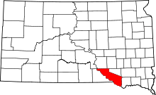 | |
| Towns | ||
| CDP | ||
| Unincorporated communities | ||
| Indian reservation | ||