Garhwa district
| Garhwa district गढवा जिला | |
|---|---|
| District of Jharkhand | |
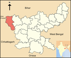 Location of Garhwa district in Jharkhand | |
| Country | India |
| State | Jharkhand |
| Administrative division | Palamu division |
| Headquarters | Garhwa |
| Government | |
| • Lok Sabha constituencies | Palamau (shared with Palamu district) |
| • Assembly seats | 2 (Garhwa-Ranka, Bhawnathpur) |
| Area | |
| • Total | 4,044 km2 (1,561 sq mi) |
| Population (2011) | |
| • Total | 1,322,387 |
| • Density | 330/km2 (850/sq mi) |
| Demographics | |
| • Literacy | 62.18 per cent |
| • Sex ratio | 933 |
| Major highways | NH 75 |
| Website | Official website |
Garhwa district (Hindi: गढवा जिला) is one of the twenty-four districts of Jharkhand state, India. Garhwa district is a part of the Palamu division, and its administrative headquarters are in the city of Garhwa.
History
On 1 April 1991, this district was created from the former Palamu district by separating its former Garhwa sub-division.
As of 2011 Garhwa district is currently a part of the Red Corridor.[1]
Administration
Garhwa district consists of 19 blocks. The following are the list of the blocks in Garhwa district:
Geography
Garhwa district lies between 23° 60’ and 24° 39’ north latitude and 83° 22’ and 84° 00’ east longitude. It is bordered by the Son River on the north, Palamau district of Jharkhand state on the east, Surguja district of Chhattisgarh state on the south, and Sonebhadra district of Uttar Pradesh on the west.
Economy
In 2006 the Indian government named Garhwa district as one of the country's 250 most forward districts, out of a total of 640.[2] It is one of the 21 districts in Jharkhand state currently receiving funds from the Backward Regions Grant Fund Programme (BRGF).[2]
Sub-divisions
Garhwa district comprises two subdivisions: Garhwa and Nagar-Untari, which are further divided into 14 blocks. At the time of creation, this district comprised only eight blocks: Bhandaria, Bhawanathpur, Dhuraki, Garhwa, Majhiyaon, Meral, Nagar-Untari and Ranka. Later, six more blocks were created by reorganizing the existing blocks. These are: Chiniya, Dandai, Kandi, Kharaundhi, Ramkanda and Ramuna. This district comprises 156 gram panchayat and 916 villages. It has two police sub-divisions: Garhwa and Nagar-Untari, with eight police stations in Bhandaria, Bhawnathpur, Dhurki, Garhwa, Majhiyaon, Meral, Nagar-Untari, and Ranka.
The district consists mostly forests and has only one city, Garhwa, which is also the district headquarters.
There are two Vidhan Sabha constituencies in this district: Garhwa and Bhawanathpur. Both are part of Palamau Lok Sabha constituency.
Transport
Garhwa is well-connected to roads and railways. Daily bus services are available from Ranchi and major districts of Jharkhand, Bihar and Chhattisgarh. Road communication in this district is not as good as in other districts of the state. Garhwa district is connected to Rewa in Madhya Pradesh and Ranchi in Jharkhand by National Highway No. 75. There are 210 km of state highway, 55 km of national highway (NH-75) and 96.95 km of district roads. Link roads and corridors are altogether 190 km.[3]
The nearest airport is at Varanasi (140 km). Garhwa Railway Station is a major railhead of the Eastern Railway zone. National Highway 75 has its route through Garhwa.
Health
Hospitals
- Sadar hospital, Garhwa
- Vananchal Dental College & Hospital Garhwa,
- Devki Mahaveer Homoeopathic Medical College & Research Hospital,
Diagnostic Centres
- Trauma Centre Hospital Nagar Untari.
Demographics
According to the 2011 census,[4] Garhwa district has a population of 1,322,387, roughly equal to the nation of Mauritius[5] or the US state of New Hampshire.[6] This gives it a ranking of 368th in India, out of a total of 640. The district has a population density of 327 inhabitants per square kilometre (850/sq mi). Its population growth rate over the decade 2001-2011 was 27.71%. Garhwa has a sex ratio of 933 females for every 1000 males, and a literacy rate of 62.18%.
See also
References
- ↑ "83 districts under the Security Related Expenditure Scheme". IntelliBriefs. 2009-12-11. Retrieved 2011-09-17.
- 1 2 Ministry of Panchayati Raj (September 8, 2009). "A Note on the Backward Regions Grant Fund Programme" (PDF). National Institute of Rural Development. Retrieved September 27, 2011.
- ↑ http://garhwa.nic.in/communication.html
- ↑ "District Census 2011". Census2011.co.in. 2011. Retrieved 2011-09-30.
- ↑ US Directorate of Intelligence. "Country Comparison:Population". Retrieved 2011-10-01.
Mauritius 1,303,717 July 2011 est.
- ↑ "2010 Resident Population Data". U. S. Census Bureau. Retrieved 2011-09-30.
New Hampshire 1,316,470
External links
 |
Sonbhadra district, Uttar Pradesh | Rohtas district, Bihar | | |
| |
Palamu district | |||
| ||||
| | ||||
| Surguja district, Chhattisgarh | Latehar district |
Coordinates: 24°10′12″N 83°48′36″E / 24.17000°N 83.81000°E