Ranchi
| Ranchi राँची | |
|---|---|
| Metropolis | |
|
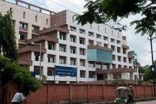
Ranchi skyline | |
| Nickname(s): City of waterfalls | |
 Ranchi  Ranchi Location in Jharkhand | |
| Coordinates: 23°22′N 85°20′E / 23.36°N 85.33°ECoordinates: 23°22′N 85°20′E / 23.36°N 85.33°E | |
| Country | India |
| State | Jharkhand |
| District | Ranchi |
| Government | |
| • Body | Ranchi Municipal Corporation |
| • Mayor | Asha Lakra |
| • Deputy mayor | Sanjeev Vijayvargiya |
| Area | |
| • Metropolis | 175 km2 (68 sq mi) |
| Elevation | 651 m (2,136 ft) |
| Population (2011)[1] | |
| • Metropolis | 1,073,440 |
| • Rank | 38th |
| • Density | 6,100/km2 (16,000/sq mi) |
| • Metro[2] | 1,126,741 (39th) |
| Time zone | IST (UTC+5:30) |
| PIN | 834001(83 xxxx) |
| Telephone code | +91-651 |
| Vehicle registration | JH 01 [earlier BR 14] |
| Sex ratio(per 1000 male) | 950 |
| Literacy | 87.68 % |
| Website |
www |

Ranchi (/ˈrɑːntʃi/ ![]() ) is the capital of the Indian state of Jharkhand, and its third most populous city of the state. Ranchi was the centre of the Jharkhand movement,[3] which called for a separate state for the tribal regions of South Bihar, northern Orissa, western West Bengal & the eastern area of what is present-day Chhattisgarh. The Jharkhand state was formed on 15 November 2000 by carving out the Bihar divisions of Chota Nagpur and Santhal Parganas.
) is the capital of the Indian state of Jharkhand, and its third most populous city of the state. Ranchi was the centre of the Jharkhand movement,[3] which called for a separate state for the tribal regions of South Bihar, northern Orissa, western West Bengal & the eastern area of what is present-day Chhattisgarh. The Jharkhand state was formed on 15 November 2000 by carving out the Bihar divisions of Chota Nagpur and Santhal Parganas.
The name Ranchi is derived from the previous name of the Oraon village at the same site, Archi.[4] "Archi" derives from the Oraon word for bamboo grove or stave. According to legend, after an altercation with a spirit, a farmer beat the spirit with his bamboo stave. The spirit shouted archi, archi, archi and vanished. Archi became Rachi, which became Ranchi.[5] One of the historically significant neighbourhoods of Rachi is Doranda (duran "दुरङ" means song and daah "दअः" means water in the Mundari language). Doranda lies between the Hinoo (Bhusur) & Harmoo Rivers, where the civil station, treasury and church established by the British Raj were destroyed by rebel forces during the Sepoy Mutiny.[6]
Ranchi has been selected as one of the hundred Indian cities to be developed as a smart city under PM Narendra Modi's flagship Smart Cities Mission. [7]
Geography
Ranchi lies at 23°22′N 85°20′E / 23.36°N 85.33°E near to the Tropic of Cancer . Its municipal area is 175.12 square kilometers, and its average elevation is 651 m above sea level.
Ranchi is located in the southern part of the Chota Nagpur plateau, which is the eastern section of the Deccan plateau. Ranchi is known as the "City of Waterfalls" because of its numerous waterfalls, the most well known of which are Dassam Falls, Hundru Falls, Jonha Falls, Hirni Falls, and Panchghagh Falls.
The Subarnarekha river and its tributaries like Jumar constitute the local river system. The channels Kanke, Rukka and Hatia have been dammed to create reservoirs that supply water for sanitation, drinking to the majority of the population.
Ranchi has a hilly topography and its dense tropical forests a combination that produces a relatively moderate climate compared to the rest of the state. However due to the uncontrolled afforestation, and development of the city, the average temperature has increased.[8] During the period of British rule, it was accorded a 'hill station' status. Since that time, rapid population growth and industrialisation have caused a marked change in its weather patterns and an increase in average temperature. This has resulted in gradual loss of its eligibility for "hill station" status.
Climate
| Ranchi | ||||||||||||||||||||||||||||||||||||||||||||||||||||||||||||
|---|---|---|---|---|---|---|---|---|---|---|---|---|---|---|---|---|---|---|---|---|---|---|---|---|---|---|---|---|---|---|---|---|---|---|---|---|---|---|---|---|---|---|---|---|---|---|---|---|---|---|---|---|---|---|---|---|---|---|---|---|
| Climate chart (explanation) | ||||||||||||||||||||||||||||||||||||||||||||||||||||||||||||
| ||||||||||||||||||||||||||||||||||||||||||||||||||||||||||||
| ||||||||||||||||||||||||||||||||||||||||||||||||||||||||||||
Although Ranchi has a humid subtropical climate, its location and the forests surrounding it combine to produce the unusually pleasant climate for which it's known. Its climate is the primary reason why Ranchi was once the summer capital of the undivided State of Bihar and was designated a preferable "hill station". Summer temperatures range from 20 °C to 42 degrees, winter temperatures from 0 °C to 25 degrees. December and January are the coolest months, with temperatures dipping to the freezing point in some areas. The annual rainfall is about 1430 mm (56.34 inches). From June to September the rainfall is about 1,100 mm. The Köppen Climate Classification subtype for this climate is "Cwa"(Humid Subtropical Climate).[9]
| Climate data for Ranchi | |||||||||||||
|---|---|---|---|---|---|---|---|---|---|---|---|---|---|
| Month | Jan | Feb | Mar | Apr | May | Jun | Jul | Aug | Sep | Oct | Nov | Dec | Year |
| Average high °C (°F) | 23.0 (73.4) |
25.4 (77.7) |
31.4 (88.5) |
35.4 (95.7) |
36.6 (97.9) |
33.3 (91.9) |
29.4 (84.9) |
28.8 (83.8) |
29.0 (84.2) |
28.7 (83.7) |
26.1 (79) |
23.2 (73.8) |
29.3 (84.7) |
| Average low °C (°F) | 8.2 (46.8) |
11.0 (51.8) |
15.0 (59) |
20.1 (68.2) |
23.0 (73.4) |
23.4 (74.1) |
22.4 (72.3) |
22.1 (71.8) |
21.0 (69.8) |
17.2 (63) |
12.0 (53.6) |
8.5 (47.3) |
18.1 (64.6) |
| Average precipitation mm (inches) | 21.8 (0.858) |
24.4 (0.961) |
22.8 (0.898) |
27.3 (1.075) |
59.6 (2.346) |
250.9 (9.878) |
341.9 (13.461) |
341.3 (13.437) |
266.2 (10.48) |
80.2 (3.157) |
14.4 (0.567) |
11.9 (0.469) |
1,462.8 (57.591) |
| Source: IMD | |||||||||||||
Demographics
As per latest 2011 India census,[10] Ranchi municipal corporation has a population of 1,120,374,[11] making it the 46th largest urban city in India. Males constitute 51.3% of the population and females 48.7%.Ranchi city has an average literacy rate of 87.68% (census 2011).
The city witnessed a sudden surge in population after the declaration of the new state of Jharkhand in 2000. Owing to the rising employment opportunities and opening of numerous regional and state level offices, banks, and FMCG companies, the city witnessed a rapid influx of employment seeking migrants. As per a study done by ASSOCHAM in late 2010, Ranchi was one of the highest employment generating Tier-III city in India with a share of 16.8%, followed by Mangalore and Mysore.[12]
Transportation
Airways

Birsa Munda Airport (IXR) of Ranchi has direct flights from Patna, Kolkata, Delhi, Mumbai, Bangalore, Pune, Chennai, Jammu and Goa. Few major airlines like Air India, GoAir, Indigo and Jet Airways serve this purpose. A new domestic terminal is now ready which is spread over 19,676 square metres of land furnished with imported equipment, and has the capacity to handle 500 domestic passengers.[13]
Railways
Ranchi Railway Station is well connected with direct trains from Delhi, Kolkata, Mumbai, Chennai and other major cities. It consist of 6 platforms with all standards necessities. It is also well connected to Ranchi Airport and Bus Terminals. The Ranchi Railway station cater to 36 halting trains, 27 originating trains and 27 terminating trains.[14] Apart from Ranchi Railway Staion, Hatia Railway Staion is also a major railway station in Ranchi.
Research institutions
- ICAR Research Complex for Eastern Region (ICAR RCER) Research Centre, Ranchi
 ICAR RCER RC Ranchi
 - Indian Institute of Natural Resins and Gums (IINRG), Namkum][15]
- Indian Institute of Agricultural Biotechnology, Gharkhatanga
Education
Higher educational institutions

- Ranchi University (RU), Ranchi
- National Institute of Foundry and Forge Technology
- Birla Institute of Technology (BIT), Mesra
- Indian Institute of Management Ranchi, IIM-R
- Institute of Management Studies, Ranchi
- National University of Study and Research in Law, Ranchi (NUSRL)
- National Institute of Foundry and Forge Technology (NIFFT)
- Rajendra Institute of Medical Sciences (RIMS)
- Central University of Jharkhand, Ranchi (CUJ, Ranchi)
- Xavier Institute of Social Service (XISS)
- Birsa Agricultural University
- Central Institute of Psychiatry, Kanke
Public libraries
Sports
Ranchi is centre for numerous sports activities, including cricket, hockey, football, and many others.[16] The 34th National Games were successfully held in Ranchi in February 2011.
An International Cricket stadium with an indoor stadium and a practice ground has been constructed. So far, this stadium has hosted three One day International matches and one T20 International match. Apart from that, this stadium has hosted two IPL 6 matches for KKR, three champions league 2013 matches and Celebrity Cricket League Matches for Bhojpuri Dabanggs. A tennis academy, which was inaugurated by Sania Mirza and Shoaib Malik, also runs besides the cricket stadium.[17]
The Ranchi franchise for Hockey India League was bought by Patel-Uniexcel Group and the team named Ranchi Rhinos.[18]
Sports teams
Stadiums in Ranchi
- Jaipal Singh Stadium
- JSCA International Cricket Stadium
- Birsa Munda Hockey Stadium
- Birsa Munda Athletics Stadium
- Birsa Munda Football Stadium
Media
Radio
Ranchi has the following FM radio stations: (Listed in increasing order of frequency)
- Radio Mantra: 91.9 FM
- Big FM: 92.7 FM
- AIR FM Rainbow 100.5 FM
- Vividh Bharati (All India Radio): 103.3 FM.
- Radio Dhamaal 106.4 FM
- Radio Dhoom 104.8 FM
Internet service providers
Tourist attractions


- Rock garden & Kanke dam (Gonda hills): Gonda Hill and Rock Garden is situated at a distance of about 4 km from Ranchi town on Ranchi Kanke Road. Rock Garden is carved out of the rocks of Gonda Hill and resembles its design to rock garden of Jaipur. At the base of the Hill is Kanke Dam.
- Hundru Falls: Hundru Fall is one of the most picturesque falls surrounding Ranchi. It is 45 km from Ranchi on Ranchi-Purulia Road. Here, the Subarnarekha river falls from a height of 320 feet. The pools at the bottom of the falls are favourite picnic and bathing spots.
- Jonha Falls: Jonha Falls is also known as Gautamdhara, is around 40 km from Ranchi. It is approachable by both Road and train. The fall can be admired by descending around 500 steps. There is a tourist rest house which contains Lord Buddha temple. The river Kanchi flows nearby.
- Panchghagh Falls: Panchghagh falls is on Ranchi-Chakradharpur Road about 6 km from Khunti. This fall consists of five streams formed in a row due to the breaking up of the Banai river which falls from a good height. Cemented walkways connect the different cataracts, of which stream 2 is the most popular while 5 is the biggest, though a bit inaccessible.
- Dassam Falls: Dassam falls is 34 km from Ranchi on Ranchi-Tata Road near a village called Taimara. Here, the Kachni river falls from an altitude of 144 feet. It is also known as Dassam Gagh.
- Hirni Falls: Another beautiful waterfall amidst forests about 70 km from Ranchi.
- Nakshatra Van: Nakshatra Van is situated in the heart of the city. It is divided into various sections. There is a big circle in the centre of the park which is divided into arcs. The tree that represents the particular nakshatras in the zodiac has been planted in each of the corresponding arcs.
- Jharkhand War Memorial
- Crocodile Breeding Centre, Muta, Ormajhi:[19] About 60 Km from the Ranchi, on NH 20 near Sikidri lines this breeding place for the Crocodiles. It has been recognized as Mini Zoo by the Zoo Authority of India[20] There is a small stream by the name of Bhairavi River nearby and the crocodiles could be seen in it as after breeding they are released in that river. It is one of the most upcoming picnic spots.
- Jagannathpur Temple: It is 10 km apart from Ranchi town Jagannathpur temple was built in 1691 having resemblance with architectural style of Puri temple. Thakur Ani Nath Shahdeo, of Barkagarh Jagannathpur built the temple. Rath yatra similar to Puri is held every year.
Festivals
- Karma
- Manasa Puja
- Rath Yatra
- Christmas
- Good Friday
- Durga Puja
- Deepawali
- Holi
- Chhath Puja
- Ram Navami
- Id-ul fitr
- Eid al-Adha
- Moharram
- Rakhi
- Basant Panchami
Notable people

- Rajesh Chauhan, former Indian cricketer, was born in Ranchi[21]
- Mahendra Singh Dhoni, Indian Cricket Team Captain
- Carl Haeberlin, German physician, was born in Ranchi
- Deepika Kumari, International Level Archer
- Peter Mansfield, British journalist and historian, was born in Ranchi
- Kariya Munda, Former Deputy Speaker of the 15th Lok Sabha and current Member of Parliament
- Vinay Pathak, actor schooled at Vikas Vidyalaya in Ranchi
- Pat Reid MBE MC, escapee from Colditz Castle, was born in Ranchi
- Telesphore Toppo, Cardinal-Archbishop of Ranchi in the Roman Catholic Church.
- Tapen Sen, Former Judge Calcutta High Court, Punjab & Haryana High Court and Jharkhand High Court.
See also
References
- ↑ "Cities having population 1 lakh and above, Census 2011" (PDF). The Registrar General & Census Commissioner, India. Retrieved 25 June 2014.
- ↑ "Urban Agglomerations/Cities having population 1 lakh and above" (PDF). censusindia. The Registrar General & Census Commissioner, India. Retrieved 25 June 2014.
- ↑ "Jharkhand Movement". Country Studies. Retrieved 2009-05-07.
- ↑ Cultural Configuration of Ranchi, Lalita Prasad Vidyarthi, Rajendra Behari Lal, India. Planning Commission. Research Programmes Committee, 1969, pg 306.
- ↑ Journal and Proceedings of the Asiatic Society Of Bengal, Volume 4, No. 11, 1927, "The Etymology of Ranchi", pg 601.
- ↑ Kaye's and Malleson's history of the Indian mutiny of 1857–8, Volume 4, By Sir John William Kaye, George Bruce Malleson, W.H. Allen, 1889, pg 95.
- ↑ http://www.firstpost.com/business/why-only-98-cities-instead-of-100-announced-all-questions-answered-about-smart-cities-project-2410576.html
- ↑ "Sultry weather likely to continue in city, for now - Times of India". Retrieved 2016-06-24.
- ↑ Climate Summary for Ranchi (from Weatherbase.com)
- ↑ "Census of India 2001: Data from the 2001 Census, including cities, villages and towns (Provisional)". Census Commission of India. Archived from the original on 2004-06-16. Retrieved 2008-11-01.
- ↑ http://www.census2011.co.in/census/district/113-ranchi.html
- ↑ Assocham report, 2010 Archived 14 January 2012 at the Wayback Machine.
- ↑ "Ranchi ready with state-of-the-art airport". The Times Of India. 2012-04-04.
- ↑ http://indiarailinfo.com/departures/ranchi-junction-rnc/384
- ↑ "IINRG". Retrieved 4 July 2014.
- ↑ "Sports".
- ↑ "Sania and Shoaib in Ranchi".
- ↑ "Ranchi franchise becomes third team in Hockey India League". The Times Of India. 2012-09-14.
- ↑ "Crocodile Breeding Centre, Muta". Tripadvisor. Retrieved 2016-08-08.
- ↑ http://www.jharwildlife.in/2014-10-09-13-56-25/2014-10-11-14-37-18/crocodile.html
- ↑ "Rajesh Chauhan". ESPN Cricinfo. Retrieved 30 January 2015.
External links
| Wikimedia Commons has media related to Ranchi. |

|