GOES 14
 GOES 14 during pre-launch processing | |
| Mission type | Weather satellite |
|---|---|
| Operator | NOAA / NASA |
| COSPAR ID | 2009-033A |
| SATCAT № | 35491 |
| Mission duration | 10 years |
| Spacecraft properties | |
| Spacecraft type | GOES-N series |
| Bus | BSS-601 |
| Manufacturer | Boeing, ITT Corporation |
| Launch mass | 3,133 kilograms (6,907 lb) |
| Power | 2.3 kilowatts from solar array |
| Start of mission | |
| Launch date | 27 June 2009, 22:51 UTC |
| Rocket | Delta IV-M+(4,2) |
| Launch site | Cape Canaveral SLC-37B |
| Contractor | United Launch Alliance |
| Orbital parameters | |
| Reference system | Geocentric |
| Regime | Geostationary |
| Longitude | 105° West[1] |
| Eccentricity | 0.0003154 |
| Perigee | 35,773 kilometres (22,228 mi) |
| Apogee | 35,800 kilometres (22,200 mi) |
| Inclination | 0.2184° |
| Period | 1,437 minutes |
GOES 14, known as GOES-O prior to reaching its operational orbit, is an American weather satellite, which is part of the US National Oceanic and Atmospheric Administration (NOAA)'s Geostationary Operational Environmental Satellite (GOES) system. The spacecraft was built by Boeing and is based on the BSS-601 bus. It is the second of three GOES satellites to use the BSS-601 bus, after GOES 13, which was launched in May 2006.
It was launched by United Launch Alliance aboard a Delta IV-M+(4,2) rocket at 22:51 GMT on 27 June 2009, from Space Launch Complex 37B at the Cape Canaveral Air Force Station. Upon reaching geostationary orbit, on 7 July, it was redesignated GOES 14. It underwent a 6-month series of post-launch tests[2] before completing its "check-out" phase and then was placed into "orbital storage mode" or stand-by.[3][4] Its first full disk image was sent on 27 July 2009[5]
GOES 14 was brought out of storage and began one-minute rapid scans of Tropical Storm Isaac on August 24, 2012. On September 24, 2012, it temporarily assumed the role of GOES-East after GOES 13 experienced technical difficulties.[6] On October 1, 2012 it began moving east at a rate of .9 degrees per day to an ultimate geosynchronous position of 75 degrees west longitude to better cover the Atlantic basin during troubleshooting and repair of GOES 13.[7] GOES 13 was returned to service on 18 October 2012.
GOES 14 was used to monitor Superstorm Sandy in parallel with the repaired GOES 13[8] and was returned to storage afterwards. GOES 14 was reactivated on May 23, 2013 following another anomaly with GOES 13.[1]
Launch
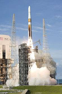

The first attempt to launch GOES-O was made on 26 June 2009, during a launch window running from 22:14-23:14 UTC (18:14-19:14 EDT). Due to rain and lightning at the launch site, the launch was delayed from the start of the window to 22:44 GMT, and once this passed, it was reset to the end of the window. At 22:59 GMT, the launch was scrubbed after field mills detected an unacceptably strong electrical field in the atmosphere, and fifteen minutes would have been required from this clearing in order to launch - longer than remained of the launch window.[9] The weather satellite was eventually launched on 27 June 2009 22:51 UTC (16:51 EDT).[10]
| Attempt | Planned | Result | Turnaround | Reason | Decision point | Weather go (%) | Notes |
|---|---|---|---|---|---|---|---|
| 1 | 26 Jun 2009, 6:14:00 pm | scrubbed | --- | weather (lightning) | 26 Jun 2009, 6:44 pm | [9] | |
| 2 | 27 Jun 2009, 6:51:00 pm | success | 1 day, 0 hours, 37 minutes | [10] |
See also
- Geostationary Operational Environmental Satellite
- National Oceanic and Atmospheric Administration
- NASA
References
- 1 2 "Product Outage/Anomaly: GOES-13 (GOES-East) Data Outage". NOAA. Retrieved 23 May 2013.
- ↑ Hillger, Don (27 July 2009). "GOES-14 NOAA/Science Post Launch Test (PLT)". NOAA. Cooperative Institute for Research in the Atmosphere. Retrieved 6 August 2009.
- ↑ "New NOAA Satellite Reaches Orbit". NOAA. 27 June 2009. Retrieved 6 August 2009.
- ↑ "GOES-14 (O) Moving Into on-Orbit Storage Around Earth". Science Daily. Retrieved February 7, 2010.
- ↑ "GOES-14 first full disk image" (JPEG (75k)). NOAA. Retrieved 6 August 2009.
Standard file type 389K at http://www.osei.noaa.gov/Events/Current/UNIgoes208_G14.jpg. - ↑ "GOES-14 Replaces GOES-13 as the GOES East Satellite". NOAA. Retrieved 25 September 2012.
- ↑ http://earthsky.org/earth/goes-14-satellite-drifts-eastward-to-replace-malfunctioning-goes-13
- ↑ http://cimss.ssec.wisc.edu/goes/blog/archives/11686
- 1 2 GOES-O Launch Coverage (Webcast). Cape Canaveral Air Force Station: NASA TV. 26 June 2009. Retrieved 6 August 2009.
- 1 2 "Weather Scrub statement for Delta IV GOES-O launch". Spaceref.com. 26 June 2009. Retrieved 6 August 2009.
External links
- GOES-14 image examples on the CIMSS Satellite Blog
- NASA Sets Coverage for Goes-O Launch on June 26
- GOES-O Update
- GOES-O Spacecraft
- GOES-N, O, P, Q
- ITT Provides Main Sensors for GOES-O Weather Satellite
| Predecessor SMS |  | |
|---|---|---|
| SMS derived | ||
| 1st Generation | ||
| 2nd Generation | ||
| 3rd Generation | ||
| 4th Generation | ||
| Related | ||
| Policy and history |
| |||||||
|---|---|---|---|---|---|---|---|---|
| Robotic programs |
| |||||||
| Human spaceflight programs |
| |||||||
| Individual featured missions (human and robotic) | ||||||||
| Communications and Navigation | ||||||||
| NASA lists | ||||||||
| ||||||||