Franklin, Kansas
| Franklin, Kansas | |
|---|---|
| Census-designated place | |
 Franklin | |
| Coordinates: 37°31′35″N 94°42′21″W / 37.52639°N 94.70583°WCoordinates: 37°31′35″N 94°42′21″W / 37.52639°N 94.70583°W | |
| Country | United States |
| State | Kansas |
| County | Crawford |
| Area | |
| • Total | 1.72 sq mi (4.46 km2) |
| • Land | 1.71 sq mi (4.43 km2) |
| • Water | 0.01 sq mi (0.03 km2) |
| Elevation | 988 ft (429 m) |
| Population (2010) | |
| • Total | 375 |
| • Density | 220/sq mi (84/km2) |
| Time zone | CST (UTC-6) |
| • Summer (DST) | CDT (UTC-5) |
| ZIP code | 66735 |
| Area code | 620 |
| GNIS feature ID | 475147 [1] |
Franklin is an unincorporated community and census-designated place in Crawford County, Kansas, United States. As of the 2010 census it had a population of 375.[2] Franklin is located along U.S. Route 69 1 mile (1.6 km) south of Arma, or 5.9 miles (9.5 km) north of Frontenac. Franklin has a post office with ZIP code 66735.[3]
History
Franklin began as a mining community in the early 1900s. It is located just off Highway 69 Bypass which is a major corridor between Kansas City and Pittsburg, Ks./Joplin, Mo. Franklin was a shipping point on the Joplin & Pittsburg electric railroad.[4] The first post office in Franklin was established in 1908.[5]
On May 4, 2003, a high-end F4 tornado ripped through Franklin, the path reached over 0.5 miles (0.80 km) wide at points. Franklin was all but destroyed, the U.S. Post Office, community center, and approximately 1/3 of family homes were destroyed. Four deaths and approximately 20 injuries were reported.[6][7][8]
Area attractions
Opened on May 1, 2012, the Miner’s Hall Museum was established to preserve and present authentic materials and artifacts that document the history of coal mining and its impact on Southeast Kansas, as well as to be a vital partner in the educational and cultural life of Southeast Kansas through its collections and programs.
Franklin Sidewalk National and Kansas Historic Site & Guinness World Record Holder Listed on the National Register of Historic Places by the United States Department of the Interior March 16, 2007 and on the Kansas Register of Historic Places November 18, 2006. Constructed in 1936 with federal funding assistance, the Franklin Sidewalk connects two rural mining communities in Crawford County - Arma and Franklin. The 3-foot wide sidewalk begins at the south edge of Arma and stretches south 1.7 miles to the south edge of Franklin. It has become well known as the "longest sidewalk connecting two communities". It runs adjacent to Business 69 Highway also known as "Jefferson Highway" and the "Frontier Military Scenic Byway".
Fiction
In Disney's 1985 film Return to Oz, Dorothy Gale lived with Aunt Em and Uncle Henry outside of Franklin or near it in Crawford County.
Notable people
- Frank Wayenberg, baseball player
References
- ↑ "US Board on Geographic Names". United States Geological Survey. 2007-10-25. Retrieved 2008-01-31.
- ↑ "Geographic Identifiers: 2010 Demographic Profile Data (G001): Franklin CDP, Kansas". U.S. Census Bureau, American Factfinder. Retrieved August 4, 2014.
- ↑ ZIP Code Lookup
- ↑ Blackmar, Frank Wilson (1912). Kansas: A Cyclopedia of State History, Embracing Events, Institutions, Industries, Counties, Cities, Towns, Prominent Persons, Etc. Standard Publishing Company. p. 679.
- ↑ "Kansas Post Offices, 1828-1961 (archived)". Kansas Historical Society. Archived from the original on October 9, 2013. Retrieved 6 June 2014.
- ↑ Franklin 2003 tornado stories.
- ↑ Tornado damage leaves town on brink of non-existence; Chicago Tribune; June 22, 2003.
- ↑ Public Response to Tornado Warnings: A Comparative Study of the May 4, 2003, Tornados in Kansas, Missouri, Tennessee; University of Colorado - Boulder; November 2003.
External links
- Community
- Schools
- USD 246, local school district
- Maps
Municipalities and communities of Crawford County, Kansas, United States | ||
|---|---|---|
| Cities | 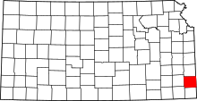 | |
| Townships | ||
| CDPs | ||
| Unincorporated communities | ||
| Footnotes | ‡This populated place also has portions in an adjacent county or counties | |