Fosston, Minnesota
| City of Fosston | ||
|---|---|---|
| City | ||
| ||
| Motto: Where The Prairie Meets The Pines | ||
 Location of Fosston, Minnesota | ||
| Coordinates: 47°34′41″N 95°44′56″W / 47.57806°N 95.74889°W | ||
| Country | United States | |
| State | Minnesota | |
| County | Polk | |
| Incorporated | 1889 | |
| Area[1] | ||
| • Total | 1.71 sq mi (4.43 km2) | |
| • Land | 1.69 sq mi (4.38 km2) | |
| • Water | 0.02 sq mi (0.05 km2) 1.17% | |
| Elevation | 1,293 ft (394 m) | |
| Population (2010)[2] | ||
| • Total | 1,527 | |
| • Estimate (2015)[3] | 1,498 | |
| • Density | 903.6/sq mi (348.9/km2) | |
| Time zone | Central (CST) (UTC-6) | |
| • Summer (DST) | CDT (UTC-5) | |
| ZIP code | 56542 | |
| Area code(s) | 218 | |
| FIPS code | 27-21986 | |
| GNIS feature ID | 0643832[4] | |
| Website | http://www.fosston.com/ | |

Fosston is a city in Polk County, Minnesota, United States. It is part of the Grand Forks ND-MN Metropolitan Statistical Area. The population was 1,527 at the 2010 census.[5]

Geography
According to the United States Census Bureau, the city has a total area of 1.71 square miles (4.43 km2), of which 1.69 square miles (4.38 km2) is land and 0.02 square miles (0.05 km2) is water.[1]
Four-lane U.S. Highway 2 serves as a main route in the city.

Demographics

| Historical population | |||
|---|---|---|---|
| Census | Pop. | %± | |
| 1890 | 207 | — | |
| 1900 | 864 | 317.4% | |
| 1910 | 1,075 | 24.4% | |
| 1920 | 1,014 | −5.7% | |
| 1930 | 978 | −3.6% | |
| 1940 | 1,271 | 30.0% | |
| 1950 | 1,424 | 12.0% | |
| 1960 | 1,704 | 19.7% | |
| 1970 | 1,684 | −1.2% | |
| 1980 | 1,599 | −5.0% | |
| 1990 | 1,517 | −5.1% | |
| 2000 | 1,575 | 3.8% | |
| 2010 | 1,527 | −3.0% | |
| Est. 2015 | 1,498 | [6] | −1.9% |
| U.S. Decennial Census[7] 2015 Estimate[3] | |||
2010 census
As of the census[2] of 2010, there were 1,527 people, 670 households, and 367 families residing in the city. The population density was 903.6 inhabitants per square mile (348.9/km2). There were 750 housing units at an average density of 443.8 per square mile (171.4/km2). The racial makeup of the city was 94.0% White, 2.9% Native American, 0.4% Asian, and 2.8% from two or more races. Hispanic or Latino of any race were 2.2% of the population.
There were 670 households of which 27.0% had children under the age of 18 living with them, 37.5% were married couples living together, 11.9% had a female householder with no husband present, 5.4% had a male householder with no wife present, and 45.2% were non-families. 41.0% of all households were made up of individuals and 22.3% had someone living alone who was 65 years of age or older. The average household size was 2.14 and the average family size was 2.89.
The median age in the city was 43 years. 25.5% of residents were under the age of 18; 6.3% were between the ages of 18 and 24; 20.2% were from 25 to 44; 21.9% were from 45 to 64; and 26% were 65 years of age or older. The gender makeup of the city was 46.9% male and 53.1% female.
2000 census
As of the census of 2000, there were 1,575 people, 681 households, and 379 families residing in the city. The population density was 969.1 people per square mile (373.1/km²). There were 739 housing units at an average density of 454.7 per square mile (175.0/km²). The racial makeup of the city was 96.70% White, 0.19% African American, 1.52% Native American, 0.51% Asian, 0.06% Pacific Islander, 0.06% from other races, and 0.95% from two or more races. Hispanic or Latino of any race were 0.57% of the population.
There were 681 households out of which 26.0% had children under the age of 18 living with them, 42.4% were married couples living together, 10.0% had a female householder with no husband present, and 44.2% were non-families. 40.2% of all households were made up of individuals and 25.3% had someone living alone who was 65 years of age or older. The average household size was 2.16 and the average family size was 2.92.
In the city the population was spread out with 23.1% under the age of 18, 6.5% from 18 to 24, 22.2% from 25 to 44, 19.6% from 45 to 64, and 28.7% who were 65 years of age or older. The median age was 44 years. For every 100 females there were 83.4 males. For every 100 females age 18 and over, there were 78.4 males.
The median income for a household in the city was $27,634, and the median income for a family was $40,521. Males had a median income of $29,688 versus $21,176 for females. The per capita income for the city was $17,064. About 11.4% of families and 14.9% of the population were below the poverty line, including 15.6% of those under age 18 and 21.1% of those age 65 or over.
History
The incorporation papers of Fosston were recorded June 8, 1889, by the Register of Deeds in Crookston, the County Seat of Polk County, Minnesota. Fosston was named for Louis Foss (1849–1920), who was an immigrant from the village Nyttingnes in Sogn og Fjordane county, Norway. Mr. Foss was the founder and owner of Louis Foss & Company, one of the first business to be established in the community.[8] The city of Fosston is reputed to be the adopted hometown of Cordwood Pete, younger brother of famed lumberjack Paul Bunyan.
High School Sports
Fosston's boys basketball team won the first ever state basketball championship in 1919. In 2002, the girls basketball team set the state consecutive win record, winning 76 games between 1999 and 2002.
Media
Radio
(studios in Fosston, both licensed to nearby Bagley, MN. Owned by R & J Broadcasting.
- KKEQ FM 107.1 “QFM” - contemporary Christian music.
(Owned by Pine to Prairie Broadcasting. QFM's city of license is Fosston, but studios are split between Grand Forks, ND and Bemidji, MN)
Other radio and television stations from Bemidji, Thief River Falls, Crookston, Grand Forks, ND, and Fargo, ND can also be received.
There is one local newspaper, "The 13 Towns", with additional newspapers Grand Forks Herald (Grand Forks), The Forum (Fargo, ND), The Pioneer (Bemidji), and Star Tribune (Minneapolis) available via subscription or at newsboxes.
See also
References
- 1 2 "US Gazetteer files 2010". United States Census Bureau. Retrieved 2012-11-13.
- 1 2 "American FactFinder". United States Census Bureau. Retrieved 2012-11-13.
- 1 2 "Population Estimates". United States Census Bureau. Retrieved June 17, 2016.
- ↑ "US Board on Geographic Names". United States Geological Survey. 2007-10-25. Retrieved 2008-01-31.
- ↑ "2010 Census Redistricting Data (Public Law 94-171) Summary File". American FactFinder. U.S. Census Bureau, 2010 Census. Retrieved 23 April 2011.
- ↑ "Annual Estimates of the Resident Population for Incorporated Places: April 1, 2010 to July 1, 2015". Retrieved July 2, 2016.
- ↑ United States Census Bureau. "Census of Population and Housing". Retrieved September 11, 2013.
- ↑ Fosston, Minnesota – A Story of the Old Town (Esten Moen, Thirteen Towns Press: 1944)
External links
Municipalities and communities of Polk County, Minnesota, United States | ||
|---|---|---|
| Cities | 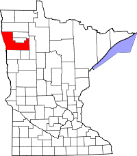 | |
| Townships |
| |
| Unincorporated communities | ||
| Indian reservation | ||
| Footnotes | ‡This populated place also has portions in an adjacent county or counties | |
| Counties | ||
|---|---|---|
| Main cities | ||
| Surrounding areas | ||
† - county seat | ||
Coordinates: 47°34′35″N 95°45′05″W / 47.57639°N 95.75139°W