Farm to Market Road 1640
| ||||
|---|---|---|---|---|
| Route information | ||||
| Maintained by TxDOT | ||||
| Length: | 3.83 mi[1] (6.16 km) | |||
| Existed: | May 23, 1951[1] – present | |||
| Major junctions | ||||
| West end: |
| |||
|
| ||||
| East end: |
| |||
| Location | ||||
| Counties: | Fort Bend | |||
| Highway system | ||||
| ||||

Farm to Market Road 1640 (FM 1640) is a state highway in the U.S. state of Texas that stays within Fort Bend County. The highway begins at Texas State Highway Spur 529 (Spur 529) in Rosenberg and follows a city street east to FM 762 in Richmond.
Route description
FM 1640 begins at Spur 529 on the western edge of Rosenberg and follows Avenue I east for most of its length. From Spur 529 to the traffic light at State Highway 36 (SH 36) or First Street is 0.7 miles (1.1 km). From SH 36 to the slight jog at Millie Street is 1.0 mile (1.6 km). From Millie Street to the traffic signal at Reading Road is 1.1 miles (1.8 km). This stretch of Avenue I passes the administration building for the Lamar Consolidated Independent School District and Traylor Stadium's south grandstand. From Reading Road to the intersection with FM 2218 is 0.7 miles (1.1 km). In the last 200 yards (183 m) before the intersection, FM 1640 changes direction from east to northeast. In this area, there are several businesses including a Valero filling station and a Wal-Mart on the south side of the highway and a Wharton County Junior College campus on the north side. After going 0.3 miles (0.5 km) to the northeast, FM 1640 crosses Union Pacific Railroad tracks and ends at a traffic light at FM 762 in front of the George Memorial Library. The continuation of the road to the northeast is called Golfview Drive.[2]
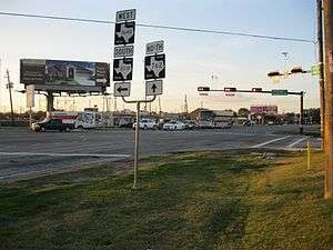
-

View is northeast at start of FM 1640 in Rosenberg.
-

View is east on Avenue I between 4th and 5th Streets.
History
FM 1640 was originally authorized on May 23, 1951 to run from FM 762 in Richmond west to Jeanetta Street in Rosenberg, which was a distance of 2.2 miles (3.5 km). On January 1, 1966 the highway was extended an additional 1.7 miles (2.7 km) along Avenue I to U.S. Route 59. The connection to US 59 was 0.25 miles (0.40 km) west of the US 59 intersection with SH 36. There was also a short spur connection to US 59 at Millie Street.[1] A 1955 USGS map showed that US 59 shared its right-of-way with U.S. Route 90 Alternate (US 90A), which still passes through downtown Richmond and Rosenberg. US 59 split off from US 90A on the west side of Rosenberg in 1955 and headed southwest.[3] By the time the 1971 USGS map was published, US 59 bypassed Rosenberg to the south and Spur 529 used the former right-of-way of US 59 west of Rosenberg.[4] On April 3, 2006 the spur connection to US 90A at Millie Street was removed from the state highway system.[1][note 1]
-

Lamar CISD administration building is on FM 1640.
-

View is southwest at FM 1640 and FM 2218 in Richmond.
-
View is northwest at intersection of FM 762 and 1640.
Major intersections
The entire highway is in Fort Bend County.
| Location | mi | km | Destinations | Notes | |
|---|---|---|---|---|---|
| Rosenberg | 0.0 | 0.0 | Western terminus of FM 1640 | ||
| 0.7 | 1.1 | First Street | |||
| Richmond | 3.5 | 5.6 | B F Terry Blvd | ||
| 3.8 | 6.1 | Eastern terminus of FM 1640 | |||
| 1.000 mi = 1.609 km; 1.000 km = 0.621 mi | |||||
See also
 Texas portal
 U.S. Roads portal
References
- Footnotes
- ↑ The TxDOT website fails to mention that the western end of FM 1640 is at Spur 529.
- Citations
- 1 2 3 4 Transportation Planning and Programming Division (n.d.). "Farm to Market Road No. 1640". Highway Designation Files. Texas Department of Transportation. Retrieved February 3, 2013.
- ↑ Google (February 3, 2013). "Farm to Market Road 1640" (Map). Google Maps. Google. Retrieved February 3, 2013.
- ↑ "Richmond 1955 15 minute series". U.S. Geological Survey. Retrieved February 3, 2013.
- ↑ "Richmond 1971 7.5 minute series". U.S. Geological Survey. Retrieved February 3, 2013.