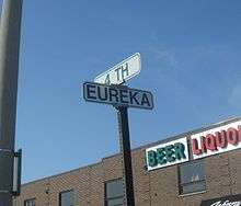
Eureka Road
 Eureka Road in Wyandotte | |
| Length | 13.21 mi[1] (21.26 km) |
|---|---|
| West end | Huron River Drive in Romulus |
| Major junctions | |
| East end | Detroit River in Wyandotte |
Eureka Road (Eureka Avenue in Wyandotte) is a major east-west thoroughfare and section line road in the Downriver region of Metro Detroit in the U.S. state of Michigan. Although it is not a signed state trunkline, it is still a major roadway through the region.
Route description
In Wyandotte, Eureka Avenue starts out as a residential street at the foot of the Detroit River, which runs west-northwestward. The avenue then intersects Biddle Avenue, and turns due west and widens to a major five-lane street with four through lanes and a left-turn lane in the center. Eureka passes by Roosevelt High School before sinking below ground level to accommodate five viaducts, all built in 1927: the four easternmost viaducts each carry Conrail Shared Assets/Norfolk Southern and Canadian National rail lines and the fifth is currently unused, but originally carried Detroit, Monroe & Toledo Short Line Railway interurban tracks[2] until that railroad folded in the early 1930s as a result of increasing competition from automobiles and intercity buses as well as the effects of the Great Depression.

Eureka Road crosses M-85 (Fort Street) into Southgate, where it forms the southern border of the Old Homestead subdivision. The road passes by Dunham's and Kroger (originally Downriver's first Kmart store) stores, and neighboring Southgate Shopping Center, which includes Applebee's and Buffalo Wild Wings. After Trenton Road, the road continues on through more suburbs and commercial areas as the road continues west. West of Dix-Toledo Highway (formerly US-25), the area becomes increasingly commercial.
Eureka widens into a seven-lane road at Allen Road as it enters the city of Taylor before becoming a six-lane divided highway as the road crosses under another Canadian National line. The road then passes by a Denny's, Bob Evan's, Super 8 hotel, and one of the tallest office buildings in Downriver as it approaches the I-75 interchange. West of the interchange and south of Eureka is the original location of the Gibraltar Trade Center, which closed its doors in November 2014 and was demolished in September 2015 for a Menards store, which is planning to open in 2017. A Costco store is also rumored to build on the former Gibraltar Trade Center site along with Menard's, but the future is not yet known. The road then crosses under another Conrail Shared Assets railroad line and crosses over the Frank & Poet drain before transitioning back into a seven-lane road at Racho Road. Eureka then passes the Kohl's-anchored Cross Creek Plaza and neighboring Southland Center, which includes a Best Buy storefront, and continues past several other businesses including Meijer, PetSmart, Panera Bread (previously co-located with Southgate Buffalo Wild Wings), McDonald's, Party City, and Wendy's.
In Romulus, Eureka continues west as the suburban sprawl on both sides of the road significantly decreases. The suburban sprawl stops completely east of Merriman Road as Eureka curves southwest and becomes a four-lane divided highway. The road then curves northwest as it approaches John Dingell Drive, which is the entrance to Detroit Metro Airport. Eureka transitions back into a five-lane road east of the Wayne Road/Wahrman Road intersection and I-275. Immediately after the Interstate 275 interchange, Eureka Road becomes a two-lane road as it approaches a CSX Transportation crossing and continues for a half-mile before ending at a stop sign and flashing red light at Huron River Drive.
Eureka Road Today
– In 2016, Eureka Road will be resurfaced between Allen and Racho Road in Taylor. This includes new road signage, new lighting, new mast-arm traffic signals with countdown pedestrian signals, and minor reconfigurations of the road in preparation for the proposed Menard's store and shopping center that will be built.
– In December 2015, several speed limits were changed along Eureka Road. In Wyandotte, the speed limit was changed from 30 to 35 between Biddle Avenue and the viaducts, 35 to 40 between the viaducts and Dix-Toledo Highway in Southgate. In Romulus, the speed limit was changed from 45 to 55 between Middlebelt Road and Wayne/Wahrman Road. It was also changed from 45 to 50 between Wayne/Wahrman Road and the CSX Railroad crossing just west of the I-275 interchange.
– Eureka Road between Fort Street (M-85) and Dix Toledo in Southgate is known for its potholes and its heavy congestion, mostly due to traffic signal timings, and businesses. No scheduled maintenance will occur for at least two more years, but is relatively high on the priority list.
Expressway portion
Eureka Road becomes an expressway from just west of Merriman Road to just west of Wayne Road along the southern edge of Metro Airport in Romulus. This includes a trumpet interchange with John D. Dingell Drive, which is Metro Airport's southern entrance, providing access to the airport's McNamara Terminal. Eureka Road was first converted to an expressway at this point in the early 1990s and was extended a 1⁄4 mile (0.40 km) east from its original terminus halfway between Merriman Road and Dingell Drive in late 2002.
Speed Limits
Currently, the speed limit on Eureka Road is 30 miles per hour (48 km/h) between Biddle Avenue and the railroad viaducts, 35 miles per hour (56 km/h) from the viaducts to Dix-Toledo Road, and 45 miles per hour (72 km/h) from Dix-Toledo westward. On September 6, 2015, The News-Herald announced that the speed limits on Eureka Road would increase by values of five. By the end of September 2015, the speed limit is expected to be changed to 35 miles per hour (56 km/h), 40 miles per hour (64 km/h) and 50 miles per hour (80 km/h) respectively.
Name
Eureka Road took its name from the Eureka Iron Company, whose plant was located at the foot of the road at the Detroit River in Wyandotte in the late 19th century. The Eureka Iron Company used this road to ship supplies to the plant.[3]
Public transportation
Eureka Road is served by portions of a total of three Suburban Mobility Authority for Regional Transportation routes, all serving Southland Center: Route 125 provides half-hour service between M-85 (Fort Street) and Metro Airport seven days a week, Route 160 provides hourly service six days a week between Trenton Road in Southgate and Biddle Avenue in downtown Wyandotte and Route 275 provides weekday rush-hour express service along Eureka between Southland Center and U.S. Highway 24 (Telegraph Road) in Taylor.
See also
 Metro Detroit portal
References
- ↑ Google Earth ruler path measurements
- ↑ "Passenger Railroads Used to Be Popular Downriver". The News-Herald. Southgate, MI. Retrieved July 1, 2014.
- ↑ Gavrilovich, Peter & McGraw, Bill (2000). The Detroit Almanac: 300 Years of Life in the Motor City. Detroit: Detroit Free Press. pp. 240–8. ISBN 978-0-937247-34-1.