Old Homestead, Southgate, Michigan
| Old Homestead | |
|---|---|
| Neighborhood of Southgate, Michigan | |
|
Businesses along Eureka Road in Old Homestead | |
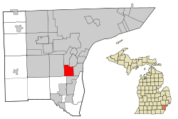 Location of Old Homestead within the city of Southgate | |
| Coordinates: 42°12′N 83°11′W / 42.200°N 83.183°WCoordinates: 42°12′N 83°11′W / 42.200°N 83.183°W | |
| Country | United States |
| State | Michigan |
| County | Wayne |
| City | Southgate |
| Platted as part of Ecorse Township | 1923 |
| Incorporated as part of Southgate | 1958 |
| Area | |
| • Land | 0.336 sq mi (0.87 km2) |
| Population (2010) | |
| • Total | 1,263 |
| Time zone | EST (UTC-5) |
| • Summer (DST) | EDT (UTC-4) |
| ZIP code(s) | 48195 |
| Area code(s) | 734 |
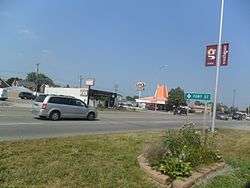
Old Homestead is a neighborhood on the east side of the Metro Detroit suburb of Southgate, Michigan. Usually, Old Homestead is bordered by Superior Street to the north, Eureka Road to the south, M-85 (Fort Street) to the east and either Trenton Road or Burns Street to the west. Commercial districts are located along Eureka Road and Fort Street and the rest of the neighborhood is mostly single-family homes, most of which were built during the 1940s and 1950s. The most common housing stock within Old Homestead consists of one-and-a-half-story bungalows and two-story colonials.
History
Old Homestead was originally platted in 1923 as a subdivision of Ecorse Township, however, for about twenty years after, it continued to remain mostly farmland. In 1958, the remaining areas of Ecorse Township were incorporated as the city of Southgate-this included Old Homestead.
Education
Old Homestead residents are zoned to Fordline and Grogan Elementary Schools, Davidson Middle School and Southgate Anderson High School, none of which are in Old Homestead. Until the 2012-13 school year, Old Homestead residents were also zoned to Chormann Elementary School.
Public transportation
The Suburban Mobility Authority for Regional Transportation operates three bus routes along the borders of Old Homestead. Route #125 travels from Detroit Metropolitan Wayne County Airport along Eureka Road and Fort Street to River Rouge via Southland Center and during weekday rush hours continues into downtown Detroit. Route #160 travels along Eureka Road along the southern edge of Old Homestead, connecting it to Trenton, downtown Wyandotte, Wayne County Community College District's Downriver Campus and Southland Center. Route #830 is a weekday-rush-hour park and ride service that runs along Trenton Road in Old Homestead and connects Trenton and downtown Detroit.[1]
References
- ↑ Suburban Mobility Authority for Regional Transportation (2014). "SMART System Map" (PDF). Retrieved August 4, 2014.
External links
| Areas | |
|---|---|
| Primary and secondary schools | |
| Landmarks | |
| Media | |