Draža Vas
| Draža Vas | |
|---|---|
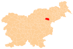
 Draža Vas Location in Slovenia | |
| Coordinates: 46°19′34.08″N 15°28′44.74″E / 46.3261333°N 15.4790944°ECoordinates: 46°19′34.08″N 15°28′44.74″E / 46.3261333°N 15.4790944°E | |
| Country |
|
| Traditional region | Styria |
| Statistical region | Savinja |
| Municipality | Slovenske Konjice |
| Area | |
| • Total | 2.45 km2 (0.95 sq mi) |
| Elevation | 283.9 m (931.4 ft) |
| Population (2002) | |
| • Total | 487 |
| [1] | |
Draža Vas (pronounced [ˈdɾaːʒa ˈʋaːs]; Slovene: Draža vas) is a settlement in the Municipality of Slovenske Konjice in eastern Slovenia. It lies on the Dravinja River east of Slovenske Konjice. The area is part of the traditional region of Styria. The municipality is now included in the Savinja Statistical Region.[2]
A prehistoric hill fort has been identified in the area with archaeological topography. Surface finds have helped date the site to the Early Iron Age.[3]
References
External links
| Settlements | Administrative centre: Slovenske Konjice
|  |
|---|---|---|
| Landmarks |
| |
| Notable people |
| |
This article is issued from Wikipedia - version of the 7/25/2016. The text is available under the Creative Commons Attribution/Share Alike but additional terms may apply for the media files.