Selski Vrh
| Selski Vrh Vrh (until 1953) | |
|---|---|
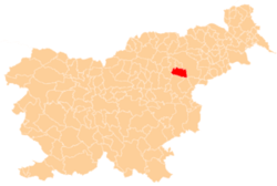
 Selski Vrh Location in Slovenia | |
| Coordinates: 46°18′25.83″N 15°32′1.42″E / 46.3071750°N 15.5337278°ECoordinates: 46°18′25.83″N 15°32′1.42″E / 46.3071750°N 15.5337278°E | |
| Country |
|
| Traditional region | Styria |
| Statistical region | Savinja |
| Municipality | Slovenske Konjice |
| Area | |
| • Total | 1.91 km2 (0.74 sq mi) |
| Elevation | 316.6 m (1,038.7 ft) |
| Population (2002) | |
| • Total | 93 |
| [1] | |
Selski Vrh (pronounced [ˈseːu̯ski ˈʋəɾx]) is a dispersed settlement in the Municipality of Slovenske Konjice in eastern Slovenia. It lies in the hills east of Loče and west of Poljčane. The area is part of the traditional region of Styria. The municipality is now included in the Savinja Statistical Region.[2]
Name
The name of the settlement was changed from Vrh to Selski Vrh in 1953.[3]
References
- ↑ Statistical Office of the Republic of Slovenia
- ↑ Slovenske Konjice municipal site
- ↑ Spremembe naselij 1948–95. 1996. Database. Ljubljana: Geografski inštitut ZRC SAZU, DZS.
External links
| Settlements | Administrative centre: Slovenske Konjice
|  |
|---|---|---|
| Landmarks |
| |
| Notable people |
| |
This article is issued from Wikipedia - version of the 7/30/2016. The text is available under the Creative Commons Attribution/Share Alike but additional terms may apply for the media files.