Spodnja Pristava
| Spodnja Pristava | |
|---|---|
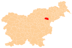
 Spodnja Pristava Location in Slovenia | |
| Coordinates: 46°19′31.57″N 15°28′24.33″E / 46.3254361°N 15.4734250°ECoordinates: 46°19′31.57″N 15°28′24.33″E / 46.3254361°N 15.4734250°E | |
| Country |
|
| Traditional region | Styria |
| Statistical region | Savinja |
| Municipality | Slovenske Konjice |
| Area | |
| • Total | 0.17 km2 (0.07 sq mi) |
| Elevation | 295.9 m (970.8 ft) |
| Population (2002) | |
| • Total | 32 |
| [1] | |
Spodnja Pristava (pronounced [ˈspoːdnja ˈpɾiːstaʋa]) is a small settlement in the Municipality of Slovenske Konjice in eastern Slovenia. It lies on the right bank of the Dravinja River just west of Draža Vas. The area is part of the traditional region of Styria and is now included in the Savinja Statistical Region.[2]
References
External links
| Settlements | Administrative centre: Slovenske Konjice
|  |
|---|---|---|
| Landmarks |
| |
| Notable people |
| |
This article is issued from Wikipedia - version of the 7/31/2016. The text is available under the Creative Commons Attribution/Share Alike but additional terms may apply for the media files.