Douar
| Ed-Douar الدوار | |
|---|---|
| Village | |
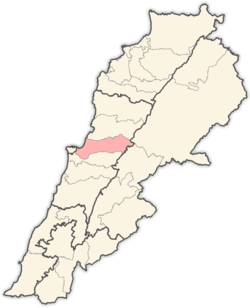
 Ed-Douar Location within Lebanon | |
| Coordinates: 33°50′39″N 35°39′35″E / 33.84417°N 35.65972°ECoordinates: 33°50′39″N 35°39′35″E / 33.84417°N 35.65972°E | |
| Country |
|
| Governorate | Mount Lebanon Governorate |
| District | Matn District |
| Time zone | EET (UTC+2) |
| • Summer (DST) | EEST (UTC+3) |
| Dialing code | +961 |
Douar or Ed-Douar (Arabic: الدوار) is small, mainly Maronite, village located in the Metn District of the Mount Lebanon Governorate of Lebanon. Douar means "tent", which shows the independence of the village.?
Location
The municipality of Douar is located in the Kaza of Matn one of is one of the eight mohafazats (governorates) of Lebanon. Douar is 28 kilometers (17 miles) away from Beyrouth (Beirut) the capital of Lebanon. Its elevation is 1,150 meters (3,770 feet; 1,260 yards) above sea level. Douar surface stretches for 132 hectares (1.32 square kilometres; 0.51 square miles).[1]
See also
References
Capital: Jdeideh | ||
| Towns and villages |
|  |
| Notable landmarks | ||
| Notable touristic sites | ||
This article is issued from Wikipedia - version of the 11/23/2016. The text is available under the Creative Commons Attribution/Share Alike but additional terms may apply for the media files.