Mrouj
| Mrouj المروج | |
|---|---|
| City | |
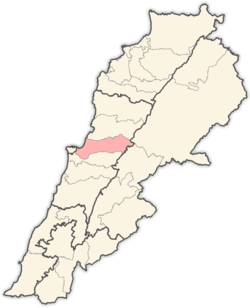
 Mrouj Location within Lebanon | |
| Coordinates: 33°54′45″N 35°44′57″E / 33.91250°N 35.74917°ECoordinates: 33°54′45″N 35°44′57″E / 33.91250°N 35.74917°E | |
| Country |
|
| Governorate | Mount Lebanon Governorate |
| District | Matn District |
| Government | |
| • Mayors | Elie Dagher |
| Elevation | 1,220 m (4,000 ft) |
| Time zone | EET (UTC+2) |
| • Summer (DST) | EEST (UTC+3) |
| Dialing code | +961 |
Mrouj (Arabic: المروج, also spelled Mrouje and El Mrouj) is a municipality in the Matn District of the Mount Lebanon Governorate of Lebanon. The English translation of Mrouj is "The Meadows"
Outlying areas
- Mtein
- Zaarour
- Bois Du Boulognes
- Marjaba
Water
Lake Mrouj is located approximately 3 km north of the town. It is a source of water for many villages in the Matn District
Economy
Mrouj is mostly a destination for summer tourism for Beirutis in the summer and ski enthusiasts in the winter. Zaarour ski resorts are about 6 km north of Mrouj
The town also hosts an annual festival for St. Takla in September in the St. Takla Square in the center of Mrouj
Education
There is one public school in the town named Mrouj Public School, and one private Catholic school.
Religion
The inhabitants of Mrouj are almost all Christians, predominantly Maronites. St. Takla Church was built approx in 1792
Churches
- Evangelical Church.
- St. Takla – Maronite.
References
External links
- Mrouj, Localiban
- Google Satellite Picture of Mrouje
Capital: Jdeideh | ||
| Towns and villages |
|  |
| Notable landmarks | ||
| Notable touristic sites | ||