Dordrecht, Eastern Cape
| Dordrecht | |
|---|---|
|
View of the town of Dordrecht | |
 Dordrecht  Dordrecht  Dordrecht
| |
| Coordinates: 31°22′0″S 27°3′0″E / 31.36667°S 27.05000°ECoordinates: 31°22′0″S 27°3′0″E / 31.36667°S 27.05000°E | |
| Country | South Africa |
| Province | Eastern Cape |
| District | Chris Hani |
| Municipality | Emalahleni |
| Established | 1856 |
| Area[1] | |
| • Total | 17.4 km2 (6.7 sq mi) |
| Elevation | 1,600 m (5,200 ft) |
| Population (2011)[1] | |
| • Total | 10,261 |
| • Density | 590/km2 (1,500/sq mi) |
| Racial makeup (2011)[1] | |
| • Black African | 93.1% |
| • Coloured | 3.3% |
| • Indian/Asian | 0.4% |
| • White | 2.8% |
| • Other | 0.4% |
| First languages (2011)[1] | |
| • Xhosa | 90.1% |
| • Afrikaans | 5.4% |
| • English | 2.0% |
| • Other | 2.5% |
| Postal code (street) | 5435 |
| PO box | 5435 |
| Area code | 045 |

Dordrecht is a town situated in the Eastern Cape Province of South Africa. Dordrecht was founded in 1856 by Baron Smiddolff (later changed to Smithdorff), a minister of the Dutch Reformed Church. The town was named for the city of the same name in the South-Western Netherlands and had a population of about 8,741 people in 2001.
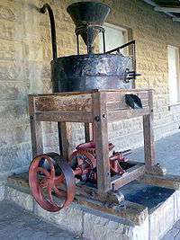
Dordrecht lies nestled in the Stormberg Mountains, just north of Queenstown between Middelburg and Mthatha. Its many historical buildings and museum display turn-of-the-century furniture and clothing. Dodrecht is a small town surrounded by a number of farms with a large number of merino sheep and cattle ranchers in the region. Farmers around Dordrecht also grow potatoes. Dordrecht prides itself on a number of historical sites including a unique 1873 colonial country B&B. There are farmstay holidays available in the region. They are well known in South Africa for trout fishing, pheasant hunting and game hunting. The town is also situated near to the Western Drakensberg Mountains where the only snow skiing resort is in South Africa.
It has two high schools, Masikhanyise High School and Dordrecht High School (that is 102 years old). Its oldest townships are Sinako township, Munikville and Marabastad.
A Remembrance Garden is in the city centre in memorial to Baron Smithdorff and high in the kopje in the foothills is a plaque dedicated to the Smithdorff family.
Geography
Climate
Dordrecht has a subtropical highland climate (Cwb, according to the Köppen climate classification), with warm summers and chilly, dry winters, with occasional snowfalls. It borders on a cold semi-arid climate (BSk). The average annual precipitation is 466 mm (18 in), with most rainfall occurring mainly during summer.
The village of Buffelsfontein, located between the towns of Dordrecht and Molteno, has the lowest recorded temperature in South Africa, of −20.1 °C (−4 °F), on 23 August 2013.[2] The former national record, of −18.6 °C (−1 °F), was also registered in the same locality, on 28 June 1996.[3]
| Dordrecht | ||||||||||||||||||||||||||||||||||||||||||||||||||||||||||||
|---|---|---|---|---|---|---|---|---|---|---|---|---|---|---|---|---|---|---|---|---|---|---|---|---|---|---|---|---|---|---|---|---|---|---|---|---|---|---|---|---|---|---|---|---|---|---|---|---|---|---|---|---|---|---|---|---|---|---|---|---|
| Climate chart (explanation) | ||||||||||||||||||||||||||||||||||||||||||||||||||||||||||||
| ||||||||||||||||||||||||||||||||||||||||||||||||||||||||||||
| ||||||||||||||||||||||||||||||||||||||||||||||||||||||||||||
References
- 1 2 3 4 Sum of the Main Places Dordrecht and Tjoksville from Census 2011.
- ↑ "New minimum temperature record for South Africa". Retrieved 12 June 2014.
- ↑ Details of the temperature, rainfall and wind extremes recorded in SA South African weather service. Retrieved on 22 June 2010]
External links
| Wikimedia Commons has media related to Dordrecht, Eastern cape. |
Municipalities and communities of Chris Hani District Municipality, Eastern Cape | ||
|---|---|---|
District seat: Queenstown | ||
| Intsika Yethu | .svg.png) | |
| Enoch Mgijima | ||
| Engcobo | ||
| Emalahleni | ||
| Inxuba Yethemba | ||
| Sakhisizwe | ||