Deer Park Monastery
| Deer Park Monastery Tu Viện Lộc Uyển 大隱山鹿苑寺 | |
|---|---|
|
Meditation Hall | |
| Basic information | |
| Location | 2499 Melru Lane Escondido, CA 92026 |
| Affiliation |
Order of Interbeing Lam Te Dhyana |
| Country | United States |
| Website | http://www.deerparkmonastery.org/ |
| Architectural description | |
| Founder | Thich Nhat Hanh |
| Completed | 2000 |

Deer Park Monastery (Vietnamese: Tu Viện Lộc Uyển,) is a 400-acre (1.6 km2) Buddhist sanctuary in Escondido, California. It was founded in July 2000 by monastic and lay practitioners from Plum Village, France.
The monastery is under the direct guidance of Thich Nhat Hanh and his Order of Interbeing in the Vietnamese Zen tradition. Deer Park follows the same practices and schedule as Plum Village and its sister monastery Blue Cliff Monastery in New York and Magnolia Grove Monastery in Mississippi.
Since its founding the monastery has grown to be very active. In addition to its regular monastic schedule, Deer Park hosts twice-weekly days of mindfulness which are open to the public as well as a variety of themed and general retreats. Deer Park hosts an annual retreat when Thich Nhat Hanh travels to North America. Over the years the ordained Sangha has been growing and currently consists of 14 monks and 23 nuns. Lay practitioners also live at the monastery.
The monastery is now composed of two hamlets; Solidity Hamlet for monks and laymen and Clarity Hamlet for nuns and laywomen.
All retreats at Deer Park Monastery include the basic practices of sitting meditation and chanting, walking meditation, mindful eating, group discussions, touching the Earth, total relaxation, and working meditation. Depending on the retreat, extra activities may include private consultations, mountain hiking, bonfire, and song & skit performances. Retreats are for beginners and experienced practitioners of meditation.
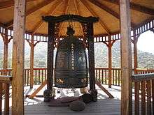
Gallery


Related monasteries
- Blue Cliff Monastery
- Plum Village
- Tu Hieu Temple
See also
External links
![]() Media related to Deer Park Monastery at Wikimedia Commons
Media related to Deer Park Monastery at Wikimedia Commons
Coordinates: 33°11′17″N 117°4′25″W / 33.18806°N 117.07361°W