Cymmer, Rhondda Cynon Taf
| Cymmer | |
 |
|
 Cymmer |
|
| Population | 4,807 (2011)[1] |
|---|---|
| OS grid reference | ST0290 |
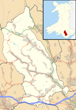
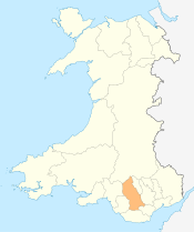
| Principal area | Rhondda Cynon Taf |
| Ceremonial county | Mid Glamorgan |
| Country | Wales |
| Sovereign state | United Kingdom |
| Post town | PORTH |
| Postcode district | CF39 |
| Dialling code | 01443 |
| Police | South Wales |
| Fire | South Wales |
| Ambulance | Welsh |
| EU Parliament | Wales |
| UK Parliament | Rhondda |
| Welsh Assembly | Rhondda |
|
|
Coordinates: 51°36′54″N 3°23′49″W / 51.61492°N 3.39692°W
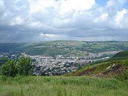
Cymmer (Welsh: Cymer) is a village and community in the Rhondda Valley, Wales. It is so named because of being located at the 'confluence' of the Rhondda Fawr and Rhondda Fach river valleys. Several collieries were opened here in the middle part of the nineteenth century. A serious mine accident in 1856 resulted in 114 casualties, and the lack of payment of any compensation to the miners' families caused bitter feelings in the community.
Location
Cymmer is located in the lower Rhondda Valley about half way between Treorchy and Pontypridd. It is situated on the A4119 road half a mile from its junction with the A4058 road. Neighbouring settlements are Penygraig, Trealaw, Tonypandy, Dinas Rhondda, Llwyncelyn and Porth. Cymmer comprises the villages of Trehafod, Trebanog, Britannia, Glynfach and Cymmer itself.[2]
History
George Insole owned the mineral rights to the land at Cymmer. Several collieries were sunk in the vicinity, namely Cymmer Colliery (Old No. 1 Pit) (1847), Glynfach Colliery (1851), New Cymmer Colliery (1855), Upper Cymmer Colliery (1851) and Ty-Newydd Colliery (1852), not to mention the several other collieries of Porth and Trehafod. This was the site of an 1856 mining accident in which 114 people were killed. The official enquiry that followed found that inadequate ventilation had caused a build up of gas, and the jury brought in a verdict of manslaughter. No compensation was paid to the families of the miners concerned. Five of the mine managers went on trial at the spring assizes in 1857; the case against two was dismissed, the judge directed the jury to discharge one of the others and advised them to acquit the remaining two, which they did. The Cymmer community seethed with rancour and the bitter feelings lasted for many years.[3]
Governance
An electoral ward in the same name exists. The population of this ward at the 2011 Census was 5,505.[4]
Education
In the early twenty-first century, there were three schools in the village: Cymmer Infant School, Cymmer Junior School and Ysgol Gyfun Y Cymer. However proposals put forward in 2015 would result in the closure of the infant and junior schools and the opening of a new community primary school.[5]
References
- ↑ "Community population 2011". Retrieved 11 November 2015.
- ↑ Concise Road Atlas of Britain. AA. 2016. p. 27. ISBN 978-0-7495-7743-8.
- ↑ Carpenter, David J. (2000). Rhondda Collieries. Stroud, Gloucestershire: Tempus Publishing. pp. 42–46. ISBN 0-7524-1730-4.
- ↑ "Ward population 2011". Retrieved 15 November 2015.
- ↑ Tegeltija, Sam (11 November 2015). "Closure notices issued for Cymmer infants and junior schools as new £2m-boosted school is a step closer". WalesOnline. Retrieved 29 April 2016.
External links
Villages and towns of the Rhondda Valley | ||
|---|---|---|
| Rhondda Fawr | 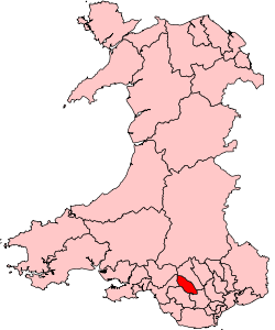 | |
| Rhondda Fach | ||