Crawford, Colorado
| Town of Crawford, Colorado | |
|---|---|
| Statutory Town | |
|
Crawford in 2016. | |
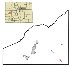 Location in Delta County and the state of Colorado | |
| Coordinates: 38°42′19″N 107°36′36″W / 38.705183°N 107.610061°WCoordinates: 38°42′19″N 107°36′36″W / 38.705183°N 107.610061°W[1] | |
| Country |
|
| State |
|
| County | Delta County[2] |
| Incorporated | December 19, 1910[3] |
| Government | |
| • Type | Statutory Town[2] |
| Area | |
| • Total | 0.3 sq mi (0.7 km2) |
| • Land | 0.3 sq mi (0.7 km2) |
| • Water | 0 sq mi (0 km2) |
| Elevation[4] | 6,558 ft (1,999 m) |
| Population (2010) | |
| • Total | 431 |
| • Density | 1,400/sq mi (620/km2) |
| Time zone | MST (UTC-7) |
| • Summer (DST) | MDT (UTC-6) |
| ZIP Code[5] | 81415 |
| Area code(s) | 970 |
| INCITS place code | 0817925 |
| GNIS feature ID | 0186721 |

The Town of Crawford is a Statutory Town in Delta County, Colorado, United States. It is sixty miles southeast of Grand Junction. This town population was 431 at the 2010 United States Census.
History
Crawford was founded in 1882.[6] The town was named for George A. Crawford, governor-elect of Kansas.[7][8] A post office has been in operation at Crawford since 1883.[9]
Geography
Crawford is located at 38°42′15″N 107°36′39″W / 38.70417°N 107.61083°W (38.704235, -107.610925).[10]
According to the United States Census Bureau, the town has a total area of 0.3 square miles (0.78 km2), all of it land. The northern shore of Crawford Reservoir stands about a mile south.
Demographics
| Historical population | |||
|---|---|---|---|
| Census | Pop. | %± | |
| 1920 | 149 | — | |
| 1930 | 157 | 5.4% | |
| 1940 | 221 | 40.8% | |
| 1950 | 170 | −23.1% | |
| 1960 | 147 | −13.5% | |
| 1970 | 171 | 16.3% | |
| 1980 | 268 | 56.7% | |
| 1990 | 221 | −17.5% | |
| 2000 | 366 | 65.6% | |
| 2010 | 431 | 17.8% | |
| Est. 2015 | 408 | [11] | −5.3% |
As of the census[13] of 2000, there were 366 people, 147 households, and 104 families residing in the town. The population density was 1,409.8 people per square mile (543.5/km²). There were 179 housing units at an average density of 689.5 per square mile (265.8/km²). The racial makeup of the town was 96.72% White, 1.64% from other races, and 1.64% from two or more races. Hispanic or Latino of any race were 2.19% of the population.
There were 147 households out of which 36.7% had children under the age of 18 living with them, 51.7% were married couples living together, 12.9% had a female householder with no husband present, and 28.6% were non-families. 25.9% of all households were made up of individuals and 14.3% had someone living alone who was 65 years of age or older. The average household size was 2.49 and the average family size was 2.88.
In the town the population was spread out with 30.3% under the age of 18, 5.7% from 18 to 24, 27.3% from 25 to 44, 21.3% from 45 to 64, and 15.3% who were 65 years of age or older. The median age was 36 years. For every 100 females there were 108.0 males. For every 100 females age 18 and over, there were 96.2 males.
The median income for a household in the town was $23,281, and the median income for a family was $27,500. Males had a median income of $37,917 versus $16,563 for females. The per capita income for the town was $13,284. About 23.5% of families and 29.4% of the population were below the poverty line, including 45.8% of those under age 18 and 15.9% of those age 65 or over.
Notable residents
- Joe Cocker (1944–2014), singer[14]
- Jeneve Rose Mitchell (1999-), singer, American Idol contestant.
See also
References
- ↑ "2014 U.S. Gazetteer Files: Places". United States Census Bureau. July 1, 2014. Retrieved January 5, 2015.
- 1 2 "Active Colorado Municipalities". State of Colorado, Department of Local Affairs. Archived from the original on 2010-11-22. Retrieved 2007-09-01.
- ↑ "Colorado Municipal Incorporations". State of Colorado, Department of Personnel & Administration, Colorado State Archives. 2004-12-01. Retrieved 2007-09-02.
- ↑ "US Board on Geographic Names". United States Geological Survey. 2007-10-25. Retrieved 2008-01-31.
- ↑ "ZIP Code Lookup". United States Postal Service. Archived from the original (JavaScript/HTML) on November 23, 2010. Retrieved September 6, 2007.
- ↑ Bright, William (2004). Colorado Place Names. Big Earth Publishing. p. 45. ISBN 978-1-55566-333-9.
- ↑ Capace, Nancy (1 March 1999). Encyclopedia of Colorado. North American Book Dist LLC. p. 178. ISBN 978-0-403-09813-2.
- ↑ Dawson, John Frank. Place names in Colorado: why 700 communities were so named, 150 of Spanish or Indian origin. Denver, CO: The J. Frank Dawson Publishing Co. p. 15.
- ↑ "Delta County". Jim Forte Postal History. Retrieved 6 January 2015.
- ↑ "US Gazetteer files: 2010, 2000, and 1990". United States Census Bureau. 2011-02-12. Retrieved 2011-04-23.
- ↑ "Annual Estimates of the Resident Population for Incorporated Places: April 1, 2010 to July 1, 2015". Retrieved July 2, 2016.
- ↑ "Census of Population and Housing". Census.gov. Archived from the original on May 11, 2015. Retrieved June 4, 2015.
- ↑ "American FactFinder". United States Census Bureau. Archived from the original on 2013-09-11. Retrieved 2008-01-31.
- ↑ Joe Cocker's 243-acre ranch is on the market in Colorado Los Angeles Times. 19 February 2015.
External links
- CDOT map of the Town of Crawford
- The Delta County Independent, the local community weekly covering Crawford and the rest of Delta County
Municipalities and communities of Delta County, Colorado, United States | ||
|---|---|---|
| City | 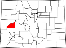 | |
| Towns | ||
| Unincorporated communities | ||