Cedaredge, Colorado
| Town of Cedaredge, Colorado | |
|---|---|
| Home Rule Municipality | |
 | |
| Nickname(s): Southern Gateway to the Grand Mesa, Cedarberry | |
 Location in Delta County and the State of Colorado | |
| Coordinates: 38°53′39″N 107°55′32″W / 38.894137°N 107.925498°WCoordinates: 38°53′39″N 107°55′32″W / 38.894137°N 107.925498°W[1] | |
| Country |
|
| State |
|
| County | Delta County[2] |
| Incorporated | May 2, 1907[3] |
| Government | |
| • Type | Statutory Town[2] |
| Area | |
| • Home Rule Municipality | 2.1 sq mi (5.3 km2) |
| • Land | 2.1 sq mi (5.3 km2) |
| • Water | 0 sq mi (0 km2) |
| Elevation[4] | 6,230 ft (1,899 m) |
| Population (2010) | |
| • Home Rule Municipality | 2,253 |
| • Density | 1,100/sq mi (430/km2) |
| • Metro | 6,000 |
| Time zone | MST (UTC-7) |
| • Summer (DST) | MDT (UTC-6) |
| ZIP Code | 81413[5] |
| Area code(s) | 970 |
| INCITS place code | 0812635 |
| GNIS feature ID | 0186245 |
| Website | Town of Cedaredge |
The Town of Cedaredge is a Home Rule Municipality in Delta County, Colorado, United States. The town population was 2253 at the 2010 United States Census. Cedaredge sits in the Surface Creek Valley beneath the southern slopes of the Grand Mesa, the largest mesa in the world. Its elevated vantage point affords southern views of the San Juan Mountains, the Black Canyon of the Gunnison National Park, and the communities of Delta, Olathe, and Montrose. Cedaredge is a small, agricultural community which produces apples, peaches, and wine from the region's several vineyards. Notable attractions include Cedaredge Golf Club, Historic Pioneer Town, and an art gallery and craft store housed in a renovated apple packing shed. Regional sporting activities include camping, trophy hunting, hiking and Gold Medal fishing at more than 250 lakes on the Grand Mesa. During the winter locals partake in snowmobiling and Nordic skiing on the Mesa's numerous trails. Powderhorn Resort is located 30 miles (48 km) north of Cedaredge and offers a variety of ski terrain such as groomers, bumps, glades, and boulder fields, as well as two quality terrain parks.
History
Early History
Up until 1880 much of central and western Colorado was inhabited by the Ute Indians. Under the Act of June 15, 1880, the Utes ceded a large portion of their land to the United States, including the Surface Creek Valley. On September 1, 1881, the last band of Utes made their exodus from western Colorado to the northeastern part of Utah under escort of troops from Fort Crawford. Settlers soon began arriving, building homesteads, barns, businesses, and churches. Much of the land was carved up into cattle ranches, fruit orchards, and fields of alfalfa, hay, corn, and other grains.
The town of Cedaredge was officially incorporated on March 25, 1907.
McGruder Fire

Lightning struck a tree on Friday July 2, 2004. The fire smoldered overnight and hot dry winds fanned the flames into a large wildfire on July 3, 2004. By Sunday July 11, the fire was considered 100 percent contained. Thanks to the efforts of the Cedaredge volunteer and other area fire departments, San Juan Hot Shots, the BLM and Forest Service, no homes or lives were lost. The total area consumed by the McGruder fire was estimated at about 3,000 acres (12 km2), 1,467 acres (5.94 km2) of which was private land, the rest belonging to BLM and Forest Service.
Centennial Celebration
The Town of Cedaredge celebrated its centennial in 2007.
Sites of Interest and Events

Pioneer Town
Pioneer Town is a museum and historical village. The centerpieces of Pioneer Town are the octagonal Bar-I Silos, the last remaining structures of the Bar-I Ranch, a cattle ranch that was established in the early 1880s. You can go back in time by visiting the museum's replicas of early 20th-century town buildings, including a western saloon, marshall's office, barber shop, bank, clothing store, jail, creamery, and a working blacksmith's shop. Pioneer Town is also the home of the Chapel of the Cross, with its summer season concerts; available for private weddings. It is a prairie-style chapel housing one of the world's largest digital organs. Also in Pioneer Town is the Doll and Toy House, a building designed to display a portion of the museum's large collection of dolls and toys from the past, and the Sutherland Indian Museum housing one of Colorado's largest arrowhead displays. The old Stolte Packing Shed also serves as a rental facility for local events and receptions. Open Memorial weekend in May through the first weekend in October, with its renowned Antique and Classic Car Show as part of the town of Cedaredge's Applefest weekend celebration.
Cedaredge Golf Club
Opened in the Spring of 1988, as the Deer Creek Village Golf Club, Cedaredge Golf Club is a premier public golf course in Cedaredge, Colorado. The golf course was completed in April 1992 and is located on what was part of the Bar-I Cattle Ranch hayfields of the early 1900s. This 18 hole course can suit both the serious sportsman and the occasional enthusiast; the back nine has some of the most difficult golf terrain on the Western Slope. The course offers four tee boxes per hole, and adapts to any playing level. Cedaredge Golf Club includes a driving range, clubhouse, and grill.
Nestled in a protected valley at 6,100 feet (1,900 m) in elevation, the Cedaredge Golf Club course features natural cedars and winding creek beds. Adding to the challenge of play and the beauty of the surroundings is a variety of trees, lakes and bunkers. Each hole offers breathtaking views of the 14,000-foot (4,300 m) peaks of the San Juan Mountains, the West Elk wilderness, Grand Mesa, and the Uncompahgre Mountains.
Open year-round, Cedaredge Golf Club generally enjoys a moderate climate of warm, sunny days and cool, refreshing evenings. Western Colorado's unique combination of sunshine and temperate weather makes it possible for golfers to play around 320 days per year.
Applefest
In 1978 the "Cedaredge Harvest Festival" officially changed its name to "AppleFest." Applefest is an annual celebration of apples, arts, music, and food held the first weekend in October in Cedaredge, Colorado. It is attended by around 15,000 visitors each year and typically over 200 food, arts and crafts vendors. The event features a classic car show, antique tractor show, and motorcycle show.
Musical guests feature folk, gospel, blues, country, rock, bluegrass and others with local, regional and national artists.
Applefest 2014 marked the 37th Anniversary of the event.
Little Britches Rodeo and Parade
The Western Slope Little Britches Rodeo was organized in 1958 by Dr. Walter H. Simon and Webb Bryson of Cedaredge. Land was provided east of town by Harry Palmer for $1.00 a year and a rodeo arena was built. In September 1958, fifty-four boys and girls entered the first Western Slope Little Britches Rodeo. The Western Slope Little Britches continues to this day and consists of a rodeo, parade, car show, and Lion's Club barbecue in the park.
Grand Mesa Scenic and Historic Byway
The Grand Mesa Scenic and Historic Byway scenic and historic byway was approved by the Colorado Department of Transportation in 1991. It runs North from Cedaredge along Highway 65, to the top of the Grand Mesa at more than 10,000 feet (3,000 m). Grand Mesa visitors center has maps, books and other information about the area. The byway sneaks past Island Lake, one of more than 300 trout-filled lakes in Grand Mesa National Forest. On the north side of the Mesa are the towns of Mesa, Collbran, and Powderhorn Ski Resort. The byway continues along De Beque Canyon, with its colorful sandstone bluffs, and eventually meets Interstate 70 in the town of De Beque.
Cedaredge Volunteer Fire Department
Cedaredge Volunteer Fire Station has held an annual "5-Alarm Chili Cook-off" fundraiser since 2000. This yearly fundraising event kicks off the town of Cedaredge's Applefest celebration during the first week of October.
Education
Education in the early days of Surface Creek Valley consisted of several one-room school houses scattered across the rural countryside. In 1920 the new Consolidated Cedaredge High School was constructed and regular bussing began in the area.
Cedaredge High School
Completed in 1982, the current Cedaredge High School has an enrollment of approximately 250 students. Unusual for a school of its size, it contains a technology lab, geodesic greenhouse, and an integrated cafeteria/auditorium. The mascot for its athletic teams is the Bruin and it competes in 2A football, and in division 3A for volleyball, basketball, wrestling, baseball, swimming, tennis, and track. The Cedaredge High School Bruin Marching Band has won six state marching titles in class 1A (2002, 2003, 2005, 2011, 2012 and 2013) The band set the record in 2011 for the smallest band to win a state championship in Colorado and broke that record in 2012 by marching 17 members.
The (boys') football team won second place in the state championships in 1993, with the final being held at Cedaredge High School. After the team had not been to the state play-offs since 2002 and the 2008 season resulted in a win of 4 out of 10 games (no draws), the team was considered to have been "down the past several years" even by local media;[6] the Denver Post criticized as its primary weakness the "lack of playing as a team."[7] The school managed to hire Rich Stubler, who coached for 22 years in the Canadian Football League including being head coach for the Toronto Argonauts for 10 games in 2008, as new head coach starting in the off-season of 2009; Stubler explained his choice of working for a small town high school with needing a break.[8] The team finished the season with Stubler with 2 wins out of 10 games (no draws).[9] They hired Brandon Milholland the next year (2010) and he would lead the team to a state championship in 2012
Cedaredge Middle School
Cedaredge Middle School occupied the original building of the Cedaredge Consolidated High School from the early 1980s until the current home for Cedaredge Middle School was built in 2004. It is located between the High School and Deer Creek Village golf course at the foot of Cedar Mesa.
Cedaredge Elementary School
Built in 1959 and also known as Cedaredge Hunsicker Elementary School.
Surface Creek Vision Program
Founded in 2003, the Surface Creek branch of the Delta County Vision program is a synthesis of homeschooling and public schooling philosophies.
Cedaredge Public Library
The current home for the Cedaredge Public Library was built in 199x.
Geography
Cedaredge is located at 38°54′06″N 107°55′35″W / 38.90167°N 107.92639°W (38.9016487,-107.9264540).[4]
Climate
The climate in Cedaredge, like much of the Grand Valley and Uncompahgre Valley, consists of mild, snowy winters; summers are hot and dry with scattered afternoon thunderstorms occurring often but delivering a small amount of total precipitation. Summers see typical highs of 92 and lows of 60, winters can see highs in the 50s and lows of 11 °F (−12 °C).
Demographics
| Historical population | |||
|---|---|---|---|
| Census | Pop. | %± | |
| 1910 | 295 | — | |
| 1920 | 455 | 54.2% | |
| 1930 | 463 | 1.8% | |
| 1940 | 556 | 20.1% | |
| 1950 | 574 | 3.2% | |
| 1960 | 549 | −4.4% | |
| 1970 | 581 | 5.8% | |
| 1980 | 1,184 | 103.8% | |
| 1990 | 1,380 | 16.6% | |
| 2000 | 1,854 | 34.3% | |
| 2010 | 2,253 | 21.5% | |
| Est. 2015 | 2,183 | [10] | −3.1% |
As of the census[12] of 2010, there were 2,253 people, 894 households, and 554 families residing in the town. The population density was 898.9 people per square mile (347.5/km2). There were 1,000 housing units at an average density of 484.9 per square mile (187.4/km2). The racial makeup of the town was 96.01% White, 0.05% African American, 0.38% Native American, 0.43% Asian, 0.16% Pacific Islander, 0.59% from other races, and 2.37% from two or more races. Hispanic or Latino of any race were 5.39% of the population.
There were 894 households out of which 20.8% had children under the age of 18 living with them, 51.6% were married couples living together, 7.3% had a female householder with no husband present, and 38.0% were non-families. 34.3% of all households were made up of individuals and 21.1% had someone living alone who was 65 years of age or older. The average household size was 2.07 and the average family size was 2.61.
In the town the population was spread out with 18.8% under the age of 18, 5.5% from 18 to 24, 19.0% from 25 to 44, 25.1% from 45 to 64, and 31.6% who were 65 years of age or older. The median age was 51 years. For every 100 females there were 88.2 males. For every 100 females age 18 and over, there were 85.3 males.
The median income for a household in the town was $27,381, and the median income for a family was $35,052. Males had a median income of $32,426 versus $21,500 for females. The per capita income for the town was $20,059. About 10.0% of families and 14.9% of the population were below the poverty line, including 20.8% of those under age 18 and 10.4% of those age 65 or over.
See also
References
- ↑ "2014 U.S. Gazetteer Files: Places". United States Census Bureau. July 1, 2014. Retrieved January 5, 2015.
- 1 2 "Active Colorado Municipalities". State of Colorado, Department of Local Affairs. Archived from the original on 2010-11-23. Retrieved 2007-09-01.
- ↑ "Colorado Municipal Incorporations". State of Colorado, Department of Personnel & Administration, Colorado State Archives. 2004-12-01. Retrieved 2007-09-02.
- 1 2 "US Board on Geographic Names". United States Geological Survey. 2007-10-25. Retrieved 2008-01-31.
- ↑ "ZIP Code Lookup". United States Postal Service. Archived from the original (JavaScript/HTML) on September 3, 2007. Retrieved September 4, 2007.
- ↑ Wayne Crick (2 September 2009). Cedaredge football has new coach. Delta County Independent (retrieved 25 February 2010)
- ↑ Brian Forbes & Michael Hicks (1 September 2009). Prep football Class 2A team previews. The Denver Post (retrieved 25 February 2010)
- ↑ Sam Farnsworth (20 August 2009). Football Campin': Cedaredge High School. NBC11News (retrieved February 25, 2010)
- ↑ (no author, no date). Cedaredge Bruins High School Football Home. MaxPreps (retrieved 25 February 2010)
- ↑ "Annual Estimates of the Resident Population for Incorporated Places: April 1, 2010 to July 1, 2015". Retrieved July 2, 2016.
- ↑ "Census of Population and Housing". Census.gov. Archived from the original on May 11, 2015. Retrieved June 4, 2015.
- ↑ "American FactFinder". United States Census Bureau. Archived from the original on 2013-09-11. Retrieved 2008-01-31.
External links
| Wikimedia Commons has media related to Cedaredge, Colorado. |
- Town of Cedaredge Web site
- CDOT map of the Town of Cedaredge
- The Delta County Independent, the local community weekly covering Cedaredge and the rest of Delta County
- GJSentinel.com/The Daily Sentinel, daily newspaper covering western Colorado and eastern Utah
Municipalities and communities of Delta County, Colorado, United States | ||
|---|---|---|
| City | 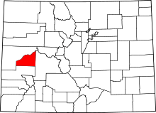 | |
| Towns | ||
| Unincorporated communities | ||