Hotchkiss, Colorado
| Hotchkiss, Colorado | |
|---|---|
| Statutory Town | |
|
East Bridge Street in Hotchkiss, looking towards Mt. Lamborn | |
| Motto: "Friendliest Town Around" | |
 Location in Delta County and the state of Colorado | |
| Coordinates: 38°47′57″N 107°43′1″W / 38.79917°N 107.71694°WCoordinates: 38°47′57″N 107°43′1″W / 38.79917°N 107.71694°W | |
| Country |
|
| State |
|
| County[1] | Delta |
| Incorporated (town) | March 14, 1901[2] |
| Government | |
| • Type | Statutory Town[1] |
| Area | |
| • Total | 0.91 sq mi (2.36 km2) |
| • Land | 0.91 sq mi (2.36 km2) |
| • Water | 0 sq mi (0 km2) |
| Elevation[3] | 5,331 ft (1,625 m) |
| Population (2010) | |
| • Total | 944 |
| • Density | 1,038/sq mi (400.8/km2) |
| Time zone | MST (UTC-7) |
| • Summer (DST) | MDT (UTC-6) |
| ZIP code[4] | 81419 |
| Area code(s) | 970 |
| FIPS code | 08-37545 |
| GNIS feature ID | 0186534 |
| Website |
townofhotchkiss |

Hotchkiss is a statutory town in Delta County, Colorado, United States. The population was 944 at the 2010 census.[5]
A post office called Hotchkiss has been in operation since 1882.[6] The town has the name of Enos T. Hotchkiss, a local pioneer.[7]
Geography
Hotchkiss is located in eastern Delta County at 38°47′57″N 107°43′1″W / 38.79917°N 107.71694°W (38.799275, -107.716976),[8] on the north side of the North Fork Gunnison River.
Colorado State Highway 92 passes through the center of town as Bridge Street, leading west 20 miles (32 km) to Delta, the county seat, and southeast 52 miles (84 km) to U.S. Route 50 at Blue Mesa Reservoir. Colorado State Highway 133 starts at the east end of town and leads northeast 66 miles (106 km) over McClure Pass to Carbondale.
According to the United States Census Bureau, the town of Hotchkiss has a total area of 0.93 square miles (2.4 km2), all of it land.[5]
Demographics
| Historical population | |||
|---|---|---|---|
| Census | Pop. | %± | |
| 1900 | 261 | — | |
| 1910 | 600 | 129.9% | |
| 1920 | 572 | −4.7% | |
| 1930 | 541 | −5.4% | |
| 1940 | 653 | 20.7% | |
| 1950 | 715 | 9.5% | |
| 1960 | 626 | −12.4% | |
| 1970 | 507 | −19.0% | |
| 1980 | 849 | 67.5% | |
| 1990 | 744 | −12.4% | |
| 2000 | 968 | 30.1% | |
| 2010 | 944 | −2.5% | |
| Est. 2015 | 902 | [9] | −4.4% |
As of the census[11] of 2000, there were 968 people, 412 households, and 271 families residing in the town. The population density was 1,452.8 people per square mile (557.8/km²). There were 451 housing units at an average density of 676.9 per square mile (259.9/km²). The racial makeup of the town was 93.18% White, 1.03% Native American, 0.52% Asian, 3.51% from other races, and 1.76% from two or more races. Hispanic or Latino of any race were 9.40% of the population.
There were 412 households out of which 31.6% had children under the age of 18 living with them, 51.7% were married couples living together, 9.7% had a female householder with no husband present, and 34.2% were non-families. 30.3% of all households were made up of individuals and 14.6% had someone living alone who was 65 years of age or older. The average household size was 2.34 and the average family size was 2.91.
In the town the population was spread out with 25.6% under the age of 18, 9.6% from 18 to 24, 26.4% from 25 to 44, 22.0% from 45 to 64, and 16.3% who were 65 years of age or older. The median age was 39 years. For every 100 females there were 88.0 males. For every 100 females age 18 and over, there were 87.0 males.
The median income for a household in the town was $28,056, and the median income for a family was $31,989. Males had a median income of $31,635 versus $20,469 for females. The per capita income for the town was $13,218. About 11.0% of families and 14.3% of the population were below the poverty line, including 16.5% of those under age 18 and 11.9% of those age 65 or over.
See also
References
- 1 2 "Active Colorado Municipalities". State of Colorado, Department of Local Affairs. Retrieved 2007-09-01.
- ↑ "Colorado Municipal Incorporations". State of Colorado, Department of Personnel & Administration, Colorado State Archives. 2004-12-01. Retrieved 2007-09-02.
- ↑ "US Board on Geographic Names". United States Geological Survey. 2007-10-25. Retrieved 2008-01-31.
- ↑ "ZIP Code Lookup" (JavaScript/HTML). United States Postal Service. Retrieved October 6, 2007.
- 1 2 "Geographic Identifiers: 2010 Demographic Profile Data (G001): Hotchkiss town, Colorado". U.S. Census Bureau, American Factfinder. Retrieved October 15, 2015.
- ↑ "Post offices". Jim Forte Postal History. Retrieved 27 June 2016.
- ↑ Dawson, John Frank. Place names in Colorado: why 700 communities were so named, 150 of Spanish or Indian origin. Denver, CO: The J. Frank Dawson Publishing Co. p. 27.
- ↑ "US Gazetteer files: 2010, 2000, and 1990". United States Census Bureau. 2011-02-12. Retrieved 2011-04-23.
- ↑ "Annual Estimates of the Resident Population for Incorporated Places: April 1, 2010 to July 1, 2015". Retrieved July 2, 2016.
- ↑ "Census of Population and Housing". Census.gov. Retrieved June 4, 2015.
- ↑ "American FactFinder". United States Census Bureau. Retrieved 2008-01-31.
External links
| Wikivoyage has a travel guide for Hotchkiss. |
- Town of Hotchkiss official website
- Town of Hotchkiss contacts
- The Delta County Independent, local community weekly covering Hotchkiss and the rest of Delta County
Municipalities and communities of Delta County, Colorado, United States | ||
|---|---|---|
| City | 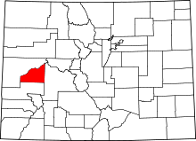 | |
| Towns | ||
| Unincorporated communities | ||
