County Route 547 (New Jersey)
| ||||
|---|---|---|---|---|
|
CR 547 highlighted in red | ||||
| Route information | ||||
| Length: | 28.29 mi[1] (45.53 km) | |||
| Major junctions | ||||
| South end: |
| |||
|
| ||||
| North end: |
| |||
| Location | ||||
| Counties: | Ocean, Monmouth | |||
| Highway system | ||||
| ||||
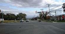
County Route 547, abbreviated CR 547, is a county highway in the U.S. state of New Jersey. The highway extends 28.29 miles (45.53 km) from Route 70 in Lakehurst to Broad Street (Route 71/CR 537) in Eatontown. Near its southern terminus, it passes the East Gate of Joint Base McGuire–Dix–Lakehurst, known as Lakehurst Naval Air Station in the past, and the site of the crash of the Hindenburg in 1937.
Route description
CR 547 begins at an intersection with Route 70 in Lakehurst, Ocean County, heading northeast on two-lane undivided Lakehurst-Lakewood Road. Immediately after beginning, the route crosses the Manasquan Brook into Manchester Township and turns north, running through forested areas of the Pine Barrens to the east of Naval Air Engineering Station Lakehurst. CR 547 is briefly a four-lane divided highway as it passes an entrance to the naval station before narrowing back to a two-lane undivided road and entering more dense forests as it comes to the CR 571 junction. From this point, the route becomes Lakehurst-Whitesville Road before continuing into Jackson Township as South Hope Chapel Road, running northeast through more woods with occasional development, crossing an abandoned railroad right-of-way before turning north and intersecting CR 527 near homes and businesses. Past this intersection, CR 547 continues north through wooded areas of residences before coming to an intersection with CR 528 near businesses.[1][2]

At this point, CR 547 turns east to form a concurrency with CR 528 on East Veterans Highway, with CR 639 continuing north on South Hope Chapel Road. The two routes continues through residential and commercial development, intersecting CR 626 before crossing into Lakewood Township. At this point, CR 528/CR 547 becomes Lakewood-New Egypt Road and turns northeast into wooded residential neighborhoods. In this area, the routes turn east onto Central Avenue and passes more homes before crossing Lake Carasaljo and coming to an intersection with US 9. At this point, CR 528 continues northeast on Hurley Avenue and CR 547 turns north to follow US 9 on Madsion Avenue, crossing the Metedeconk River, which Lake Carasaljo is formed from. After intersecting the western terminus of Route 88, Madison Avenue continues north through the commercial and residential center of Lakewood as a four-lane undivided road, with CR 547 splitting from US 9 by turning east onto two-lane 8th Street. The route passes through residential areas before splitting from 8th Street by turning northeast onto Squankum Road. Signage along US 9 shows CR 547 leaving the concurrency at 9th Street.[2] Along this stretch, CR 547 runs through wooded areas of homes, crossing CR 526.[1][2]


Crossing the Metedeconk River again, CR 547 enters Howell Township in Monmouth County and continues through a mix of homes, businesses, and woods as it crosses the Southern Secondary railroad line, formerly owned by the Central Railroad of New Jersey, and now by Conrail Shared Assets Operations. Farther northeast, the road continues into a mix of farmland, woodland, and residences as it reaches an intersection with CR 549 and CR 21. After this, CR 547 turns north and the lanes split as it comes to a cloverleaf interchange with I-195. The lanes rejoin as the route comes to an intersection with CR 524 and CR 524A, at which point CR 524 turns north to join CR 547. The two routes continues north through wooded areas of homes and businesses on Lakewood-Farmingdale Road, intersecting CR 18 before entering Farmingdale and turning northwest. The road becomes Main Street and passes residences before crossing the Southern Secondary into business areas. CR 547 splits from CR 524 by heading northeast on Asbury Avenue, passing some homes before crossing back into Howell Township. The route passes a mix of woodland and residential neighborhoods before making a turn to the east and crossing the Southern Secondary again. CR 547 enters Wall Township and runs through wooded areas of industry before intersecting Route 33 and Route 34 at the Collingwood Circle.[1][2]
CR 547 heads east for a brief concurrency with four-lane Route 33 after the circle before turning northeast onto four-lane undivided Shafto Road. The road continues into Tinton Falls and passes through a mix of farms and woods before continuing into forested areas with some commercial development. Upon crossing CR 16, the road runs between Naval Weapons Station Earle to the west and wooded residential and commercial development to the east. CR 547 passes through dense forests before intersecting CR 38 and passing under the Garden State Parkway. The road intersects CR 38 again after and enters Eatontown at the CR 51 junction, where the name becomes Wyckoff Road. A short distance later, the route comes to a partial interchange providing access to and from the southbound direction of the Route 18 freeway before heading into wooded residential neighborhoods. CR 547 widens to a divided highway as it passes the Monmouth Mall and comes to an intersection with Route 36. The road passes more businesses as it becomes undivided and comes to the Route 35 junction a short distance later. CR 547 continues past more homes before it reaches its northern terminus at Route 71/CR 537.[1][2]
Major intersections
| County | Location | mi[1] | km | Destinations | Notes |
|---|---|---|---|---|---|
| Ocean | Lakehurst | 0.00 | 0.00 | ||
| Manchester Township | 1.70 | 2.74 | |||
| Jackson Township | 4.43 | 7.13 | |||
| 5.54 | 8.92 | South end of CR 528 overlap | |||
| Lakewood Township | 8.46 | 13.62 | North end of CR 528 overlap, south end of US 9 overlap | ||
| 8.70 | 14.00 | Western terminus of Route 88 | |||
| 9.28 | 14.93 | North end of US 9 overlap | |||
| 10.18 | 16.38 | ||||
| Monmouth | Howell Township | 14.67 | 23.61 | Northern terminus of CR 549 | |
| 15.05 | 24.22 | Exit 31 (I-195) | |||
| 15.33 | 24.67 | South end of CR 524 overlap; southern terminus of CR 524A | |||
| Farmingdale | 17.60 | 28.32 | North end of CR 524 overlap | ||
| Wall Township | 20.44 | 32.89 | Collingwood Circle, south end of Route 33 overlap | ||
| 20.79 | 33.46 | North end of Route 33 overlap | |||
| Eatontown | 25.78 | 41.49 | Exit 13A (Route 18); access from northbound CR 547 to southbound Route 18 / northbound Route 18 to southbound CR 547 only | ||
| 27.08 | 43.58 | ||||
| 27.37 | 44.05 | ||||
| 28.29 | 45.53 | ||||
1.000 mi = 1.609 km; 1.000 km = 0.621 mi
| |||||
See also
 U.S. Roads portal
 New Jersey portal
References
- 1 2 3 4 5 6 NJDOT County Route 547 Straight Line Diagram (PDF) (NJDOT) (Straight line diagram)
- 1 2 3 4 5 Google (January 6, 2011). "overview of County Route 547" (Map). Google Maps. Google. Retrieved January 6, 2011.
External links
| Wikimedia Commons has media related to County Route 547 (New Jersey). |

_map.svg.png)