Wyalusing State Park
| Wyalusing State Park | |
| Wisconsin State Park | |
 Wyalusing State Park | |
| Country | United States |
|---|---|
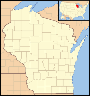
| State | Wisconsin |
| County | Grant |
| Location | Wyalusing |
| - coordinates | 42°58′47″N 91°6′31″W / 42.97972°N 91.10861°WCoordinates: 42°58′47″N 91°6′31″W / 42.97972°N 91.10861°W |
| Area | 2,628 acres (1,064 ha) |
| Founded | 1917 |
| Management | Wisconsin Department of Natural Resources |
| Designated | 1973 |
| IUCN category | V - Protected Landscape/Seascape |
 | |
| Website: Wyalusing State Park | |
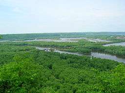
Wyalusing State Park /waɪ.əˈluːsɪŋ/ is a 2,628-acre (1,064 ha) Wisconsin state park at the confluence of the Mississippi and Wisconsin rivers in the town of Wyalusing, just south of Prairie du Chien. Wyalusing means "home of the warrior" in the Lenape language spoken by Munsee-Delaware Indians who settled in the area in the 19th century after being displaced from farther east. 500-foot-high (150 m) bluffs dotted with prehistoric Indian mounds look out over the river valleys. Two park resources have been recognized nationally: the Wyalusing Hardwood Forest is a National Natural Landmark and the Wyalusing State Park Mounds Archaeological District is on the National Register of Historic Places.
Geology
The park is in the Driftless Area of Wisconsin, a portion of territory that remained ice free during the last ice age, while land to the east and west was crushed by glaciers. The high bluffs along the Mississippi River and the large deep canyon of the Wisconsin River are evidence of glacial meltwaters reshaping this region.
External links
- Wyalusing State Park Wisconsin Department of Natural Resources
- Friends of Wyalusing State Park
![]() Media related to Wyalusing State Park at Wikimedia Commons
Media related to Wyalusing State Park at Wikimedia Commons
