Conner, Apayao
| Conner | |
|---|---|
| Municipality | |
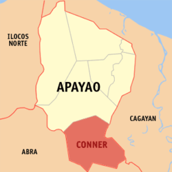 Location within Apayao province | |
.svg.png) Conner Location within the Philippines | |
| Coordinates: 17°48′N 121°20′E / 17.8°N 121.33°ECoordinates: 17°48′N 121°20′E / 17.8°N 121.33°E | |
| Country | Philippines |
| Region | Cordillera Administrative Region (CAR) |
| Province | Apayao |
| District | Lone District |
| Barangays | 21 (see Barangays) |
| Government [1] | |
| • Type | Sangguniang Bayan |
| • Mayor | Leonardo D. Dangoy |
| Area[2] | |
| • Total | 694.3 km2 (268.1 sq mi) |
| Population (2015 census)[3] | |
| • Total | 26,051 |
| • Density | 38/km2 (97/sq mi) |
| • Voter (2016)[4] | 12,961 |
| Time zone | PST (UTC+8) |
| ZIP code | 3807 |
| IDD : area code | +63 (0)74 |
| Income class | 2nd class |
| PSGC | 148102000 |
Conner, officially the Municipality of Conner (Filipino: Bayan ng Conner), is a municipality in the province of Apayao in the Cordillera Administrative Region (CAR) of the Philippines. The population was 26,051 at the 2015 census.[3] In the 2016 election, it had 12,961 registered voters.[4]
Geography
Conner is located at 17°48′N 121°20′E / 17.8°N 121.33°E.
According to the Philippine Statistics Authority, the municipality has a land area of 694.3 square kilometres (268.1 sq mi)[2] constituting 15.73% of the 4,413.35-square-kilometre- (1,704.00 sq mi) total area of Apayao.
Barangays
Conner is politically subdivided into 21 barangays.[5]
| PSGC | Barangay | Population | ±% p.a. | ||
|---|---|---|---|---|---|
| 2015[3] | 2010[6] | ||||
| 148102001 | Allangigan | 1.9% | 494 | 424 | +2.95% |
| 148102018 | Banban | 4.2% | 1,088 | 1,042 | +0.83% |
| 148102002 | Buluan | 5.9% | 1,537 | 1,462 | +0.96% |
| 148102003 | Caglayan (New Poblacion) | 8.2% | 2,132 | 1,865 | +2.58% |
| 148102004 | Calafug | 4.0% | 1,041 | 906 | +2.68% |
| 148102005 | Cupis | 1.7% | 446 | 441 | +0.21% |
| 148102006 | Daga | 5.0% | 1,315 | 1,281 | +0.50% |
| 148102019 | Guinaang | 5.8% | 1,507 | 1,476 | +0.40% |
| 148102007 | Guinamgaman | 3.1% | 798 | 841 | −0.99% |
| 148102020 | Ili | 5.1% | 1,325 | 1,195 | +1.99% |
| 148102008 | Karikitan | 7.2% | 1,879 | 1,928 | −0.49% |
| 148102009 | Katablangan | 2.1% | 559 | 697 | −4.11% |
| 148102010 | Malama | 11.4% | 2,979 | 2,885 | +0.61% |
| 148102011 | Manag | 6.8% | 1,771 | 1,629 | +1.60% |
| 148102021 | Mawegui | 3.1% | 800 | 763 | +0.91% |
| 148102012 | Nabuangan | 2.0% | 528 | 594 | −2.22% |
| 148102013 | Paddaoan | 6.4% | 1,678 | 1,623 | +0.64% |
| 148102014 | Puguin | 3.3% | 859 | 805 | +1.24% |
| 148102015 | Ripang (Old Poblacion) | 3.8% | 979 | 841 | +2.94% |
| 148102016 | Sacpil | 4.7% | 1,230 | 1,141 | +1.44% |
| 148102017 | Talifugo | 4.2% | 1,106 | 972 | +2.49% |
| Total | 26,051 | 24,811 | +0.93% | ||
Demographics
| Population census of Conner | |||||||||||||||||||||||||
|---|---|---|---|---|---|---|---|---|---|---|---|---|---|---|---|---|---|---|---|---|---|---|---|---|---|
|
| ||||||||||||||||||||||||
| Source: PSA[3][6][7] | |||||||||||||||||||||||||
In the 2015 census, Conner had a population of 26,051.[3] The population density was 38 inhabitants per square kilometre (98/sq mi).
In the 2016 election, it had 12,961 registered voters.[4]
References
- ↑ "Municipality". Quezon City, Philippines: Department of the Interior and Local Government. Retrieved 31 May 2013.
- 1 2 "Province: Apayao". PSGC Interactive. Makati City, Philippines: Philippine Statistics Authority. Retrieved 4 November 2016.
- 1 2 3 4 5 "CORDILLERA ADMINISTRATIVE REGION (CAR)". Census of Population (2015): Total Population by Province, City, Municipality and Barangay (Report). PSA. Retrieved 20 June 2016.
- 1 2 3 "2016 National and Local Elections Statistics". Commission on Elections. 2016.
- ↑ "Municipal: Conner, Apayao". PSA. Philippines: National Statistical Coordination Board. Retrieved 8 January 2016.
- 1 2 "CORDILLERA ADMINISTRATIVE REGION (CAR)". Census of Population and Housing (2010): Total Population by Province, City, Municipality and Barangay (Report). NSO. Retrieved 29 June 2016.
- ↑ "CORDILLERA ADMINISTRATIVE REGION (CAR)". Census of Population (1995, 2000 and 2007): Total Population by Province, City and Municipality (Report). NSO. Archived from the original on 24 June 2011.
External links
| Wikimedia Commons has media related to Conner, Apayao. |
 |
Kabugao | | ||
| Tineg, Abra Lacub, Abra |
|
Rizal, Cagayan | ||
| ||||
| | ||||
| Balbalan, Kalinga / Pinukpuk, Kalinga | Tuao, Cagayan |