Congis-sur-Thérouanne
| Congis-sur-Thérouanne | |
|---|---|
 Congis-sur-Thérouanne | |
|
Location within Île-de-France region 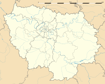 Congis-sur-Thérouanne | |
| Coordinates: 49°00′28″N 2°58′34″E / 49.0078°N 2.9761°ECoordinates: 49°00′28″N 2°58′34″E / 49.0078°N 2.9761°E | |
| Country | France |
| Region | Île-de-France |
| Department | Seine-et-Marne |
| Arrondissement | Meaux |
| Canton | Lizy-sur-Ourcq |
| Intercommunality | Pays de l'Ourcq |
| Government | |
| • Mayor (2014–2020) | Francis Élu |
| Area1 | 15.12 km2 (5.84 sq mi) |
| Population (2012)2 | 1,772 |
| • Density | 120/km2 (300/sq mi) |
| Time zone | CET (UTC+1) |
| • Summer (DST) | CEST (UTC+2) |
| INSEE/Postal code | 77126 / 77440 |
| Elevation | 42–122 m (138–400 ft) |
|
1 French Land Register data, which excludes lakes, ponds, glaciers > 1 km² (0.386 sq mi or 247 acres) and river estuaries. 2 Population without double counting: residents of multiple communes (e.g., students and military personnel) only counted once. | |
Congis-sur-Thérouanne is a commune in the Seine-et-Marne department in the Île-de-France region in north-central France.
Demographics
The inhabitants are called Congissois.
Schools
The communal preschool and elementary school is the École "Casse-Noisettes". Junior high school students attend Collège Camille-Saint-Saëns in Lizy-sur-Ourcq and Collège du Champivert in Crouy-sur-Ourcq. There is one senior high school/sixth-form college in the commune, Lycée du Gué-à-Tresmes.[1]
People linked to the commune
- Pierre Baillet, (born Paris c.1447; died Auxerre before 1513), lord of Villers-lès-Rigault, a former commune merged with Congis-sur-Thérouanne in 1807. He is interred in the Saint-Alexandre chapel, behind the choir, with his brother, Jean III Baillet, Bishop of Auxerre.
- Henri Hérouin, (1876-?), Olympic champion archer at the 1900 Summer Olympics in Paris, was born here.
See also
References
- ↑ "Vie scolaire." Congis-sur-Thérouanne. Retrieved on September 3, 2016.
External links
| Wikimedia Commons has media related to Congis-sur-Thérouanne. |
- Home page (French)
- 1999 Land Use, from IAURIF (Institute for Urban Planning and Development of the Paris-Île-de-France région) (English)
- French Ministry of Culture list for Congis-sur-Thérouanne (French)
- Map of Congis-sur-Thérouanne on Michelin (English)
This article is issued from Wikipedia - version of the 9/3/2016. The text is available under the Creative Commons Attribution/Share Alike but additional terms may apply for the media files.