Clay Township, Dearborn County, Indiana
| Clay Township | |
|---|---|
| Township | |
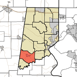 Location of Clay Township in Dearborn County | |
| Coordinates: 39°00′44″N 85°03′35″W / 39.01222°N 85.05972°WCoordinates: 39°00′44″N 85°03′35″W / 39.01222°N 85.05972°W | |
| Country | United States |
| State | Indiana |
| County | Dearborn |
| Government | |
| • Type | Indiana township |
| Area | |
| • Total | 25.3 sq mi (66 km2) |
| • Land | 25.25 sq mi (65.4 km2) |
| • Water | 0.05 sq mi (0.1 km2) |
| Elevation[1] | 869 ft (265 m) |
| Population (2010) | |
| • Total | 2,966 |
| • Density | 117.5/sq mi (45.4/km2) |
| FIPS code | 18-13024[2] |
| GNIS feature ID | 453207 |
Clay Township is one of fourteen townships in Dearborn County, Indiana. As of the 2010 census, its population was 2,966 and it contained 1,271 housing units.[3]
History
Clay Township was organized in 1835.[4][5]
Geography
According to the 2010 census, the township has a total area of 25.3 square miles (66 km2), of which 25.25 square miles (65.4 km2) (or 99.80%) is land and 0.05 square miles (0.13 km2) (or 0.20%) is water.[3]
Cities and towns
Major highways
Cemeteries
The township contains four cemeteries: Conaway, Oakdale, Spangler and Windsor.
References
- "Clay Township, Dearborn County, Indiana". Geographic Names Information System. United States Geological Survey. Retrieved 2009-09-24.
- United States Census Bureau cartographic boundary files
- ↑ "US Board on Geographic Names". United States Geological Survey. 2007-10-25. Retrieved 2008-01-31.
- ↑ "American FactFinder". United States Census Bureau. Archived from the original on 2013-09-11. Retrieved 2008-01-31.
- 1 2 "Population, Housing Units, Area, and Density: 2010 - County -- County Subdivision and Place -- 2010 Census Summary File 1". United States Census. Retrieved 2013-05-10.
- ↑ Shaw, Archibald (1915). History of Dearborn County, Indiana: Her People, Industries and Institutions. Unigraphic. p. 159.
- ↑ History of Dearborn and Ohio Counties, Indiana. F. E. Weakley. 1885. p. 495.
External links

Municipalities and communities of Dearborn County, Indiana, United States | ||
|---|---|---|
| Cities | ||
| Towns | ||
| Townships | ||
| CDPs | ||
| Other unincorporated communities | ||
This article is issued from Wikipedia - version of the 11/26/2016. The text is available under the Creative Commons Attribution/Share Alike but additional terms may apply for the media files.