Chapel Allerton, Somerset
| Chapel Allerton | |
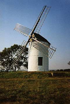 Ashton Windmill |
|
 Chapel Allerton |
|
| Population | 401 (2011)[1] |
|---|---|
| OS grid reference | ST405505 |
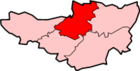
| District | Sedgemoor |
| Shire county | Somerset |
| Region | South West |
| Country | England |
| Sovereign state | United Kingdom |
| Post town | AXBRIDGE |
| Postcode district | BS26 |
| Dialling code | 01934 |
| Police | Avon and Somerset |
| Fire | Devon and Somerset |
| Ambulance | South Western |
| EU Parliament | South West England |
| UK Parliament | Wells |
Coordinates: 51°15′04″N 2°51′14″W / 51.251°N 2.854°W
Chapel Allerton is a village and civil parish, south of Cheddar in the English county of Somerset. The parish includes the hamlets of Ashton and Stone Allerton.
History
The name comes from "Aelfweard's settlement", with the chapel prefix being added in 1708 to distinguish it from the adjourning Stone Allerton. The manor was brought in 1492 by John Gunthorpe and passed to the Bishop of Wells.[2]
Chapel Allerton was part of the hundred of Bempstone.[3]
Chapel Allerton forms part of Sedgemoor district and is located southwest of Cheddar. It is noted for the striking Ashton windmill nearby.
Governance
The parish council has responsibility for local issues, including setting an annual precept (local rate) to cover the council’s operating costs and producing annual accounts for public scrutiny. The parish council evaluates local planning applications and works with the local police, district council officers, and neighbourhood watch groups on matters of crime, security, and traffic. The parish council's role also includes initiating projects for the maintenance and repair of parish facilities, as well as consulting with the district council on the maintenance, repair, and improvement of highways, drainage, footpaths, public transport, and street cleaning. Conservation matters (including trees and listed buildings) and environmental issues are also the responsibility of the council.
The village falls within the Non-metropolitan district of Sedgemoor, which was formed on 1 April 1974 under the Local Government Act 1972, having previously been part of Axbridge Rural District,[4] which is responsible for local planning and building control, local roads, council housing, environmental health, markets and fairs, refuse collection and recycling, cemeteries and crematoria, leisure services, parks, and tourism.
Somerset County Council is responsible for running the largest and most expensive local services such as education, social services, libraries, main roads, public transport, policing and fire services, trading standards, waste disposal and strategic planning.
It is also part of the Wells county constituency represented in the House of Commons of the Parliament of the United Kingdom. It elects one Member of Parliament (MP) by the first past the post system of election, and part of the South West England constituency of the European Parliament which elects seven MEPs using the d'Hondt method of party-list proportional representation.
Religious sites
The parish church dates from the 13th century and has been designated by English Heritage as a grade II listed building.[5]
References
- ↑ "Statistics for Wards, LSOAs and Parishes — SUMMARY Profiles" (Excel). Somerset Intelligence. Retrieved 4 January 2014.
- ↑ Bush, Robin (1994). Somerset: The complete guide. Wimborne, Dorset: Dovecote Press. p. 58. ISBN 1-874336-26-1.
- ↑ "Bempstone Hundred". A Vision of Britain Through Time. Retrieved 19 November 2016.
- ↑ "Axbridge RD". A vision of Britain Through Time. University of Portsmouth. Retrieved 4 January 2014.
- ↑ "Parish Church". Images of England. Retrieved 3 March 2008.
External links
| Wikimedia Commons has media related to Chapel Allerton, Somerset. |