Vengurla
| Vengurla वेंगुर्ला | |
|---|---|
| city | |
|
Vengurla beach (Navabag beach) | |
 Vengurla Location in Maharashtra, India | |
| Coordinates: 15°51′00″N 73°37′56″E / 15.8500522°N 73.6322812°ECoordinates: 15°51′00″N 73°37′56″E / 15.8500522°N 73.6322812°E | |
| Country |
|
| State | Maharashtra |
| District | Sindhudurg |
| Elevation | 11 m (36 ft) |
| Population (2001) | |
| • Total | 12,471 |
| Languages | |
| • Official | Marathi |
| Time zone | IST (UTC+5:30) |

Vengurla is a town in Sindhudurg district of Maharashtra, India just north of Goa. It is surrounded by a semicircular range of hills with lush green foliage mainly of cashew, mango, coconut, and different kinds of berry trees. The hills of Dabholi, Tulas, and Mochemad respectively lie in the north, the east, and the south of Vengurla, while the Arabian Sea is located on its west.
The town has a rich cultural heritage. Vengurla Taluka has some temples including those of Shri Sateri, Shri Rameshwar, Shri Navadurga at Kanyale Redi, Shri Mauli at Redi and Shiroda, Shri Vetoba at Aaravali, Shri Ganesh at Redi and Shri Ravalnath.
History
Vengurla, being a safe and natural port, commercial centre was initially established during 1665 by Dutch traders and subsequently by British rulers. Signs of Dutch - British rulers are present in the city : Dutch Wakhar (Godown), St. Lukes Hospital, Crowferd Market etc. Planned city having road & drainage system, market, commercial and office buildings, Municipal Council, Hospitals, Parks etc. was developed by British rulers. The 130-year-old Vengurla Municipal Council is one of the oldest Municipal Council in Maharashtra State.
Geography
Vengurla is located at 15°52′N 73°38′E / 15.87°N 73.63°E.[1] It has an average elevation of 11 metres (36 ft).Vengurla is also known as Vingoria. Areas included are Dabholi, Khanoli, Vetore, Tendoli, Vayangani, Surangpani.
Climate
| Climate data for Vengurla | |||||||||||||
|---|---|---|---|---|---|---|---|---|---|---|---|---|---|
| Month | Jan | Feb | Mar | Apr | May | Jun | Jul | Aug | Sep | Oct | Nov | Dec | Year |
| Record high °C (°F) | 36 (97) |
37 (99) |
37 (99) |
37 (99) |
42 (108) |
33 (91) |
36 (97) |
37 (99) |
33 (91) |
31 (88) |
35 (95) |
36 (97) |
42 (108) |
| Average high °C (°F) | 32 (90) |
31 (88) |
32 (90) |
32 (90) |
32 (90) |
30 (86) |
28 (82) |
28 (82) |
29 (84) |
31 (88) |
32 (90) |
32 (90) |
31 (88) |
| Average low °C (°F) | 18 (64) |
18 (64) |
21 (70) |
24 (75) |
25 (77) |
24 (75) |
24 (75) |
23 (73) |
23 (73) |
23 (73) |
21 (70) |
19 (66) |
22 (72) |
| Record low °C (°F) | 11 (52) |
10 (50) |
12 (54) |
20 (68) |
17 (63) |
21 (70) |
22 (72) |
17 (63) |
20 (68) |
17 (63) |
16 (61) |
13 (55) |
10 (50) |
| Average precipitation mm (inches) | 0 (0) |
0 (0) |
0 (0) |
5.1 (0.201) |
188.0 (7.402) |
830.6 (32.701) |
937.3 (36.902) |
762.0 (30) |
287.0 (11.299) |
83.9 (3.303) |
36.0 (1.417) |
25.4 (1) |
3,155.3 (124.225) |
| Source: [2] | |||||||||||||
Under the Köppen climate classification, Vengurla features a tropical monsoon climate. The highest temperature in summer reaches 42°C while in winter, temperature drops up to 10°C. The annual precipitation is 3,155.3 mm (124.22 in).
Demographics
According to India's 2001 census,[3] Vengurla had a population of 12,471 in 2001. Males and females constituted 49% and 51%, respectively, of the population. 81% of Vengurla's population was literate (86% of males and 76% of females) compared to 59.5% of India's total population. 10% of the town's population was under 6 years of age at the time of the census.
Language
Malvani is spoken as a local language (Malwani Konkani). Marathi, being the state language, is also understood and implemented. Kirat is a local weekly newspaper published in town.
Places of interest
- Mochemad Beach
- Dutch Fortified Factory (1637)
- Velaghar
- Asoli
- Lighthouse
- Terekhol Beach
- Mansishwar Temple, Bagayatwadi
- kalvi beach, kelus
- Redi
- Vengurla's Lighthouse
- Vengurla jetty
- Sagareshwar Beach
Image gallery
 Mochemad
 Velaghar
 Terekhol
 Vengurla
References
- ↑ Falling Rain Genomics, Inc - Vengurla
- ↑ "Vengurla, India". Whetherbase. Retrieved 2010-07-01.
- ↑ "Census of India 2001: Data from the 2001 Census, including cities, villages and towns (Provisional)". Census Commission of India. Archived from the original on 2004-06-16. Retrieved 2008-11-01.
External links
| Wikimedia Commons has media related to Vengurla. |
- Vengurla:Waman Parulekar - information about Vengurla
- Navadurga at Redi Vengurla - information about famous Navadurga Temple at Redi, Vengurla
Sindhudurg district topics | ||
|---|---|---|
| History | 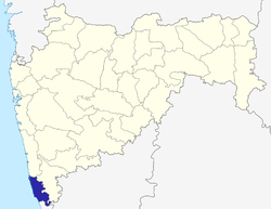 | |
| Geography | ||
| Cities and towns | ||
| Culture | ||
| Transport | ||
| Lok Sabha constituencies | ||
| Vidhan Sabha constituencies | ||