Cecil, Wisconsin
| Cecil, Wisconsin | |
|---|---|
| Village | |
|
Downtown Cecil | |
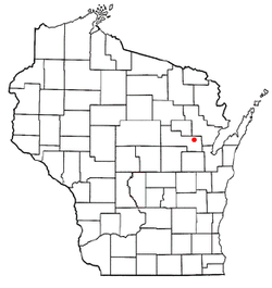 Location of Cecil, Wisconsin | |
| Coordinates: 44°48′34″N 88°27′8″W / 44.80944°N 88.45222°WCoordinates: 44°48′34″N 88°27′8″W / 44.80944°N 88.45222°W | |
| Country | United States |
| State | Wisconsin |
| County | Shawano |
| Area[1] | |
| • Total | 1.80 sq mi (4.66 km2) |
| • Land | 1.79 sq mi (4.64 km2) |
| • Water | 0.01 sq mi (0.03 km2) |
| Elevation[2] | 807 ft (246 m) |
| Population (2010)[3] | |
| • Total | 570 |
| • Estimate (2012[4]) | 562 |
| • Density | 318.4/sq mi (122.9/km2) |
| Time zone | Central (CST) (UTC-6) |
| • Summer (DST) | CDT (UTC-5) |
| Area code(s) | 715 & 534 |
| FIPS code | 55-13325[5] |
| GNIS feature ID | 1562830[2] |

Cecil is a village in Shawano County, Wisconsin, United States. The population was 570 at the 2010 census.
History
The village was named after a railroad man, Cecil Leavitt when the railroad was finished in 1884.[6]
Geography
Cecil is located at 44°48′34″N 88°27′8″W / 44.80944°N 88.45222°W (44.809442, -88.452323)[7] on the east shore of Shawano Lake.
According to the United States Census Bureau, the village has a total area of 1.80 square miles (4.66 km2), of which, 1.79 square miles (4.64 km2) of it is land and 0.01 square miles (0.03 km2) is water.[1]
Demographics
| Historical population | |||
|---|---|---|---|
| Census | Pop. | %± | |
| 1910 | 351 | — | |
| 1920 | 379 | 8.0% | |
| 1930 | 356 | −6.1% | |
| 1940 | 370 | 3.9% | |
| 1950 | 395 | 6.8% | |
| 1960 | 357 | −9.6% | |
| 1970 | 369 | 3.4% | |
| 1980 | 445 | 20.6% | |
| 1990 | 373 | −16.2% | |
| 2000 | 466 | 24.9% | |
| 2010 | 570 | 22.3% | |
| Est. 2015 | 554 | [8] | −2.8% |
2010 census
As of the census[3] of 2010, there were 570 people, 262 households, and 162 families residing in the village. The population density was 318.4 inhabitants per square mile (122.9/km2). There were 328 housing units at an average density of 183.2 per square mile (70.7/km2). The racial makeup of the village was 93.0% White, 0.2% African American, 4.2% Native American, 1.1% from other races, and 1.6% from two or more races. Hispanic or Latino of any race were 2.1% of the population.
There were 262 households of which 24.0% had children under the age of 18 living with them, 51.5% were married couples living together, 6.9% had a female householder with no husband present, 3.4% had a male householder with no wife present, and 38.2% were non-families. 28.6% of all households were made up of individuals and 11.5% had someone living alone who was 65 years of age or older. The average household size was 2.18 and the average family size was 2.63.
The median age in the village was 45.6 years. 17.7% of residents were under the age of 18; 6.9% were between the ages of 18 and 24; 24.1% were from 25 to 44; 31.7% were from 45 to 64; and 19.5% were 65 years of age or older. The gender makeup of the village was 47.5% male and 52.5% female.
2000 census
As of the census[5] of 2000, there were 466 people, 199 households, and 148 families residing in the village. The population density was 339.0 people per square mile (131.3/km²). There were 246 housing units at an average density of 179.0 per square mile (69.3/km²). The racial makeup of the village was 94.85% White, 3.43% Native American, 0.64% Asian, 0.64% from other races, and 0.43% from two or more races. Hispanic or Latino of any race were 0.64% of the population.
There were 199 households out of which 24.6% had children under the age of 18 living with them, 62.8% were married couples living together, 8.5% had a female householder with no husband present, and 25.6% were non-families. 22.6% of all households were made up of individuals and 6.5% had someone living alone who was 65 years of age or older. The average household size was 2.34 and the average family size was 2.70.
In the village the population was spread out with 19.7% under the age of 18, 9.4% from 18 to 24, 24.5% from 25 to 44, 24.2% from 45 to 64, and 22.1% who were 65 years of age or older. The median age was 43 years. For every 100 females there were 96.6 males. For every 100 females age 18 and over, there were 98.9 males.
The median income for a household in the village was $38,958, and the median income for a family was $39,792. Males had a median income of $37,188 versus $23,750 for females. The per capita income for the village was $18,918. About 3.8% of families and 5.7% of the population were below the poverty line, including 10.6% of those under age 18 and 3.5% of those age 65 or over.
Images
-

DOT welcome sign
-
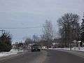
Northbound on WIS 22
-

Welcome sign
References
- 1 2 "US Gazetteer files 2010". United States Census Bureau. Archived from the original on 2012-01-24. Retrieved 2012-11-18.
- 1 2 "US Board on Geographic Names". United States Geological Survey. 2007-10-25. Retrieved 2008-01-31.
- 1 2 "American FactFinder". United States Census Bureau. Retrieved 2012-11-18.
- ↑ "Population Estimates". United States Census Bureau. Archived from the original on 2013-06-17. Retrieved 2013-06-24.
- 1 2 "American FactFinder". United States Census Bureau. Archived from the original on 2013-09-11. Retrieved 2008-01-31.
- ↑ Village of Cecil, Wisconsin-History
- ↑ "US Gazetteer files: 2010, 2000, and 1990". United States Census Bureau. 2011-02-12. Retrieved 2011-04-23.
- ↑ "Annual Estimates of the Resident Population for Incorporated Places: April 1, 2010 to July 1, 2015". Retrieved July 2, 2016.
- ↑ "Census of Population and Housing". Census.gov. Archived from the original on May 11, 2015. Retrieved June 4, 2015.
External links
Municipalities and communities of Shawano County, Wisconsin, United States | ||
|---|---|---|
| Cities | 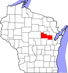 | |
| Villages | ||
| Towns | ||
| CDPs | ||
| Unincorporated communities | ||
| Indian reservations | ||
| Footnotes | ‡This populated place also has portions in an adjacent county or counties | |