Cathedral Range (Victoria)
| Cathedral Range | |
|---|---|
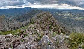 A panoramic view of the Cathedral Range ridge from Cathedral Peak, looking south towards the Jawbones and Sugarloaf Peak | |
| Highest point | |
| Peak | The Green Hill |
| Elevation | 1,241 m (4,072 ft) [1] AHD |
| Coordinates | 37°25′40″S 145°47′09″E / 37.42778°S 145.78583°E [2] |
| Geography | |
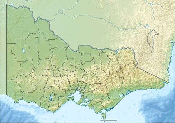 Location of the Cathedral Range in Victoria | |
| Country | Australia |
| State/Province | Victoria |
| Range coordinates | 37°22′16″S 145°45′11″E / 37.3711°S 145.7531°ECoordinates: 37°22′16″S 145°45′11″E / 37.3711°S 145.7531°E |
| Parent range | Great Dividing Range |
| Geology | |
| Age of rock | Devonian Period |
| Type of rock | Sedimentary, Sandstone and Mudstone |
The Cathedral Range is a mountain range that is part of the Great Dividing Range in Victoria, Australia, located in Cathedral Range State Park. The range is formed from a 7 kilometres (4.3 mi) ridge of upturned sedimentary rock, consisting mainly of sandstone, mudstone and conglomerates of the Devonian Period. This has given the range steep sides, and a narrow razorback ridge. The plateau on the eastern boundary of the park continues to the nearby Lake Mountain cross country ski area. Much of the park was burnt in the Black Saturday bushfires.
Panorama
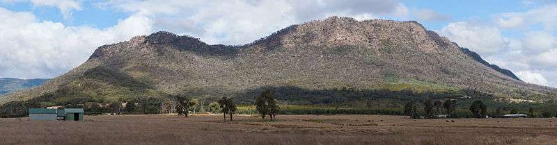
The northern section of the Cathedral Range as viewed from the west on Maroondah Highway.
See also
References
- ↑ "Map of Cathedral Range, VIC". Bonzle Digital Atlas of Australia. Retrieved 5 August 2014.
- ↑ "The Green Hill: 27465". Vicnames. 2 May 1966. Retrieved 5 August 2014.
External links
This article is issued from Wikipedia - version of the 8/15/2014. The text is available under the Creative Commons Attribution/Share Alike but additional terms may apply for the media files.