Mount Donna Buang
| Mount Donna Buang | |
|---|---|
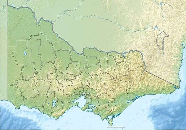 Mount Donna Buang Location in Victoria | |
| Highest point | |
| Elevation | 1,250 metres (4,100 ft) AHD |
| Coordinates | 37°42′23″S 145°40′52″E / 37.70639°S 145.68111°ECoordinates: 37°42′23″S 145°40′52″E / 37.70639°S 145.68111°E |
| Geography | |
| Location | Victoria, Australia |
| Parent range | Donna Buang Range, Victorian Alps, Great Dividing Range |
Mount Donna Buang is a mountain in the southern reaches of the Victorian Alps of the Great Dividing Range, located in the Australian state of Victoria. Approximately 80 kilometres (50 mi) from Melbourne with an elevation of 1,250 metres (4,101 ft), Mount Donna Buang is the closest snowfield to Melbourne.[1]
Location and features
In winter, it usually receives snow suitable for snowplay and tobogganing, and during the non-winter months the area is well visited by bushwalkers and cyclists. The summit of Mount Donna Buang is surrounded by alpine ash trees and sub-alpine snow gums, and at nearby Cement Creek there is a raised walkway through myrtle beech (Nothofagus cunninghamii) and mountain ash (Eucalyptus regnans) trees known as the Mount Donna Buang Skywalk.
Mount Donna Buang is part of the Yarra Ranges National Park (formed in 1995) in which there are a number of species that have become rare or threatened, including the slender tree fern, and the geebung tree. It contains a number of native mammals including the endangered Leadbeater's possum, and is home to 120 species of native birds. Some examples include the pink robin, yellow-tailed black cockatoo and the crimson rosella.
The nearest serviced town to the mountain is Warburton.
Flora and fauna
The rare and possibly endangered Mount Donna Buang wingless stonefly (Riekoperla darlingtoni) is endemic to the area.[2]
History
In the 1860s, “Mount Acland” was the name given to the 1,250m high mountain by a Police Magistrate called Joseph Anderson Panton. The name it has today, “Mount Donna Buang”, came from the Wurundjeri Aborigines.
A walking track to the summit of Mount Donna Buang was cut during the 1890s and the much wider Donna Buang Bridle Track, which the current road from Warburton to the top of Mount Donna Buang follows, was opened in 1912.
Timber from the mountain was harvested from the early 1900s to the mid 1920s with seven cable hauled tramways moving logs from the Ben Cairn - Donna Buang ridge down to sawmills near Warburton.[3] While the forest has regrown and the mountain appears to have never been logged, relics such as tram rails and cables can still be found in the forest.
From 1925 to the early 1950s Mt Donna Buang was a popular ski resort. It had four ski lodges, day visitor shelters, cafes, a ski hire, a ski jump and six runs cut through forests of myrtle beech and woollybutt. For over 20 years it had thousands of visitors every weekend there was snow. However, the runs were fairly short and the snow cover was always erratic, so after the Second World War better transport meant it lost out to higher ski resorts further from Melbourne.[4]
Cycling
The road from Warburton to Mount Donna Buang is a challenging cycling route, averaging 6.2% over 16.6 km[5] and has also become a popular destination for recreational driving, motorcycling, and in the summer a challenging training route for endurance cyclists and triathletes.[6]
The main public roads on Mt Donna Buang are:
- Donna Buang Road, sealed from Warburton to a bit past the Mount Donna Buang Summit Road junction.
- Acheron Way, joining Donna Buang Road about halfway up, leads to Marysville. It is sealed except for a 12 kilometre section in the middle.
- Don Rd runs from Healesville to the Warburton Highway between Yarra Junction and Launching Place. It connects with Donna Buang Road, and is unsealed for much of its length.

See also
References
- ↑ Yarra Valley Directory
- ↑ Mount Donna Buang Wingless Stonefly (Riekoperla darlingtoni) - Unsuccessful listing advice
- ↑ McCarthy, Mike. Mountains of ash: a history of the sawmills and tramways of Warburton and district. Light Railway Research Society of Australia, 2001. Chapters 3,4 and 6.
- ↑ Sisson, David. Donna Buang: the forgotten ski resort, 2015. http://www.australianmountains.com/donnabuang/
- ↑ http://www.cyclingprofiles.com.au/HTM/MelClimbs/MC_DB.htm
- ↑ http://theclimbingcyclist.com/climbs/yarra-ranges/mt-donna-buang/
External links
| Wikimedia Commons has media related to Mount Donna Buang. |
- Donna Buang: the forgotten ski resort A history of Mt Donna Buang
- parkweb.vic.gov.au - mt-donna-buang-summit
- Warburton Valley official website
- Snow report
- WarburtonInfo Mt Donna Snow Info
- Tour of the Summit of Mount Donna Buang
- "Place ID 15429". Australian Heritage Database. Department of the Environment.