Mount Baw Baw
| Mount Baw Baw | |
|---|---|
 The view south across Gippsland from Mount Baw Baw | |
| Highest point | |
| Elevation | 1,567 metres (5,141 ft) AHD |
| Coordinates | 37°50′S 146°16′E / 37.833°S 146.267°ECoordinates: 37°50′S 146°16′E / 37.833°S 146.267°E |
| Geography | |
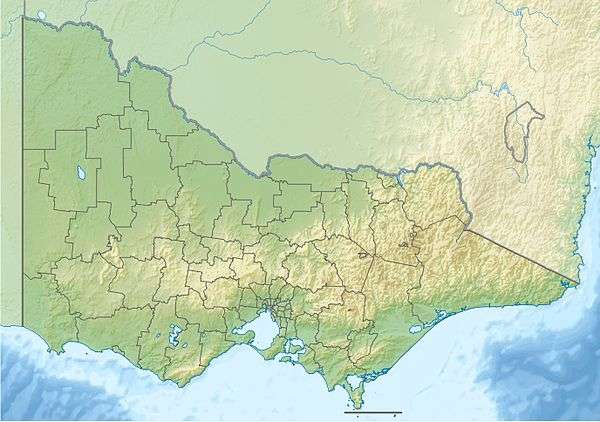 Mount Baw Baw Location in Victoria | |
| Location | Victoria, Australia |
| Parent range | Baw Baw Plateau, Great Dividing Range |
| Climbing | |
| Easiest route | Hike/ski |
Mount Baw Baw is a mountain of the Great Dividing Range, located in Victoria, Australia. Mount Baw Baw Alpine Resort is an unincorporated area of Victoria surrounded by the Shire of Baw Baw.
Location
Mount Baw Baw is about 120 kilometres (75 miles) east of Melbourne and 50 km (31 mi) north of the Latrobe Valley. The mountain itself is one of several peaks on the Baw Baw Plateau, a long plateau tending north-east. Other peaks on the plateau include Mount Mueller, Mount Whitelaw, Mount St Phillack, Mount Tyers, Mount Kernot and Mount St Gwinear. The plateau itself is isolated from most of Victoria's high country by the Thomson and Aberfeldy rivers and tributaries of the La Trobe River, including the Tanjil and Tyers rivers to the south.
Geology and biology
The Baw Baw massif consists of a late Devonian granodiorite pluton. There is relatively little relief on the plateau itself, the highest point reaching 1,567 metres (5,141 feet). The lower slopes of the plateau are covered in montane eucalypt forest and tall forest, and creek valleys have cool temperate rainforest of myrtle beech, Nothofagus cunninghamii. Above 1,200 m (3,900 ft) snow gum woodland occurs. There is no alttudinal treeline limit; subalpine grasslands and shrublands occur in flat valley bottoms on the plateau as a result of cold-air drainage. Much of this subalpine zone is included in the 133 km2 (51 sq mi) Baw Baw National Park. The Baw Baw Village ski resort is technically outside the national park.
The climate of the plateau itself is subalpine, with an average annual precipitation of 1,900 mm (75 in). Snow covers the plateau from June to September.
It is thought that Baron Ferdinand von Mueller made the first recorded European ascent of Baw Baw in 1860,[1] naming Christmas Creek on one of his major collecting expeditions. It was on this trip that he collected the Baw Baw Berry, Wittsteinia vacciniacea. There are two routes up the mountain; one via Noojee and Icy Creek which is very winding, and the unsealed South Face Road via Erica.[2]
Mount Baw Baw is a stronghold for Eucalyptus regnans, the tallest flowering plant on Earth. The largest reported measurement for an E. regnans was the Robinson Tree, measured at 143 metres by licensed surveyor G.W. Robinson, which was cut from the slopes of Mt. Baw Baw. If accurate, this measurement would make it the tallest tree ever measured by an accredited source.
Mount Baw Baw is home to the critically endangered Baw Baw frog.[1]
Climate
The mountain summit receives more annual precipitation than most places in mainland Australia and frequent snow in winter. Frequent heavy cloud cover means temperatures rarely drop well below freezing and the mountain is often shrouded in low cloud or mist. Summers are cool and temperatures rarely rise above 25 °C (77 °F). During the 2009 Victorian heatwave most of the state saw highs of above 45 °C (113 °F), while the temperature on Mount Baw Baw's summit reached a comparatively cool maximum of just 31.3 °C (88 °F).
| Climate data for Mount Baw Baw Summit | |||||||||||||
|---|---|---|---|---|---|---|---|---|---|---|---|---|---|
| Month | Jan | Feb | Mar | Apr | May | Jun | Jul | Aug | Sep | Oct | Nov | Dec | Year |
| Record high °C (°F) | 30.9 (87.6) |
31.3 (88.3) |
26.1 (79) |
20.0 (68) |
16.2 (61.2) |
11.6 (52.9) |
10.0 (50) |
13.1 (55.6) |
15.7 (60.3) |
20.8 (69.4) |
26.0 (78.8) |
27.7 (81.9) |
31.3 (88.3) |
| Average high °C (°F) | 17.4 (63.3) |
16.8 (62.2) |
13.9 (57) |
9.7 (49.5) |
6.4 (43.5) |
3.5 (38.3) |
2.1 (35.8) |
3.0 (37.4) |
5.7 (42.3) |
8.8 (47.8) |
12.5 (54.5) |
14.3 (57.7) |
9.5 (49.1) |
| Average low °C (°F) | 8.6 (47.5) |
8.4 (47.1) |
6.3 (43.3) |
3.7 (38.7) |
1.6 (34.9) |
−0.5 (31.1) |
−1.6 (29.1) |
−1.4 (29.5) |
−0.1 (31.8) |
1.7 (35.1) |
4.4 (39.9) |
5.7 (42.3) |
3.1 (37.6) |
| Record low °C (°F) | −2.0 (28.4) |
−1.0 (30.2) |
−2.2 (28) |
−5.7 (21.7) |
−5.0 (23) |
−7.0 (19.4) |
−6.0 (21.2) |
−6.6 (20.1) |
−6.1 (21) |
−6.4 (20.5) |
−4.5 (23.9) |
−3.1 (26.4) |
−7.0 (19.4) |
| Average rainfall mm (inches) | 94.0 (3.701) |
101.0 (3.976) |
101.8 (4.008) |
142.9 (5.626) |
121.8 (4.795) |
139.7 (5.5) |
161.8 (6.37) |
158.9 (6.256) |
149.5 (5.886) |
146.2 (5.756) |
154.5 (6.083) |
143.8 (5.661) |
1,615.9 (63.618) |
| Average precipitation days | 12.5 | 11.5 | 13.7 | 15.3 | 15.4 | 15.5 | 19.1 | 18.7 | 15.6 | 17.4 | 15.7 | 15.0 | 185.4 |
| Average relative humidity (%) | 71 | 73 | 75 | 81 | 83 | 88 | 89 | 87 | 85 | 82 | 77 | 73 | 80 |
| Source: [3] | |||||||||||||
Ski resort
There is a ski resort to the west of the summit.[2] There are about 30 hectares of mainly beginner-intermediate ski runs. Seven lifts service a variety of runs, with the highest going almost to the top of Mount Baw Baw with a 91-metre rise. The resort village is at the bottom of the lifts, offering ski in-ski out access. In addition to the downhill runs there are a number of cross country trails offering access to other parts of the Baw Baw plateau. Like most lower-lying Australian ski resorts, snow cover varies greatly from year to year, but is regularly available for the local ski season from about July to the end of September.
The alpine resort village has modern facilities and caters for both day-trippers and long-term visitors, with accommodation, ski hire, food outlets, medical and information centres all within walking distance of the car parks.[4]
Walking
During the summer months, Mt Baw Baw is popular for hiking and bushwalking given its location in the Baw Baw National Park. The alpine grasses are blanketed with wildflowers and walks at a higher elevation pass through snow gum forest.[5]
Popular walks include the Great Walhalla Alpine Trail, which starts at the gold mining town of Walhalla and finishes at the Mt Baw Baw Alpine Resort. The hike is the first 40 kilometres of the Australian Alps Walking Track.[6] The Mt Baw Baw Summit Walk arrives at the highest peak of the Baw Baw plateau, elevation 1564m. Situated at the summit is the historic cairn used as a survey reference in 1903.[7]
Cycling
The access road to the resort, the Mount Baw Baw Tourist Road, features one of the toughest climbs accessible by road bicycles in Australia. The final climb of 6.2 kilometres rises 718 metres at an average grade of 11.5%, maxing out at 20.3%.[8] The climb is not as long as, but considerably steeper than, any of the hors catégorie climbs featured in the Tour de France. The Mount Baw Baw Classic,[9] which began in 2001, is an annual cycling race held by the Warragul Cycling Club, and ends at the Mount Baw Baw village.
Downhill mountain biking
There is a purpose-built downhill track located on the south western side of the mountain, facing towards the sea. The course has hosted the Victorian Downhill Championships as well as a number of state rounds. The track is around 3 1⁄2 min in duration, comprising a good mix of cambered dirt, rocks, fire road and technical sections. A shuttle service is provided from the base of the track along the Mount Baw Baw Tourist Road back to the Baw Baw Village, so that the venue is very mountain bike friendly.
See also
- Alpine National Park
- List of mountains in Victoria
- List of reduplicated Australian place names
- Skiing in Australia
References
- 1 2 "Baw Baw National Park". Australian Alps National Parks. 21 November 2011. Retrieved 13 December 2011.
- 1 2 "Small slope, big heart". The Sydney Morning Herald. Fairfax Media. 7 August 2010. Retrieved 15 December 2011.
- ↑ "Climate statistics for Mount Baw Baw". Bureau of Meteorology. Retrieved 21 October 2016.
- ↑ "Mt Baw Baw, Gippsland, Victoria, Australia". Tourism Victoria home. Retrieved 2015-06-25.
- ↑ "Parks Victoria - Baw Baw National Park". parkweb.vic.gov.au. Retrieved 2015-06-25.
- ↑ "Great Walhalla Alpine Trail, Attraction, Gippsland, Victoria, Australia". Tourism Victoria home. Retrieved 2015-06-25.
- ↑ "Mt Baw Baw Summit Walk, Attraction, Gippsland, Victoria, Australia". Tourism Victoria home. Retrieved 2015-06-25.
- ↑ http://theclimbingcyclist.com/climbs/baw-baw-national-park/mt-baw-baw/
- ↑ Baw Baw Classic. The Warragul Cycling Club. Retrieved on 15 December 2011.
External links
- Information on all ski lifts to have run at Baw Baw in Australian Ski Lift Directory.
- Mount Baw Baw Alpine Resort
- Gippsland’s official tourism website – Great Walhalla Alpine Trail
- Gippsland’s official tourism website – Mt Baw Baw Summit Walk