Caravonica
For the place in Australia, see Caravonica, Queensland.
| Caravonica | |
|---|---|
| Comune | |
| Comune di Caravonica | |
|
Caravonica | |
 Caravonica Location of Caravonica in Italy | |
| Coordinates: 43°59′N 7°58′E / 43.983°N 7.967°ECoordinates: 43°59′N 7°58′E / 43.983°N 7.967°E | |
| Country | Italy |
| Region | Liguria |
| Province / Metropolitan city | Province of Imperia (IM) |
| Area | |
| • Total | 4.9 km2 (1.9 sq mi) |
| Population (Dec. 2004) | |
| • Total | 301 |
| • Density | 61/km2 (160/sq mi) |
| Time zone | CET (UTC+1) |
| • Summer (DST) | CEST (UTC+2) |
| Postal code | 18021 |
| Dialing code | 0183 |
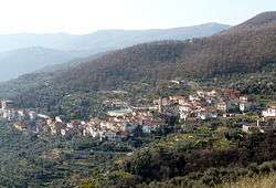
Caravonica is a comune (municipality) in the Province of Imperia in the Italian region Liguria, located about 90 kilometres (56 mi) southwest of Genoa and about 12 kilometres (7 mi) northwest of Imperia. As of 31 December 2004, it had a population of 301 and an area of 4.9 square kilometres (1.9 sq mi).[1]
Caravonica borders the following municipalities: Borgomaro, Cesio, Chiusanico, and Pieve di Teco.
Demographic evolution

References
This article is issued from Wikipedia - version of the 1/31/2015. The text is available under the Creative Commons Attribution/Share Alike but additional terms may apply for the media files.