Busby, New South Wales
| Busby Sydney, New South Wales | |||||||||||||
|---|---|---|---|---|---|---|---|---|---|---|---|---|---|
 Busby Public School | |||||||||||||
| Population | 4,208 (2011 census)[1] | ||||||||||||
| Postcode(s) | 2168 | ||||||||||||
| Location | 37 km (23 mi) south-west of Sydney CBD | ||||||||||||
| LGA(s) | City of Liverpool | ||||||||||||
| State electorate(s) | Liverpool | ||||||||||||
| Federal Division(s) | Werriwa | ||||||||||||
| |||||||||||||
Busby is a suburb of Sydney, in the state of New South Wales, Australia. Busby is located 37 kilometres south-west of the Sydney central business district, in the local government area of the City of Liverpool. Neighbouring suburbs include Miller, Heckenberg, Hinchinbrook, Green Valley and Bonnyrigg.
History
Busby was named after James Busby (1801-1871), a pioneer viticulturist, widely regarded as the father of the Australian wine industry. Busby, who arrived in Sydney from Scotland in 1824, was a teacher of Viticulture at the Male Orphans School at Bald Hills near Liverpool. The school closed in 1851.
He was the son of John Busby (1765-1857), the engineer who constructed Busby's Bore, Sydney's second water supply from Centennial Park to Hyde Park, Sydney.
Busby was part of the Green Valley housing estate, which was developed in the 1960s and 1970s.
Demographics
According to the 2011 census of Population, there were 4,208 residents in Busby. In Busby, 56.1% of people were born in Australia. The most common other countries of birth were Lebanon 5.2%, Vietnam 4.1%, New Zealand 2.5%, Fiji 2.4% and Iraq 1.9%. 44.2% of people only spoke English at home. Other languages spoken at home included Arabic 17.3%, Vietnamese 6.7%, Hindi 2.9%, Spanish 2.1% and Samoan 2.1%. The most common responses for religion in Busby were Catholic 23.9%, Islam 16.8% and Anglican 13.8%. [1]
Schools
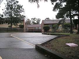
Busby has two Primary Schools (Busby Public School and Busby West Public School) and a High School (James Busby High School).
Parks
Whitlam Park is named after former Australian Prime Minister Gough Whitlam.
References
- 1 2 Australian Bureau of Statistics (31 October 2012). "Busby (State Suburb)". 2011 Census QuickStats. Retrieved 29 April 2013.
- The Book of Sydney Suburbs, Compiled by Frances Pollen, Angus & Robertson Publishers, 1990, Published in Australia ISBN 0-207-14495-8
Coordinates: 33°54′51″S 150°52′57″E / 33.91413°S 150.88247°E
| Wikimedia Commons has media related to Busby, New South Wales. |