Badgerys Creek, New South Wales
| Badgerys Creek Sydney, New South Wales | |||||||||||||
|---|---|---|---|---|---|---|---|---|---|---|---|---|---|
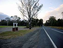 Badgerys Creek Road at Badgerys Creek Park | |||||||||||||
| Coordinates | 33°52′47″S 150°45′08″E / 33.87961°S 150.75231°ECoordinates: 33°52′47″S 150°45′08″E / 33.87961°S 150.75231°E | ||||||||||||
| Population | 455 (2011 census)[1] | ||||||||||||
| Postcode(s) | 2555 | ||||||||||||
| Location | 51 km (32 mi) west of Sydney CBD | ||||||||||||
| LGA(s) | City of Liverpool | ||||||||||||
| State electorate(s) | |||||||||||||
| Federal Division(s) | |||||||||||||
| |||||||||||||
Badgerys Creek, also known as Badgery's Creek, is a suburb of Sydney, in the state of New South Wales, Australia, located approximately 51 kilometres (32 mi) west of the Sydney central business district, in the local government areas of the City of Liverpool. It is part of the Greater Western Sydney region and is adjacent to the suburbs of Kemps Creek and Austral.
The suburb is best known as being the most favoured site for a Second Sydney Airport.[2] In April 2014, the Abbott Government confirmed the construction of the Western Sydney Airport, scheduling construction in 2016.[3]
History
James Badgery was a British-born farmer and miller who, in 1806, was granted 840 acres (3.4 km2) in the suburb that bears his name today. His original land grant was on the north side of Elizabeth Drive; land which today is used for farming research by the CSIRO and University of Sydney. Badgery named his property Exeter Farm but the creek running through the property became known as Badgery's Creek and that name was eventually applied to the local area.[4]
Badgery bought other land to the south of his grant and after he died, the area was subdivided in the 1880s, vastly increasing the local population. Badgerys Creek Post Office opened on 10 July 1894 and closed in 1989.[5] A school was established in 1895 and the area gradually developed as a rural suburb which by 1981 had a population of 1,560.
In 1986, the Federal Government announced that the Second Sydney Airport would be sited at Badgerys Creek. The government bought a number of properties for that purpose, and as a result of that, as well as concerns about living near an airport, many people moved away, meaning that by 1996 there were fewer than 500 residents. By 2011 the population had further shrunk to 455. Construction of the airport has never started, but in 2012 an A$8 million report into Sydney's aviation needs found that Badgerys Creek remained the best site,[6] with construction subsequently scheduled to start in 2016.
Geography
Badgerys Creek flows north into a reservoir in the suburb's north, as does South Creek, the suburb's eastern boundary. West of the reservoir lies Mills Hill, and south-west of that, by just over a kilometre, is Raymond Hill, 125 metres (410 ft) AHD . The western boundary is Oaky Creek, and then Cosgrove Creek after the two merge 500 metres (1,600 ft) north of Elizabeth Drive, and to the south-west the hill known as Anchau (118 metres (387 ft) AHD ).[7]
Climate
| Climate data for Badgerys Creek | |||||||||||||
|---|---|---|---|---|---|---|---|---|---|---|---|---|---|
| Month | Jan | Feb | Mar | Apr | May | Jun | Jul | Aug | Sep | Oct | Nov | Dec | Year |
| Record high °C (°F) | 45.8 (114.4) |
42.6 (108.7) |
40.0 (104) |
34.6 (94.3) |
27.9 (82.2) |
25.2 (77.4) |
25.4 (77.7) |
28.8 (83.8) |
34.8 (94.6) |
37.2 (99) |
41.9 (107.4) |
42.5 (108.5) |
45.8 (114.4) |
| Average high °C (°F) | 29.8 (85.6) |
28.6 (83.5) |
26.7 (80.1) |
23.9 (75) |
20.5 (68.9) |
17.8 (64) |
17.2 (63) |
19.2 (66.6) |
22.6 (72.7) |
24.5 (76.1) |
26.1 (79) |
28.0 (82.4) |
23.7 (74.7) |
| Average low °C (°F) | 16.9 (62.4) |
17.1 (62.8) |
15.0 (59) |
11.2 (52.2) |
7.6 (45.7) |
5.2 (41.4) |
4.2 (39.6) |
4.6 (40.3) |
7.6 (45.7) |
10.2 (50.4) |
13.4 (56.1) |
15.2 (59.4) |
10.7 (51.3) |
| Record low °C (°F) | 8.2 (46.8) |
8.5 (47.3) |
6.4 (43.5) |
−0.1 (31.8) |
−1.1 (30) |
−3.0 (26.6) |
−4.5 (23.9) |
−1.9 (28.6) |
−0.5 (31.1) |
2.2 (36) |
5.3 (41.5) |
6.6 (43.9) |
−4.5 (23.9) |
| Average precipitation mm (inches) | 77.4 (3.047) |
108.0 (4.252) |
77.3 (3.043) |
43.2 (1.701) |
40.1 (1.579) |
52.1 (2.051) |
23.8 (0.937) |
30.4 (1.197) |
34.6 (1.362) |
52.9 (2.083) |
76.7 (3.02) |
60.2 (2.37) |
681.0 (26.811) |
| Average precipitation days (≥ 0.1 mm) | 11.4 | 11.3 | 11.7 | 10.4 | 8.2 | 10.4 | 8.0 | 6.5 | 8.1 | 8.8 | 11.4 | 11.4 | 117.6 |
| Average relative humidity (%) | 49 | 55 | 55 | 52 | 53 | 56 | 50 | 44 | 44 | 45 | 50 | 48 | 50 |
| Source: [8] | |||||||||||||
Commercial area
North of Elizabeth Drive, a substantial amount of land is taken up by the CSIRO Research Station, the University of Sydney MacGarvie Smith Veterinary Farm, and a landfill depot. Much of the research establishment is dotted with reservoirs. The southeast includes a brickworks, and land owned by Telstra, also featuring a number of reservoirs. The suburb is also home to the Hubertus Liverpool Rifle Club.[7]
Schools
The suburb had one primary school, Badgerys Creek Public School, decommissioned in 2014 to make way for Sydney's second airport.
Demographics
According to the 2011 census, there were 455 residents in Badgerys Creek. 64.0% of residents were born in Australia. The most common other countries of birth were China 4.2%, Malta 2.9% and Italy 2.0%. 63.9% of residents spoke only English at home. Other languages spoken at home included Cantonese 8.8%, Maltese 3.7% and Italian 2.9%. The most common responses for religious affiliation were Catholic 32.7%, Anglican 21.3% and No Religion 15.2%.[1]
Parks
The suburb is home to Badgerys Creek Park. A toilet block formerly provided has been demolished.
References
- 1 2 Australian Bureau of Statistics (31 October 2012). "Badgerys Creek (State Suburb)". 2011 Census QuickStats. Retrieved 13 January 2013.
- ↑ "Second Sydney Airport - A Chronology". Parliament of Australia. Archived from the original on 9 April 2008. Retrieved 8 June 2008.
- ↑ "Tony Abbott confirms Badgerys Creek as site of second Sydney airport". The Age. Retrieved 15 April 2014.
- ↑ "History of our suburbs: Badgerys Creek". Liverpool City Council. Archived from the original on 18 April 2008. Retrieved 12 April 2008.
- ↑ Premier Postal History. "Post Office List". Premier Postal Auctions. Retrieved 16 June 2012.
- ↑ Saulwick, Jacob (3 March 2012). "Second airport proposal struggles to get off ground". The Sydney Morning Herald. Retrieved 23 June 2013.
- 1 2 UBD CityLink Street Directory Sydney Maps 224, 225, 244 & 245, 19th Edition, Universal Publishers, 2007, Published in Australia ISBN 0-7319-1966-1
- ↑ "Badgerys Creek AWS". Bureau of Meteorology.