Brownstown, Washington
| Brownstown, Washington | |
|---|---|
| Unincorporated community | |
 Brownstown, Washington | |
| Coordinates: 46°24′15″N 120°36′25″W / 46.40417°N 120.60694°WCoordinates: 46°24′15″N 120°36′25″W / 46.40417°N 120.60694°W | |
| Country | United States |
| State | Washington |
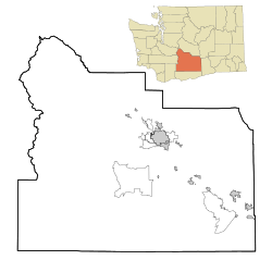
| County | Yakima |
| Elevation | 853 ft (260 m) |
| Time zone | Pacific (PST) (UTC-8) |
| • Summer (DST) | PDT (UTC-7) |
| ZIP code | 98920 |
| Area code(s) | 509 |
| GNIS feature ID | 1512039[1] |
Brownstown is an unincorporated community in Yakima County, Washington, United States. Brownstown is 3 miles (4.8 km) west of Harrah. Brownstown has a post office with ZIP code 98920.[2]
It is a loosely-knit farming community within the Yakama Nation Reservation approximately halfway between Wapato and White Swan. USPS Post Office for Brownstown is at the intersection of Branch Road with Brownstown Road.
References
- ↑ U.S. Geological Survey Geographic Names Information System: Brownstown, Washington
- ↑ ZIP Code Lookup Archived September 12, 2012, at the Wayback Machine.
Municipalities and communities of Yakima County, Washington, United States | ||
|---|---|---|
| Cities | 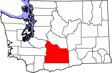 | |
| Towns | ||
| CDPs | ||
| Other unincorporated communities | ||
| Indian reservation | ||
| Footnotes | ‡This populated place also has portions in an adjacent county or counties | |
This article is issued from Wikipedia - version of the 11/18/2016. The text is available under the Creative Commons Attribution/Share Alike but additional terms may apply for the media files.