Bracalba, Queensland
| Bracalba Queensland | |||||||||||||
|---|---|---|---|---|---|---|---|---|---|---|---|---|---|
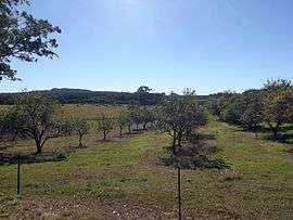 Orchard, Gamgee Road, 2015 | |||||||||||||
 Bracalba | |||||||||||||
| Coordinates | 27°00′S 152°50′E / 27°S 152.83°ECoordinates: 27°00′S 152°50′E / 27°S 152.83°E | ||||||||||||
| Population | 162 (2011)[1] | ||||||||||||
| Postcode(s) | 4512 | ||||||||||||
| LGA(s) | Moreton Bay Region | ||||||||||||
| State electorate(s) | Glass House | ||||||||||||
| Federal Division(s) | Longman | ||||||||||||
| |||||||||||||
Bracalba is a rural locality of the Moreton Bay Region in Queensland, Australia.[2] At the 2011 census, the suburb recorded a population of 162 persons, with a median age of 32 years.[1] The name is derived from the Wakawaka language, and refers to the scrub areas of the D'Aguilar Range.[2] A large portion of the northern half of Bracalba lies within Beerburrum West State Forest.
Demographics
In the 2011 census, Bray Park recorded a population of 10,002 people, 51.2% female and 48.8% male.[1] The median age of the Bray Park population was 33 years, 4 years below the national median of 37. 71.5% of people living in Bracalba were born in Australia. The other top responses for country of birth were England 3.6%, Scotland 1.8%, Germany 1.8%, Fiji 1.8%, Sri Lanka 1.8%. 90.8% of people spoke only English at home; the next most common languages were 1.4% Hungarian, 1% Croatian, 1% Italian.[1]
References
- 1 2 3 4 Australian Bureau of Statistics (31 October 2012). "Bracalba (State Suburb)". 2011 Census QuickStats.
- 1 2 "Bracalba (entry 45366)". Queensland Place Names. Queensland Government. Retrieved 30 May 2014.