Albany Creek, Queensland
| Albany Creek Moreton Bay, Queensland | |||||||||||||
|---|---|---|---|---|---|---|---|---|---|---|---|---|---|
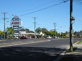 Albany Creek Road, Queensland. | |||||||||||||
| Coordinates | 27°20′49″S 152°58′05″E / 27.34694°S 152.96806°ECoordinates: 27°20′49″S 152°58′05″E / 27.34694°S 152.96806°E | ||||||||||||
| Population | 15,860 (2011 census)[1] | ||||||||||||
| • Density | 1,602/km2 (4,149/sq mi) | ||||||||||||
| Postcode(s) | 4035 | ||||||||||||
| Area | 9.9 km2 (3.8 sq mi) | ||||||||||||
| Location | 16 km (10 mi) north of Brisbane CBD | ||||||||||||
| LGA(s) | Moreton Bay Region | ||||||||||||
| State electorate(s) | Everton | ||||||||||||
| Federal Division(s) | Dickson | ||||||||||||
| |||||||||||||
Albany Creek is a suburb in the Moreton Bay Region, Queensland, Australia.[2] It is located approximately 17 kilometres north-west of Brisbane, Australia; about a half-hour drive to the central business district.
History
The suburb of Albany Creek was originally established on the intersection of two aboriginal tracks. The main track formed the primary route north of Brisbane and is still known as "Old Northern Road". The second track formed a route from Old Northern Road to Little Cabbage Tree Creek in Aspley and onto Downfall Creek in Chermside. Albany Creek Road and Gympie Road now follow this route.
Albany Creek was originally known as "Chinaman's Creek" before its name was changed in 1888.
Services
Albany Creek has one state high school and three primary schools. It is a major suburban service centre within the Moreton Bay Regional Council, featuring fast food restaurants, a council branch library, a municipal pool, and a bus interchange. Albany Creek also has three main shopping centres, including Woolworths, Aldi and a Centro Albany Creek, which hosts a Coles supermarket. Several smaller shopping facilities are also located along Albany Creek Rd.
Albany Creek is located in Zones 4 and 5 of the TransLink public transport fare system and is serviced by several Brisbane Transport bus routes. The nearest railway station is Strathpine.
Demographics
In the 2011 census, Albany Creek recorded a population of 15,860 people, 50.6% female and 49.4% male.
The median age of the Albany Creek population was 38 years, 1 year above the national median of 37.
79% of people living in Albany Creek were born in Australia. The other top responses for country of birth were England 4.9%, New Zealand 3.4%, South Africa 2%, Scotland 0.8%, Italy 0.4%.
92.4% of people spoke only English at home; the next most common languages were 0.7% Italian, 0.4% Afrikaans, 0.4% German, 0.3% Hindi, 0.3% Cantonese.
Geography
Albany Creek is located north of Brisbane in Moreton Bay Regional Council. It is positioned on a small hill which runs down to the South Pine River. Albany Creek is west of Bridgeman Downs but east of Eatons Hill. Everton is the state electoral district while Dickson is the federal electoral division.
Sport
The local Soccer Club or Football Club is ACE FC, with over 1000 registered players and more than 2,500 members, ACE FC is the largest soccer club in Brisbane providing for junior and senior players as well as a vast variety of other activities including the clubs Kindy Program for players aged 3 to 5 and the club's Football School which provides players a soccer development program for 12 months of the year modelled on European Academies. In the off-season, ACE FC provides a Five A Side Competition which incorporates over 35 men and women. The Five A Side competition has grown to be one of the largest off-season social comps in Brisbane. ACE FC coaching staff include ex European players Salvo Sottile as Technical Director, Josh McCloughan retired Brisbane Roar defender and Roberto Lettieri who played National League at the end of his career after a successful season in Brazil.
Albany Creek's local Rugby League club team is named the Albany Creek Crushers. And the suburb also has a cricket team that goes by the name of Albany Creek Hawks or just Albany Creek Cricket Club.
Notable residents
- Lady Phyllis Dorothy Cilento, doctor and author is buried in Albany Creek cemetery. Phyllis Dorothy McGlew was born on 13 March 1894 at Rockdale, Sydney, New South Wales, the daughter of Charles Thomas McGlew and Alice Lane (née Walker). She grew up in Adelaide, South Australia. She married Raphael Cilento, also a doctor, in Adelaide in 1920. They worked in a number of countries before settling in Brisbane, Queensland, in 1928. They had six children, including actress Diane Cilento, and remained married until Raphael's death in 1985. She died on 26 July 1987 in Brisbane and was buried in Albany Creek Cemetery.
- Super Rugby rugby union player Scott Daruda grew up and played football in Albany Creek.
- Queensland Roar Striker Robbie Kruse played for Albany Creek Excelsior Soccer Club in his youth.
- Screenwriter Anthony Morris lives in Albany Creek.
- Twin sisters Jessica and Lisa Origliasso, the female pop duo The Veronicas, grew up in Albany Creek.[3]
- Two time U.S. Open winning tennis player Patrick Rafter attended Albany Creek State High School.[4]
- Former Wallaby and Queensland Reds great Ben Tune grew up in Albany Creek.
References
- ↑ Australian Bureau of Statistics (31 October 2012). "Albany Creek (State Suburb)". 2011 Census QuickStats. Retrieved 2013-01-20.
- ↑ "Albany Creek (entry 45355)". Queensland Place Names. Queensland Government. Retrieved 14 March 2014.
- ↑ "The Veronicas". Music Minder. Retrieved 6 November 2013.
- ↑ "Open Day 2008". Albany Creek State High School. Retrieved 6 November 2013.
Further reading
- Teague, D. R. (David R.) (1980), The history of Albany Creek, Bridgeman Downs and Eaton's Hill (2nd ed.), Colonial Press, ISBN 978-0-909139-07-0